Category:Old maps of Cheshire County, New Hampshire
Jump to navigation
Jump to search
Subcategories
This category has the following 4 subcategories, out of 4 total.
Media in category "Old maps of Cheshire County, New Hampshire"
The following 16 files are in this category, out of 16 total.
-
 Map of Keene, Cheshire Co., N.H. LOC 2011589223.jpg 10,331 × 12,832; 11.71 MB
-
 Map of Keene, Cheshire Co., N.H. LOC 2011589223.tif 10,331 × 12,832; 379.28 MB
-
 Map of the town of Dublin, N.H. (7537848720).jpg 2,000 × 1,654; 2.76 MB
-
 Map of Cheshire Co., New Hampshire LOC 2012587747.jpg 17,321 × 17,388; 39.35 MB
-

-
 Hinsdale, N.H. LOC 75694689.jpg 8,240 × 5,152; 7.29 MB
-
 Hinsdale, N.H. (2675818976).jpg 2,000 × 1,290; 2.08 MB
-
 Hinsdale, N.H. LOC 75694689.tif 8,240 × 5,152; 121.46 MB
-
 Winchester, N.H. (2675841224).jpg 2,000 × 1,457; 2.2 MB
-
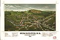 Winchester, N.H., Cheshire County, 1887 LOC 81694075.jpg 7,168 × 4,848; 6.26 MB
-
 Winchester, N.H., Cheshire County, 1887 LOC 81694075.tif 7,168 × 4,848; 99.42 MB
-

-
 Map of the city of Keene, from recent surveys (8346467669).jpg 553 × 800; 107 KB
-
 Trails of Mt. Monadnock. LOC 76692217.jpg 6,526 × 3,957; 3.64 MB
-
 Trails of Mt. Monadnock. LOC 76692217.tif 6,526 × 3,957; 73.88 MB
-
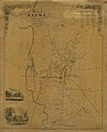
 CheshireNH-1895.jpg 900 × 867; 260 KB

.jpg)

_C._H._Hitchcock,_State_Geologist,_J._H._Huntington,_Principal_Assistant%27_(16403877219).jpg)

.jpg)
.jpg)

.jpg)
.jpg)

