Category:Old maps of Charlestown, Boston
Jump to navigation
Jump to search
Subcategories
This category has the following 2 subcategories, out of 2 total.
Media in category "Old maps of Charlestown, Boston"
The following 43 files are in this category, out of 43 total.
-
-
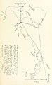
 A Plan of Charles Town - DPLA - 251836d5a4689e1277cc196b5171c306.jpg 3,607 × 2,878; 2.1 MB
-
 Plan of Charlestown peninsula in the state of Massachusetts (3121053764).jpg 2,000 × 1,626; 2.92 MB
-
 Plan of Charlestown peninsula in the state of Massachusetts LOC 2011589326.jpg 6,547 × 5,393; 4.85 MB
-
 Plan of Charlestown peninsula in the state of Massachusetts LOC 2011589326.tif 6,547 × 5,393; 101.02 MB
-

-

-
 1829 Leverett St jail Boston map BPL 12254.png 633 × 618; 599 KB
-
 Charlestown Branch Railroad plan, 1835.jpg 2,739 × 1,660; 1.03 MB
-
 Warren Bridge - Charlestown-Boston - 1.jpg 5,090 × 6,364; 13.97 MB
-
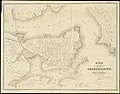 Plan of the city of Charlestown (3121053626).jpg 2,000 × 1,561; 2.69 MB
-

-
 Plan of Boston comprising a part of Charlestown and Cambridge (2674446357).jpg 1,815 × 2,000; 3.29 MB
-

-
 Plan of real estate in Charlestown belonging to Seth Barker & others (3120129873).jpg 2,000 × 1,600; 2.44 MB
-
 Plan of Charlestown (2674621825).jpg 2,000 × 1,391; 2.26 MB
-

-
 1900 Boston and Maine Railroad freight terminals map.png 3,500 × 1,877; 14.03 MB
-

-
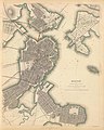
 Boston 1835 2.jpg 697 × 975; 677 KB
-
 Boston 1835.jpg 507 × 601; 307 KB
-
 Charlestown Navy Yard Mystic Wharf Map 1912.jpg 3,500 × 2,429; 2.87 MB
-
 City square east ward map 1922.jpg 500 × 350; 61 KB
-
 City square ward map 1922 1.jpg 750 × 524; 128 KB
-
 City square ward map 1922 2.jpg 750 × 524; 94 KB
-
 City square ward map 1922 3.jpg 750 × 524; 146 KB
-
 City square ward map 1922.jpg 500 × 350; 68 KB
-
 Detail of 1901 map showing East Somerville station.jpg 2,304 × 1,608; 901 KB
-
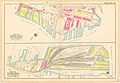
 Inventory of the West End Street Railway Company (1897) (14737076676).jpg 4,960 × 3,068; 977 KB
-
 Medford st ward map 1922.jpg 750 × 524; 124 KB
-
 Monument square ward map 1922 1.jpg 750 × 526; 110 KB
-
 Monument square ward map 1922 2.jpg 750 × 526; 101 KB
-
 Monument square ward map 1922 3.jpg 750 × 526; 127 KB
-
 Monument square ward map 1922 4.jpg 750 × 526; 100 KB
-
 Monument square ward map 1922.jpg 500 × 350; 57 KB
-
 Plan of Charlestown (3855695619).jpg 2,000 × 1,341; 2.18 MB
-

-
 Warren Bridge - Boston-Charlestown - 1.jpg 4,478 × 3,493; 6.73 MB
-
 Winthrop square ward map 1922 1.jpg 750 × 523; 123 KB
-
 Winthrop square ward map 1922 2.jpg 750 × 523; 101 KB
-
 Winthrop square ward map 1922 3.jpg 750 × 523; 119 KB
-
 Winthrop square ward map 1922 4.jpg 750 × 523; 113 KB
-
 Winthrop square ward map 1922.jpg 500 × 350; 59 KB
.jpg)

.jpg)


.jpg)

.jpg)
.jpg)
.jpg)
.jpg)
.jpg)

.jpg)


_(14737076676).jpg)


.jpg)
_June_19_1851_at_4_o_clk_pm_on_the_premises_(9472266227).jpg)


