Category:Old maps of Carthage
Jump to navigation
Jump to search
Use the appropriate category for maps showing all or a large part of Carthage. See subcategories for smaller areas:
| If the map shows | Category to use |
|---|---|
| Carthage on a recently created map | Category:Maps of Carthage or its subcategories |
| Carthage on a map created more than 70 years ago | Category:Old maps of Carthage or its subcategories |
| the history of Carthage on a recently created map | Category:Maps of the history of Carthage or its subcategories |
| the history of Carthage on a map created more than 70 years ago | Category:Old maps of the history of Carthage or its subcategories |
Media in category "Old maps of Carthage"
The following 36 files are in this category, out of 36 total.
-

-

-

-
 Recherches sur l'emplacement de Carthage - map of the region around Tunis.jpg 602 × 1,045; 113 KB
-

-

-

-

-

-
 288 of 'A History of Rome to the death of Cæsar' (11238219365).jpg 1,230 × 1,886; 279 KB
-

-
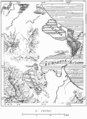
 AFR V2 D219 Carthage.jpg 1,783 × 2,186; 493 KB
-
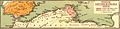
 AFR V2 D221 Ancient ports of Carthage.jpg 1,550 × 2,356; 626 KB
-

-
-
-

-
 Carthage 1770.jpg 1,297 × 901; 361 KB
-
 D419- Carthage et ses environs.-L2-Ch9.png 1,436 × 1,972; 218 KB
-

-
 Inset map of Carthage by Abraham Ortelius (cropped).jpeg 391 × 416; 76 KB
-
 Map of Roman Africa and inset map of Carthage by Abraham Ortelius.jpeg 3,049 × 2,347; 2.31 MB
-
 Map of Zeugitana - DGRG.png 705 × 611; 144 KB
-
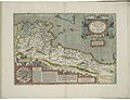
 Maps of Anatolia, of Egypt, and of Carthage by Abraham Ortelius.jpeg 1,553 × 1,184; 538 KB
-
 Meyers b9 s0565 b1.png 386 × 438; 75 KB
-
 Old Map of Tunis, Carthage and North-East of Tunisia.jpg 500 × 508; 46 KB
-
-
 Plan of Carthage (Mannert) - DGRG.png 306 × 248; 35 KB
-
 Provincia Carthaginiensibus subditae.jpg 1,555 × 374; 252 KB
-
 Putz114.jpg 595 × 623; 68 KB
-
 Roma-Kartaca 218.png 1,108 × 823; 1.39 MB
-
 Rome and Carthage, the Punic wars; (1889) (14769856391).jpg 1,750 × 2,656; 818 KB
-
 Rothert, Bd1Bl20K5 - Belagerung Karthagos 149-146.jpg 1,091 × 1,380; 230 KB
-

-
-

.jpg)
_-_Geographicus_-_AfriqueiPropre-lapie-1829.jpg)


_-_Geographicus_-_AfricaNorth-spruneri-1855.jpg)
.jpg)
.jpg)
.jpg)
%27_(11005079724).jpg)
.jpg)
_Fourth_edition.)%27_(11097775554).jpg)


_-_dessin%C3%A9s_par..._-_btv1b52503974g_(081_of_106).jpg)

_du_Roi..._-_btv1b53171162r_(1_of_2).jpg)


.jpeg)


_-_DGRG.png)


_(14769856391).jpg)

.jpg)
.jpg)
_(14786247213).jpg)