Category:Old maps of Cape Cod
Jump to navigation
Jump to search
Subcategories
This category has the following 2 subcategories, out of 2 total.
O
- Old maps of Cape Cod Canal (8 F)
Media in category "Old maps of Cape Cod"
The following 58 files are in this category, out of 58 total.
-
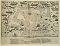 ChamplainNausetHarbor.jpg 1,000 × 778; 232 KB
-
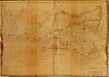
 Southern New England in 1634.jpg 600 × 882; 140 KB
-
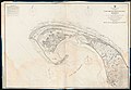
 Whydah-map.jpg 580 × 919; 273 KB
-
 Buzzards Bay and shoals of Nantucket. LOC gm72003569.jpg 12,178 × 6,686; 7.91 MB
-
 Buzzards Bay and shoals of Nantucket. LOC gm72003569.tif 12,178 × 6,686; 232.95 MB
-
 Coast of New England from Chatham Harbor to Narragansett Bay. LOC 77693979.jpg 12,824 × 9,072; 13.09 MB
-

-
 A new chart of Nantucket Shoals & Georges Bank with the adjacent coast (8249585191).jpg 2,000 × 1,368; 2.07 MB
-
 Canal du Cap-Cod (7557397698).jpg 4,648 × 3,456; 13.87 MB
-
 1836 Provincetown US Topographical Bureau.jpg 5,760 × 4,800; 1.29 MB
-
 1857 Map of the town of Sandwich, Barnstable County, Mass. (6094146242).jpg 10,259 × 7,670; 11.09 MB
-

-

-

-
 From Monomoy and Nantucket Shoals to Muskeget Channel, Mass. (8250932658).jpg 1,499 × 2,000; 2.03 MB
-

-
 Admiralty Chart No 2879 Massachusetts Cape Cod or Provincetown Harbour, Published 1862.jpg 11,956 × 8,253; 11.06 MB
-
 Admiralty Chart No 2890 Nantucket Shoal to Block Island, Published1862.jpg 13,086 × 8,678; 14.67 MB
-
-
 Sparrow-Hawk wreck site map.jpg 398 × 664; 166 KB
-
 Admiralty Chart No 2482 Fletchers Neck to Cape Cod, Published 1866.jpg 8,208 × 12,001; 9.15 MB
-
 Map of North Shore of Cape Cod - NARA - 55302734.jpg 15,741 × 9,098; 22.13 MB
-

-
 Cape cod 1871.jpg 8,896 × 6,019; 8.84 MB
-
 FMIB 33464 Map of Cape Cod Bay.jpeg 850 × 644; 148 KB
-

-
 A gazetteer of the state of Massachusetts; (1874) (14585961398).jpg 2,191 × 1,625; 619 KB
-
-

-
 Balloon view, Nantucket to Boston LOC 2010592718.jpg 4,967 × 9,269; 6.52 MB
-
 Balloon view, Nantucket to Boston LOC 2010592718.tif 4,967 × 9,269; 131.72 MB
-
 1888 Old Colony Railroad Cape Cod map.png 3,500 × 2,436; 18.69 MB
-
 1889 USGS Provincetown.png 2,238 × 1,496; 5.61 MB
-

-

-
 Deyo-map.jpg 1,560 × 1,448; 564 KB
-

-
 1893 Sectional Map of New York, New Haven and Hartford Railroad, Eastern District, Cape Cod.jpg 4,670 × 3,036; 17.25 MB
-

-
 Hyannis Harbor, Massachusetts (3120842544).jpg 2,000 × 1,926; 3.32 MB
-
 383 of 'American Historic Towns' (11244857374).jpg 1,728 × 1,415; 387 KB
-

-
 Approximate Locations of Cape Cod Wrecks Down to 1903.jpg 1,153 × 1,556; 273 KB
-
 Birds eye view of Mass., R.I. & Conn. LOC 79695398.tif 6,475 × 5,020; 93 MB
-
 Map of Cape Cod and vicinity (2675096300).jpg 1,867 × 2,000; 3.24 MB
-
 1917 map Rhode Island CapeCod byHammond BPL 10795.png 1,150 × 699; 1.34 MB
-
-
 General Plan For Oyster Harbors Osterville, Mass.jpg 8,552 × 10,061; 5.68 MB
-

-

-
 Pocasset River (Massachusetts) map.jpg 894 × 763; 348 KB
-
 1945 Miller Map of Cape Cod, Massachusetts - Geographicus - CapeCod-miller-1945.jpg 4,000 × 2,634; 3.17 MB
-
 1946 Massachusetts Steamship Lines schedule.pdf 2,031 × 1,706, 2 pages; 42.33 MB
-
 Admiralty Chart No 2489 Nantucket Sound Eastern Part and Approaches, Published 1955.jpg 11,056 × 16,249; 44.99 MB
-
 Cape Cod Bay (8347571122).jpg 800 × 649; 91 KB
-
 Cape Cod Bay Nautical Chart 1879.jpg 13,098 × 10,617; 26.31 MB
-
 Cape Cod Bay, Massachusetts (8249864115).jpg 2,000 × 1,500; 2.08 MB
-
 Coast of New England from Chatham Harbor to Narragansett Bay. LOC 77693979.tif 12,824 × 9,072; 332.85 MB


.jpg)
.jpg)
.jpg)

.jpg)


.jpg)
.jpg)


.jpg)


_(14585961398).jpg)
.jpg)
.jpg)


_(With_maps_and_illustrations.)%27_(11219087424).jpg)


.jpg)
.jpg)


.jpg)


_map.jpg)


.jpg)

.jpg)