Category:Old maps of Canterbury
Jump to navigation
Jump to search
Subcategories
This category has only the following subcategory.
Media in category "Old maps of Canterbury"
The following 25 files are in this category, out of 25 total.
-
 Cantmap1.jpg 1,688 × 1,288; 865 KB
-
 Ecclesiae Cathedralis et Prioratvs Benedictorum Cantvariae (...) (BM 1981,U.1088).jpg 1,610 × 2,500; 793 KB
-
 Ecclesiae Cathedralis et Prioratvs Benedictorum Cantvariae (...) (BM Mm,3.107).jpg 1,638 × 2,500; 860 KB
-

-

-

-
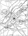
 EW(1884) p.042 - Canterbury - A + C Black (pub).jpg 1,225 × 1,902; 489 KB
-
 33 of '(Our own country. Descriptive, historical, pictorial.)' (11181417535).jpg 1,928 × 1,532; 876 KB
-
 33 of '(Our own country. Descriptive, historical, pictorial.)' (11248940725).jpg 1,935 × 1,510; 934 KB
-
 Plan of Durovernum.jpg 1,447 × 1,749; 856 KB
-
 Plan of Durovernum.png 2,893 × 3,498; 1.62 MB
-
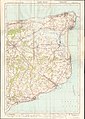
 Ordnance Survey One-Inch Sheet 173 East Kent, Published 1959.jpg 8,206 × 9,957; 9.76 MB
-

-

-

-

-

-
 Canterbury map, 1610.png 1,165 × 1,186; 3.31 MB
-
 Canterbury Orchards 1945 OS Map 171 detail.jpg 2,890 × 1,996; 2.7 MB
-
 CanterburySaxonne.png 2,839 × 2,943; 4.66 MB
-
 Canterbvry (BM 1912,1227.393).jpg 2,433 × 2,314; 1.01 MB
-
 Canterbvry (BM 1912,1227.394).jpg 2,308 × 2,500; 822 KB
-
 EB9 - Plan of Canterbury.png 1,263 × 1,593; 524 KB
-
 Ordnance Survey One-Inch Sheet 117 East Kent, Published 1920.jpg 8,603 × 12,090; 35.28 MB
-
 OS map of Canterbury 1874.jpg 2,338 × 1,682; 2.78 MB

_(BM_1981,U.1088).jpg)
_(BM_Mm,3.107).jpg)
.jpg)
.jpg)
.jpg)
_p.042_-_Canterbury_-_A_%2B_C_Black_(pub).jpg)
%27_(11181417535).jpg)
%27_(11248940725).jpg)


.jpg)
.jpg)
%27_(11235252104).jpg)
.jpg)


.jpg)
.jpg)


