Category:Old maps of Cádiz
Jump to navigation
Jump to search
Subcategories
This category has only the following subcategory.
M
Media in category "Old maps of Cádiz"
The following 78 files are in this category, out of 78 total.
-
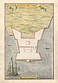 0003 Puntal De Cadiz (cropped).jpg 4,304 × 6,147; 3.45 MB
-
 1632 Cardona Descripcion Indias (5).jpg 3,184 × 2,165; 654 KB
-
 "Plan de la Baye et rades de Cadis" (21623996323).jpg 3,267 × 2,429; 1.84 MB
-

-
 1534 - Isolario di Benedetto Bordone - Gades.jpg 795 × 464; 92 KB
-

-
 AtaqueDrakes.jpg 895 × 604; 174 KB
-

-

-
 View of Cadiz in Spain from the West (BM 1875,0710.5447).jpg 1,965 × 2,500; 1.17 MB
-
 "Insula Gaditana, vulgo Isla de Cadiz" (22264216681).jpg 3,758 × 2,918; 2.05 MB
-
 1730 map of Andalusia and Gibraltar by Matthaus Seutter.jpg 1,850 × 1,600; 811 KB
-
 1736 Cadiz detail West Part of Barbary map by Herman Moll BPL 14639.png 1,245 × 473; 1.21 MB
-
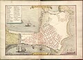
 1762 A plan of the city of Cadis.jpg 9,012 × 6,422; 8.42 MB
-
 17th century hand drawn map of Planta De Cadis. Cadiz, Spanien.jpg 9,360 × 6,795; 5.15 MB
-
 1806 map - Plan der Bay von Cadiz.djvu 5,095 × 4,764; 1.28 MB
-
 ROSSER(1869) p0538 CADIZ.jpg 3,815 × 3,441; 6.57 MB
-

-
-
 O'SHEAS (1895) p218 CADIZ.jpg 4,832 × 3,637; 8.65 MB
-

-
 1915 Bahia de Cadiz.jpg 1,600 × 1,249; 741 KB
-
 Admiralty Chart No 86 Puerto de Cadiz, Published 1955.jpg 8,093 × 11,077; 19.27 MB
-
-
-

-
 Arcenal de la Carraque proche Cadix - btv1b53032946k.jpg 5,288 × 3,721; 1.73 MB
-
 Arcenal de la Carraque proche Cadix - btv1b84944873.jpg 7,744 × 5,628; 4.48 MB
-
 Atlas Van der Hagen-KW1049B12 010-INSULA CADITANA, Vulgo ISLA DE CADIZ.jpeg 5,500 × 4,270; 2.97 MB
-

-
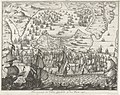
 Batalla de Cádiz 1702.jpg 570 × 477; 108 KB
-

-

-

-
 Cadiz Bay 1783.jpg 885 × 740; 211 KB
-

-

-
 Cartografía.jpg 900 × 739; 135 KB
-
 Colomnes-d-Hercule-1715.JPG 1,093 × 609; 166 KB
-
 Cádiz an la guerra de la independencia, cuadro historico (1862) (14595291180).jpg 1,858 × 2,868; 660 KB
-
 Cádiz en 1812.jpg 4,928 × 3,488; 1.89 MB
-
 Decorative scenes of the War of the Spanish Succession - Cádiz, 1702.jpg 737 × 632; 157 KB
-
 Ile, ville et port de Cadis, en Espagne, de la province d'Andalousie... - btv1b8439916n.jpg 6,128 × 5,192; 4.24 MB
-

-
 Insula Gaditana, vulgo Isla de Cadiz (8342623317).jpg 800 × 656; 96 KB
-
 Insula Gaditana.jpg 800 × 605; 172 KB
-
 Isle, ville et port de Cadis en Espagne, de la province d'Andalousie... - btv1b8439717c.jpg 5,623 × 4,018; 3.28 MB
-

-

-

-

-

-
 Map - Special Collections University of Amsterdam - OTM- HB-KZL 34.24.25.tif 9,555 × 6,496; 177.58 MB
-
 Map of Cadiz, 1685.jpg 618 × 900; 463 KB
-
 Mapa Cadiz islamico.jpg 4,032 × 3,024; 2.49 MB
-
 Maps of Carpetania, of Gipuzkoa, and of Cadiz by Abraham Ortelius.jpeg 3,047 × 2,360; 2.22 MB
-
 Meyers b3 s0718 b1.png 528 × 634; 170 KB
-
 The city and harbour of CADIZ (NYPL b13909432-1640609).jpg 5,935 × 4,935; 5.91 MB
-
 Plan du port de Cadix et de sa baie (33746955604).jpg 12,895 × 7,477; 19.57 MB
-
 Plan du port de Cadix.jpg 550 × 320; 93 KB
-
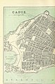
 Plan of Cadiz.jpg 495 × 600; 101 KB
-

-
 Plano de Cadiz y Extramuros - Grab. J. Dominguez - btv1b531930634.jpg 6,140 × 3,238; 3.05 MB
-
 Plano puerto Cádiz.jpg 4,928 × 3,488; 1.45 MB
-
-
-

-
 SitiodeCadiz.jpg 900 × 630; 169 KB
-
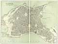
 Situationsplan von Cadiz.jpg 500 × 606; 97 KB
-
 Siège de Cadix 1810.jpg 3,456 × 5,184; 5.49 MB
-
 Spain and Portugal- handbook for travellers (1901) (14773546301).jpg 1,316 × 1,962; 798 KB
-
 Spain and Portugal- handbook for travellers (1901) (14774358064).jpg 1,428 × 2,048; 874 KB
-

-
 The city and harbour of CADIZ NYPL1640609.tiff 7,230 × 5,428; 112.28 MB
-
 Vista de Cádiz y sus contornos hacia 1813.jpg 900 × 809; 175 KB
-
 William Borough Sir Francis Drake in Cadiz.jpg 847 × 570; 361 KB
-
-
 Карта к статье «Кадикс». Военная энциклопедия Сытина (Санкт-Петербург, 1911-1915).jpg 1,445 × 1,890; 460 KB
.jpg)
.jpg)
.jpg)
.jpg)

_perlustrabat_et_sua_manu_depingebat_Georgius_Hoefnaglius..._-_btv1b8442276m_(1_of_2).jpg)

.jpg)
_-_btv1b53194510z_(1_of_2).jpg)
.jpg)
.jpg)


_p0538_CADIZ.jpg)
%27_(11251165524).jpg)
%27_(11232225403).jpg)
_p218_CADIZ.jpg)
.jpg)


%27_(11260525215).jpg)
.jpg)
.jpg)


_Serie_4_Franse,_Duitse_en_Engelse_Gebeurtenissen,_1576-,_RP-P-OB-78.785-300.jpg)
_Serie_4_Franse,_Duitse_en_Engelse_Gebeurtenissen,_1576-1610_(serietitel),_RP-P-OB-78.784-82.jpg)


_Cadix,_een_bisschoplyke_en_vermaarde_koopstad_en_haven_en_eiland_aan_de_Spaanse_kust_van_Andalusien_(..)_Cadis._Ville_episcopale_et_fameuse_par_la_commerce,_s,_RP-P-2015-62-2.jpg)
_door_de_Hollanders_en_Engelsen_ingenomen,_9_Juni_1596_Cales_Males_Durch_die_Englische_undf_Holender_eingenomen_alles_verbrant_und_mit_groser_beut_darvon_komen_den_9._juni_Ao._1596_(titel_op_object),_RP-P-1910-2102.jpg)


_(14595291180).jpg)


.jpg)
.jpg)


_Les_Forces_de_l%27Europe,_Asie,_Afrique_et_Amerique,_ou_description_des_principales_ville,_RP-P-OB-83.034-274.jpg)
_Les_Forces_de_l%27Europe,_Asie,_Afrique_et_Amerique_Comme_aussi_les_Cartes_des_C%C3%B4tes_de_France_et_d%27Espagne_(,_RP-P-OB-83.036-179.jpg)


_Les_Principales_Forteresses_%26_Villes_Fortes,_d%27Espagne,_de_France,_,_RP-P-OB-83.037-2.jpg)


.jpg)
.jpg)


,_1702_Schouwburg_van_den_Oorlog,_Beginnende_van_Koning_Karel_den_II._Tot_op_Koning_Karel_den_III._Bestaande_in_IX._Historische_Figuren_op_een_Olifants_Blad,_als_V,_RP-P-OB-83.039-4.jpg)
,_1702_Schouwburg_van_den_Oorlog,_Beginnende_van_Koning_Karel_den_II._Tot_op_Koning_Karel_den_III._Bestaande_in_IX._Historische_Figuren_op_een_Olifants_Blad,_als_V,_RP-P-OB-83.040-4.jpg)
,_1702_Schouwtoneel_van_den_Oorlog_Beginnende_met_Koning_Karel_den_tweeden_Bestaande_in_Veldslagen,_en_Belegeringen,_Zoo_te_Water_als_te_Lande,_met_de_voornaamst,_RP-P-OB-83.377-23.jpg)


_(14773546301).jpg)
_(14774358064).jpg)


,_RP-P-OB-80.182.jpg)
.jpg)