Category:Old maps of Brisbane
Jump to navigation
Jump to search
Media in category "Old maps of Brisbane"
The following 18 files are in this category, out of 18 total.
-
 Map of Brisbane Town by Robert Dixon 24 March 1840 (7173003438).jpg 3,000 × 2,267; 887 KB
-

-
 1893 Flood map.png 867 × 1,190; 1.04 MB
-
 Admiralty Chart No 1029 Danger Pt. to Cape Moreton, Queensland, Published 1869.jpg 11,125 × 16,281; 65.92 MB
-
 Admiralty Chart No 3623 Cape Byron to Lady Elliot Island Australia, Published 1907.jpg 11,307 × 16,491; 54.75 MB
-
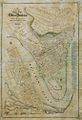
 Brisbane and Environs 1886.jpg 1,435 × 2,318; 988 KB
-
 Brisbane and Environs 1920.jpg 3,600 × 3,600; 3.68 MB
-
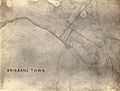 Brisbane Town 1840.jpg 788 × 596; 152 KB
-
 Brisbane Valley 1-126720 1932.jpg 10,405 × 6,942; 11.24 MB
-
 Brisbane, Queensland Topographic Map 1-63360 1937.jpg 6,000 × 3,789; 3.95 MB
-
 Flood map of Brisbane and suburbs.jpg 4,613 × 6,000; 7.13 MB
-
 Map of Brisbane at time of amalgamation (8072989293).jpg 1,010 × 833; 250 KB
-

-

-

-
 StateLibQld 2 108280 Ham's map of the city of Brisbane, Queensland, 1863.jpg 681 × 1,000; 154 KB
-
 StateLibQld 2 119348 Map of Brisbane, 1844.jpg 1,000 × 734; 123 KB
-
 StateLibQld 2 202047 Street map of the city of Brisbane, Queensland, 1878.jpg 869 × 1,000; 197 KB
.jpg)
%27_(11253090355).jpg)


.jpg)


