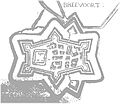
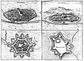
Category:Old maps of Bredevoort
Jump to navigation
Jump to search
Old maps of Bredevoort, a town in the province of Gelderland in the Netherlands.
Media in category "Old maps of Bredevoort"
The following 23 files are in this category, out of 23 total.
-
 Bredevoort 1597 prent.JPG 6,819 × 5,189; 13.94 MB
-
 Bredevoort 1750.png 790 × 646; 487 KB
-
 Bredevoort 1800 plan.JPG 3,264 × 2,448; 2.49 MB
-
 Bredevoort 1844.png 1,264 × 1,180; 3.74 MB
-
 Bredevoort kaart.gif 1,188 × 986; 218 KB
-
 Bredevoort vestingwerken.jpg 1,465 × 1,079; 2.44 MB
-
 Bredevoort.jpg 2,048 × 1,749; 1.22 MB
-
 Bredevoort1600.jpg 446 × 526; 49 KB
-
 Breevoorde JVD Bredevoort.jpg 500 × 500; 124 KB
-
 Breevoort 1606.jpg 2,000 × 1,615; 3.01 MB
-
 Brefurtum Capta Anno 1597 - Capture of Bredevoort 1597 (J.Blaeu 1649).jpg 5,500 × 4,399; 3.28 MB
-
 Brefurtum Capta Anno 1597 - Siege of Bredevoort (Detail, J.Blaeu 1649).jpg 2,872 × 4,151; 2.77 MB
-
 Fort zwanenbroek 1832.jpg 400 × 333; 88 KB
-
 Heerlijkheid bredevoort 1741.jpg 1,130 × 1,010; 878 KB
-
 Jurisbdv.jpg 510 × 430; 26 KB
-
 Kasteel bredevoort 1597.jpg 1,200 × 900; 1.56 MB
-
 Kasteel breevoort 1606.gif 250 × 150; 10 KB
-
 Lambert-van-den-Bos-Lieuwe-van-Aitzema-Historien-onses-tyds MGG 0404.tif 4,121 × 3,556; 41.96 MB
-
 Map of Bredevoort, Netherlands 1684.jpg 378 × 327; 73 KB
-

-

-
 Steden graafschap zutphen.jpg 500 × 364; 161 KB
-
 Visscher route prins naar Groll.jpg 1,167 × 1,692; 1.71 MB


.jpg)
.jpg)


