Category:Old maps of Berlin-Spandau
Jump to navigation
Jump to search
Media in category "Old maps of Berlin-Spandau"
The following 39 files are in this category, out of 39 total.
-
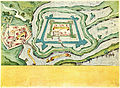
 Lynarplan Zitadelle Spandau 1578.jpg 6,170 × 5,524; 13.95 MB
-
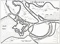
 Stadt, Schloß und Vöstung Spandaw 1604.jpg 5,820 × 4,257; 11.03 MB
-
 M. Dögen, Spandow, 1647.jpg 4,600 × 3,404; 4.82 MB
-
 Faulhaber Haubt-Vöstung Spandaw 1680 (lres).jpg 466 × 537; 108 KB
-
 Faulhaber Haubt-Vöstung Spandaw 1680.jpg 2,047 × 1,800; 1.2 MB
-
 Gustav-Haestskau-Spandau-Extra-Moenia.jpg 302 × 204; 18 KB
-
 Gustav-Haestskau-Spandau-Extra-Moenia.png 302 × 204; 135 KB
-
 Gustav-Haestskau-Spandau-Intra-Moenia.png 275 × 204; 79 KB
-
 Spandau Extra Moenia 1728.jpg 3,649 × 2,396; 3.26 MB
-
 Spandau Intra Moenia 1728.jpg 2,744 × 1,993; 1.47 MB
-
 Plan de Spandau 1751-1770.jpg 1,499 × 1,170; 476 KB
-
 Grundriss Zuchthaus Spandau 1805.jpg 1,054 × 822; 258 KB
-
 Ca. 1806 French map of Spandau.jpg 7,582 × 5,706; 6.26 MB
-
 Situations Plan von der Stadt und Festung Spandow 1812.jpg 3,589 × 2,161; 2.78 MB
-
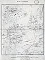
 Spandau um 1812.jpg 1,288 × 842; 656 KB
-
 Urmesstischblatt 3445 (Spandau) um 1835 (auf Stresow).jpg 1,056 × 900; 669 KB
-
 Urmesstischblatt 3445 (Spandau) um 1835.jpg 5,200 × 5,196; 15.83 MB
-
 Spandau Urmesstischblatt 1836.jpg 1,000 × 1,136; 749 KB
-
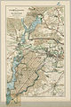
 Plan von Spandau 1859.jpg 3,600 × 4,883; 10.49 MB
-
 Die Jungfernheide und der Grunewald 1875.jpg 1,552 × 2,316; 1.81 MB
-
 Plan Königliche Artilleriewerkstätten Spandau 1887.jpg 1,455 × 1,071; 1.17 MB
-
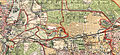
 Straube's Spezialkarte der nördlichen Vororte von Berlin 1904.jpg 10,362 × 8,160; 37.94 MB
-
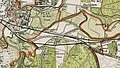 Straube's Spezialkarte der nördlichen Vororte von Berlin 1904 (Stresow-Ruhleben).jpg 1,971 × 1,122; 1.48 MB
-
 Straube's Spezialkarte der nördlichen Vororte von Berlin 1909.jpg 7,323 × 5,398; 20.81 MB
-

-
 Straube Plan der Stadt Spandau 1912.jpg 2,461 × 3,000; 3.66 MB
-
 Stadtplan von Spandau 1913.jpg 8,600 × 6,834; 27.07 MB
-
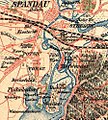
 Berlin-Stresow Karte 1842.jpg 647 × 574; 323 KB
-
 Bullengrabenniederung Spandau Karte 1836.JPG 2,187 × 986; 399 KB
-
 Gatow-aus-Karte-1768.png 2,500 × 2,759; 13.47 MB
-
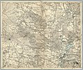 Karte des Deutschen Reiches von 1893 (268) Spandau 5820268c.jpg 11,106 × 9,328; 27.47 MB
-
 Karte Murellenberge Berlin 1842.JPG 959 × 1,235; 1.08 MB
-
 Karte Pichelsdorf Havel 1842.JPG 767 × 1,382; 1.16 MB
-
 Karte Tiefwerder 1842.JPG 394 × 656; 132 KB
-
 Nonnendamm auf Straube 1909.jpg 3,600 × 1,656; 2.75 MB
-
 Nonnendamm auf Urmesstischblatt um1835.jpg 4,500 × 1,864; 3.95 MB
-
 Paulstern Sternfeld auf Straube 1909.jpg 2,453 × 1,147; 1.39 MB
-
 Pichelsdorf 1899.jpg 894 × 996; 197 KB
-
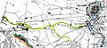
 Weg Spandau-Berlin 1778.jpg 2,000 × 1,381; 962 KB


.jpg)


_um_1835_(auf_Stresow).jpg)
_um_1835.jpg)


.jpg)

.jpg)


_Spandau_5820268c.jpg)


