Category:Old maps of Bergen, Norway
Jump to navigation
Jump to search
Subcategories
This category has the following 2 subcategories, out of 2 total.
Media in category "Old maps of Bergen, Norway"
The following 84 files are in this category, out of 84 total.
-
 "Episcopatus Stavangriae pars borealis." (22072105330).jpg 3,560 × 2,841; 1.93 MB
-
 Admiralty Chart No 1121 Bergen, Published 1888.jpg 8,087 × 11,092; 32.91 MB
-
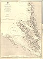
 Admiralty Chart No 2291 Norway west coast sheet 2 Bergen to Stav Fiord, Published 1874.jpg 12,359 × 8,279; 16.19 MB
-
 Admiralty Chart No 2303 Approaches to Bergen, Published 1894.jpg 11,139 × 16,266; 69.62 MB
-
 Admiralty Chart No 2304 Norway, west coast Karmö to Bergen, Published 1873.jpg 11,911 × 8,518; 14.12 MB
-
 Admiralty Chart No 3008 Bergen Havn, Published 1967.jpg 8,234 × 11,224; 38.71 MB
-
 Apotek bergen.jpg 1,200 × 1,222; 313 KB
-
 Battle of Bergen, 1665.jpg 2,092 × 1,719; 1.27 MB
-
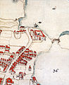
 Bergen 1768-map.jpg 1,010 × 617; 517 KB
-
 Bergen 1864 (cropped).jpg 756 × 612; 92 KB
-
 Bergen 1864.jpg 862 × 710; 107 KB
-
 Bergen 1914 (26874431886).jpg 6,400 × 5,032; 6.81 MB
-
 Bergen gamle stasjon - Utsnitt av kart fra 1880.png 2,644 × 1,326; 6.54 MB
-
 Bergen i Norge. Maalestok pas 800 Alen - btv1b84923807.jpg 4,360 × 5,897; 3.73 MB
-
 Bergen Lungegården 1740.jpg 2,394 × 2,925; 1.81 MB
-
 Bergen map 1823.jpg 639 × 976; 1.06 MB
-

-
 Bergen Sandviken 1740.jpg 700 × 379; 31 KB
-
 Bergen stasjon (24896501145).jpg 4,966 × 3,246; 8.08 MB
-

-
 Bergen-13ème.jpg 832 × 902; 247 KB
-
 Bergen-1907.png 1,309 × 1,909; 818 KB
-
 Bergen-omegn-1907-Nesttun-Os.png 522 × 733; 158 KB
-
 Bergen-omegn-1907.png 1,184 × 1,906; 816 KB
-
 Bergens by nr 1- Carta af Bergenshus Slot, 1750.jpg 7,507 × 6,400; 4.82 MB
-
 Bergens by nr 14- Forbedrings Plan af Bergenshuus Fæstning, 1800.jpg 4,975 × 3,905; 2.64 MB
-
 Bergens by nr 18- Kart over Bergenhus Fæstning, 1829.jpg 10,596 × 9,469; 19.38 MB
-
 Bergens by nr 20- Kart over Bergen med Omegn, 1864 (cropped).jpg 965 × 917; 608 KB
-
 Bergens by nr 20- Kart over Bergen med Omegn, 1864 (FREDENS BOLIG).jpg 1,891 × 1,570; 1.5 MB
-

-
 Bergens by nr 20- Kart over Bergen med Omegn, 1864.jpg 5,319 × 4,376; 6.23 MB
-
 Bergens by nr 22- Kart over Bergen, 1885.jpg 5,568 × 6,651; 11.64 MB
-
 Bergens by nr 27- Bergen med omegn, 1907 (detail1).jpg 1,920 × 1,080; 917 KB
-
 Bergens by nr 27- Bergen med omegn, 1907 takmark (cropped).jpg 2,878 × 3,230; 5.22 MB
-
 Bergens by nr 27- Bergen med omegn, 1907 takmark.jpg 3,769 × 3,505; 7.5 MB
-
 Bergens by nr 27- Bergen med omegn, 1907.jpg 7,713 × 9,627; 19 MB
-
 Bergens by nr 3- Plan von Bergen, 1745.jpg 3,720 × 5,694; 3.83 MB
-
 Bergens by nr 31- Kart over Bergen, 1934.jpg 23,600 × 6,133; 23.13 MB
-
 Bergens by nr 32- Espeland bygningsdistrikt Haus, 1940.jpg 21,330 × 12,256; 29.65 MB
-
 Bergens by nr 6- Situation af Staden og Egnen om Bergen udi Norge, 1750.jpg 5,662 × 6,809; 9.52 MB
-
 Bergens by nr 8- Situations Carte over Bergenshuus, 1757.jpg 5,830 × 4,775; 4.25 MB
-
 Bergens by nr 9- Carta over Bergen, 1768.jpg 5,270 × 3,481; 3.74 MB
-
 Bergens Museums aarbog (1902) (20176918840).jpg 2,688 × 3,208; 1.68 MB
-
 Bergens Museums aarbok (1914) (20177292528).jpg 3,744 × 1,984; 1.36 MB
-
 Bergens Museums aarsberetning for (20176854830).jpg 2,780 × 3,706; 1.76 MB
-
 Bergens Museums aarsberetning for (20364903255).jpg 2,708 × 3,942; 1.24 MB
-
 Bergenskart 1877.jpg 2,896 × 2,236; 5.88 MB
-
 Bergenskart 1902.jpg 578 × 800; 205 KB
-
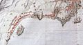
 Bradbenken Bergen map 1783.jpg 1,517 × 1,260; 1.93 MB
-
 Bsrw bergen kart hele 1885.jpg 1,325 × 1,433; 436 KB
-
-
 Episcopatus Bergensis. NYPL1696027.tiff 6,194 × 4,856; 86.06 MB
-
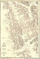
 Generalkart VII, Bergen, 1885.jpg 7,206 × 5,641; 7.93 MB
-
 Generalkart VII, Bergen, 1925.jpg 6,478 × 5,688; 8.11 MB
-
 Håndtegnet kart over Bergen med omegn (24658743400).jpg 4,100 × 3,907; 21.01 MB
-
 Kart over Bergen - btv1b532394706.jpg 9,546 × 11,644; 14.92 MB
-
 Kart over Bergens Havnedistrikt - btv1b531699733.jpg 13,818 × 8,512; 9.84 MB
-
 Kart over Søndre Bergenhus Amt (nordre), 1870.jpg 10,630 × 6,545; 15.84 MB
-
 Kongeriget Norge - no-nb digibok 2013050708075-V2.jpg 3,935 × 3,081; 1.1 MB
-
-
 Le Tour du monde-02-p083.jpg 832 × 886; 201 KB
-
 Omegnskart Bergen omland 1, 1927.jpg 10,699 × 7,488; 13.99 MB
-
 Omegnskart Bergen omland 1, 1929.jpg 5,477 × 7,793; 5.48 MB
-
 Omegnskart Bergen omland 1, 1946.jpg 5,147 × 7,563; 4.04 MB
-
 Omegnskart Bergen omland 2, 1929.jpg 5,739 × 7,986; 7.92 MB
-
 Omegnskart Bergen omland 2, 1946.jpg 5,236 × 7,481; 7.08 MB
-
 Omegnskart Bergen omland 2, 1954.jpg 5,167 × 7,568; 7.62 MB
-
 Omegnskart Bergen omland 2, 1958.jpg 5,297 × 7,522; 7.9 MB
-
 Omegnskart Bergen omland 3, 1931.jpg 5,717 × 8,039; 6.68 MB
-
 Omegnskart Bergen omland 3, 1946.jpg 5,340 × 7,576; 6.79 MB
-
 Omegnskart Bergen omland 3, 1958.jpg 5,861 × 7,396; 6.86 MB
-
 Omegnskart Bergen omland 4, 1931.jpg 5,816 × 7,652; 8.62 MB
-
 Omegnskart Bergen omland 5, 1934.jpg 5,506 × 8,028; 6.97 MB
-
 Omegnskart Bergen omland 5, 1956.jpg 5,015 × 7,444; 7.14 MB
-
 Omegnskart Bergen omland 5, 1962.jpg 4,911 × 7,483; 6.05 MB
-
 Omegnskart Bergen omland 6, 1934.jpg 5,937 × 8,082; 9.2 MB
-
 Omegnskart Bergen omland 6, 1947.jpg 6,072 × 7,452; 9.08 MB
-
 Omegnskart Bergen omland 6, 1964.jpg 6,215 × 7,636; 10.44 MB
-
 Omegnskart Bergen omland 7, 1934.jpg 5,871 × 7,664; 7.67 MB
-
 Omegnskart Bergen omland 7, 1947.jpg 5,410 × 7,736; 6.56 MB
-
 Omegnskart Bergen omland 8, 1934.jpg 5,477 × 7,838; 7.92 MB
-
 Omegnskart Bergen omland 8, 1947 - 1.jpg 5,632 × 7,533; 8.01 MB
-
 Omegnskart Bergen omland 8, 1947 - 2.jpg 5,500 × 7,471; 7.86 MB
-
 Søndre Bergenhus amt nr 14 nordre- Kart over Søndre Bergenhus Amt (nordre), 1868.jpg 8,687 × 5,387; 9.47 MB
.jpg)


.jpg)

.jpg)


_2017-10-30.jpg)

.jpg)


.jpg)
.jpg)
.jpg)


.jpg)
.jpg)


_(20176918840).jpg)
_(20177292528).jpg)
.jpg)
.jpg)


.jpg)


,_1870.jpg)


,_1868.jpg)