Category:Old maps of Belgrade
Jump to navigation
Jump to search
Use the appropriate category for maps showing all or a large part of Belgrade. See subcategories for smaller areas:
| If the map shows | Category to use |
|---|---|
| Belgrade on a recently created map | Category:Maps of Belgrade or its subcategories |
| Belgrade on a map created more than 70 years ago | Category:Old maps of Belgrade or its subcategories |
| the history of Belgrade on a recently created map | Category:Maps of the history of Belgrade or its subcategories |
| the history of Belgrade on a map created more than 70 years ago | Category:Old maps of the history of Belgrade or its subcategories |
Pages in category "Old maps of Belgrade"
This category contains only the following page.
Media in category "Old maps of Belgrade"
The following 37 files are in this category, out of 37 total.
-
 Siege of Belgrade 1456 from a 15 th century turkish manuscript.jpg 175 × 230; 52 KB
-
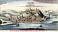
 Belgrade (Weissenburg) (1600).jpg 800 × 600; 167 KB
-
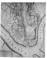
 1683 spy plan of Belgrade.jpg 2,365 × 1,726; 694 KB
-
 Belgrade 1684.jpg 555 × 305; 57 KB
-
 Belgrado - Peeters Jacob - 1686.jpg 1,500 × 675; 522 KB
-
 Belgrade 1688-1690.jpg 400 × 286; 21 KB
-
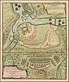
 Map of 1688 siege of Belgrade.jpg 1,800 × 1,350; 771 KB
-
 Citta di Belgrado... - (Par Coronelli, 1689) - btv1b550061701 (2 of 3).jpg 5,219 × 3,321; 2.47 MB
-
 Italian Mape of Belgrade "Talijanski Plan".tiff 2,984 × 3,674; 10.48 MB
-

-
 Belgrad BV044698773.jpg 3,107 × 3,328; 1.39 MB
-
 Eigentlicher und Warhaffter Grundriess der Vestung Belgrad samt der Belagerung - CBT 5883263.jpg 4,687 × 5,445; 12.08 MB
-
 Karte-Belgrad-1717.jpg 1,025 × 589; 117 KB
-
 Siegeofbelgarde1717.jpg 1,590 × 1,883; 3.74 MB
-
-
-
 Nándorfehérvári csata-1729.jpg 800 × 672; 236 KB
-

-
 Belgradum sive Alba 1760.jpg 604 × 513; 96 KB
-
 Banat Josephinische Landaufnahme pg150.jpg 8,524 × 5,771; 26.37 MB
-
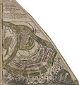
 Plan Belagerung Belgrad 1788.jpg 1,114 × 1,500; 546 KB
-
 Belgrade - btv1b8494034k (1 of 2).jpg 10,720 × 7,930; 8.01 MB
-
 Glavna ulica 1791.png 563 × 600; 420 KB
-
 Dzamija plan.tiff 2,050 × 2,556; 5.01 MB
-
 Belgrade 1822.jpg 1,406 × 711; 208 KB
-
 План Београда... - (publié par Stephan Zaritch) - btv1b53021121t.jpg 12,056 × 15,898; 22.1 MB
-
 Meyers b2 s0660 b1.png 386 × 497; 132 KB
-
 Belgrád - 38-45 (cropped).jpg 1,079 × 809; 249 KB
-
 Djeneralstabna karta 1893.jpg 1,281 × 736; 499 KB
-
 Plan Beograda 1893. godina.jpg 520 × 750; 113 KB
-

-

-
 Plan beogradske kanalizacije iz 1903. godine.jpg 2,251 × 1,703; 1.81 MB
-
 Belgrad 1905.jpg 1,200 × 1,632; 372 KB
-
-
 1914 Austrian topomap of Belgrade and Zemun.jpg 2,827 × 2,106; 1.11 MB
-
 Semlin und Pancsova. NYPL1226928.tiff 5,475 × 4,640; 72.69 MB

_(1600).jpg)


_-_btv1b550061701_(2_of_3).jpg)
,_BI-B-FM-090-10.jpg)


_Les_Forces_de_l%27Europe,_Asie,_Afrique_et_Amerique_Comme_aussi_les_Cartes_des,_RP-P-OB-83.036-224.jpg)

.jpg)


.jpg)


_-_btv1b53021121t.jpg)

.jpg)


%27_(11230197046).jpg)
.jpg)


_(14592885328).jpg)
