Category:Old maps of Bangkok
Jump to navigation
Jump to search
Subcategories
This category has only the following subcategory.
M
Media in category "Old maps of Bangkok"
The following 15 files are in this category, out of 15 total.
-
 Map of Bangkok (Baedeker, 1914).jpg 988 × 1,542; 1.45 MB
-

-

-
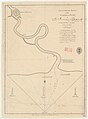 Admiralty Chart No 999 Menam River, Siam, Published 1797.jpg 2,950 × 3,996; 2.01 MB
-
 AMH-8009-KB Map of the Menam River, with Bangkok and Ayuthaya.jpg 1,650 × 2,400; 670 KB
-
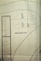
 De Lamare construction plan for 1685 Bangkok forts 01.png 745 × 561; 747 KB
-
 De Lamare construction plan for 1685 Bangkok forts 02.png 404 × 608; 560 KB
-
 De Lamare construction plan for 1685 Bangkok forts 03.jpg 640 × 943; 201 KB
-
 Karte Bangkok MKL1888 kl.png 368 × 627; 64 KB
-
 La Loubere map of Bangkok (English).jpg 388 × 642; 71 KB
-
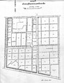 Map of Chulalongkorn University, 1925.jpg 500 × 654; 71 KB
-
 Meyers b2 s0319 b1.png 388 × 647; 119 KB
-
 Siege of Bangkok 1688.jpg 1,599 × 1,158; 578 KB
-
 Siege of Bangkok.JPG 1,319 × 1,105; 904 KB
-
 Sketch of the town of Bangkok by a native.jpg 1,247 × 1,247; 239 KB
.jpg)
.jpg)


.jpg)


%27_(11170761483).jpg)