Category:Old maps of Atlanta
Jump to navigation
Jump to search
State capitals of the United States: Albany [NY] · Atlanta [GA] · Baton Rouge [LA] · Boston [MA] · Columbus [OH] · Denver [CO] · Indianapolis [IN] · Lansing [MI] · Little Rock [AR] · Montgomery [AL] · Phoenix [AZ] · Federal district: Washington, D.C. [DC] · Insular area of the United States
Subcategories
This category has only the following subcategory.
S
Media in category "Old maps of Atlanta"
The following 47 files are in this category, out of 47 total.
-
 1853-Atlanta-Vincent-map.JPG 1,252 × 1,376; 644 KB
-

-
 1917AtlantaFire.PNG 397 × 824; 762 KB
-
 286 of 'History of the American Civil War, etc' (11094781675).jpg 1,423 × 2,390; 686 KB
-
 Air-crash search-and-rescue map. Charlie Brown County Airport, Georgia LOC 95683244.jpg 7,592 × 9,058; 12.37 MB
-
 Air-crash search-and-rescue map. Charlie Brown County Airport, Georgia LOC 95683244.tif 7,592 × 9,058; 196.75 MB
-
 Atlanta & vicinity - compiled from state map and information LOC 2006458681.jpg 4,956 × 7,003; 4.27 MB
-
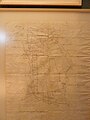
 Atlanta - from Vincent's subdivision map, published by the City Council LOC 2006459234.jpg 4,374 × 5,994; 3.98 MB
-
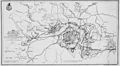
 Atlanta 19 July- 26 August 1864.jpeg 1,742 × 1,215; 384 KB
-
 Atlanta Koch map 1892.jpg 7,999 × 5,319; 17.36 MB
-
 Atlanta Ruger map 1871.jpg 7,427 × 5,999; 14.94 MB
-
 Atlanta Street Map, 1888.jpg 2,092 × 2,563; 1.99 MB
-
 Atlanta streetcars 1924.jpg 787 × 671; 92 KB
-
 Atlanta, Georgia and its rebel defences (sic) LOC gvhs01.vhs00311.jpg 4,284 × 5,520; 3.48 MB
-
 Atlanta-1911.jpg 3,685 × 2,765; 4.06 MB
-
 Atlanta-ward-1854.png 1,272 × 1,376; 3.32 MB
-
 Atlanta-wards-1871.png 1,268 × 1,376; 3.32 MB
-
 Atlanta-wards-1874.jpg 2,845 × 3,566; 3.99 MB
-
 Atlanta-wards-1883.jpg 2,845 × 3,566; 4.03 MB
-
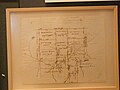
 Atlanta. From Vincent's subdivision map - Army of the Cumberland 1864.jpg 1,226 × 1,766; 172 KB
-
 Atlanta. LOC 2006459235.jpg 4,113 × 6,891; 2.88 MB
-
 Atlanta. LOC 75693190.jpg 9,536 × 5,824; 13.41 MB
-
 Bird's eye view of Atlanta, Fulton Co., State capital, Georgia. LOC 75693189.tif 15,648 × 10,272; 459.87 MB
-
 Birds eye view of the city of Atlanta, the capitol of Georgia 1871. LOC 73693339.jpg 8,928 × 7,024; 14.12 MB
-

-
 Ga.-20Northern-Arc-routes.jpg 702 × 411; 68 KB
-
 Georgia. LOC gvhs01.vhs00031.jpg 1,836 × 2,134; 506 KB
-

-
-

-

-

-

-
 Map illustrating the siege of Atlanta. Poe 1864.jpg 2,093 × 1,157; 227 KB
-
 Map of Atlanta and vicinity LOC 2008628275.jpg 3,777 × 4,763; 1.55 MB
-
 Map of Atlanta and vicinity. (July 1864). LOC 99447304.jpg 1,128 × 1,080; 275 KB
-
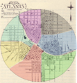
 Map of Atlanta, 1923.jpg 914 × 748; 120 KB
-
 Map of Business Section of Atlanta, 1907.png 1,077 × 874; 1.78 MB
-

-
 NIE 1905 Atlanta.jpg 2,030 × 1,694; 1.83 MB
-
 Paper Museum in Atlanta 162.JPG 3,264 × 2,448; 3.35 MB
-
 Paper Museum in Atlanta 163.JPG 2,448 × 3,264; 3.16 MB
-

-
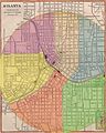
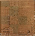
 The Heart of Atlanta, 1924.png 627 × 814; 392 KB
-
 Union troop positions at Peach Tree Creek, Georgia, July 20, 1864. LOC 2007626736.jpg 2,561 × 2,684; 668 KB
-
-


%27_(11070656744).jpg)

.jpg)


_LOC_gvhs01.vhs00311.jpg)


.jpg)


._LOC_99447304.jpg)


.jpg)