Category:Old maps of Aire-sur-la-Lys
Jump to navigation
Jump to search
Subcategories
This category has the following 3 subcategories, out of 3 total.
Media in category "Old maps of Aire-sur-la-Lys"
The following 8 files are in this category, out of 8 total.
-
 Plan d'Aire-sur-la-Lys 1693.jpg 6,460 × 5,035; 3.46 MB
-
 Plan Aire-sur-la-Lys 1710.jpg 7,548 × 5,185; 7.76 MB
-
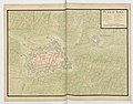
 Plan d'Aire-sur-la-Lys 17xx.jpg 8,805 × 6,349; 7.4 MB
-
 Aire-sur-la-Lys - 1710 map.jpg 1,000 × 784; 1.56 MB
-
 Aire-sur-la-Lys - 1711 map.jpg 993 × 725; 1.32 MB
-

-
 Plan Aire-sur-la-Lys 1745.jpg 3,071 × 2,220; 2.71 MB
-
 Siege and conquest of Aire by Louis XIII in 1641 (J.Blaeu, 1649).jpg 5,500 × 4,354; 3.87 MB


.jpeg)

.jpg)