Category:Old maps of Ålesund
Jump to navigation
Jump to search
Media in category "Old maps of Ålesund"
The following 17 files are in this category, out of 17 total.
-
 Aalesund-1907.png 1,781 × 1,043; 627 KB
-
 Admiralty Chart No 1291 Nerlandso to Lepso, Published 1896, Large Corrections 1928.jpg 17,461 × 11,076; 60.85 MB
-
 BORGUND KIRKE - an10071205103003.jpg 3,011 × 2,074; 3.93 MB
-
 Generalkart X, Ålesund, 1891.jpg 6,998 × 5,688; 6.3 MB
-
 Generalkart X, Ålesund, 1920.jpg 6,510 × 5,568; 6.59 MB
-
 Generalkart X, Ålesund, 1929.jpg 6,318 × 5,464; 6.52 MB
-
 Kart over Aalesund 1907 - No-nb krt 01256.jpg 3,472 × 5,100; 13.92 MB
-
 Kart over Aalesund 1907 - No-nb krt 01257.jpg 3,471 × 5,200; 15.65 MB
-
 Kart over Aalesund 1907 - No-nb krt 01258.jpg 3,395 × 5,200; 15.65 MB
-
 Kart over Aalesund 1907 - No-nb krt 01259.jpg 3,393 × 5,200; 15.02 MB
-
 Kart over Ålesund fra 1929.png 5,045 × 2,447; 35.33 MB
-
 Romsdals amt nr 27- Kart over Ålesund, 1898.jpg 11,727 × 6,902; 12.07 MB
-
 Romsdals amt nr 29- Kart over Aalesunds omegn, 1915.jpg 10,633 × 4,550; 5.07 MB
-
 Romsdals amt nr 33- Kartskisse over Aalesund, 1915.jpg 12,017 × 6,984; 8.01 MB
-
 Romsdals amt nr 52- Ålesund, 1929.jpg 12,783 × 5,001; 10.73 MB
-
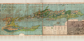
 Ålesund map 1911.jpg 2,000 × 912; 1.71 MB
-
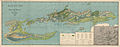
 Ålesund map 1915.jpg 750 × 431; 232 KB


