Category:Old maps by the Survey of India
Jump to navigation
Jump to search
Media in category "Old maps by the Survey of India"
The following 17 files are in this category, out of 17 total.
-
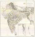 1888 India--second edition by Survey of India.jpg 20,142 × 21,316; 26.64 MB
-
 1915 India and Adjacent Countries by Survey of India.jpg 25,759 × 23,374; 329.13 MB
-
 1936 Survey of India map of Highlands of Tibet and Surrounding Regions.jpg 16,605 × 11,925; 17.46 MB
-
 1947 India showing Provinces, States and Districts by Survey of India (cropped).jpg 6,049 × 5,457; 9.8 MB
-
 1950 India showing Political Divisions in the New Republic by Survey of India.jpg 10,699 × 9,896; 5.42 MB
-
 1954 Political Map of India by Survey of India.jpg 5,000 × 4,517; 12.13 MB
-
 City of Calcutta (10403000).jpg 26,784 × 30,832; 306.51 MB
-
 City of Calcutta by Survey of India 1912.png 11,430 × 13,157; 66.89 MB
-

-
 Index-to-northwest-Himalaya-1876.pdf 2,470 × 2,566; 2.01 MB
-
 India & Burma Trigonometrical Survey, 1892.jpg 1,337 × 1,412; 1.56 MB
-
 India and adjacent countries, 1907 (13441003).jpg 26,010 × 20,306; 206.87 MB
-
 India and adjacent countries, 1917.jpg 25,429 × 23,559; 322.23 MB
-
 India showing Railways open and under construction on 31-03-1915 (13442000).jpg 24,840 × 19,992; 215.8 MB
-
 Jammu and Kashmir in 1888 Survey of India map.jpg 5,113 × 3,513; 5.64 MB
-
 McMahon Line on 1936 Survey of India map of Tibet.jpg 2,969 × 1,509; 2.12 MB
-
 Population of India Shown by Rectangles (10483000).jpg 9,345 × 7,990; 35.54 MB


.jpg)


.jpg)

.jpg)

.jpg)

.jpg)


.jpg)