Category:Old geological maps of Scotland
Jump to navigation
Jump to search
| NO WIKIDATA ID FOUND! Search for Old geological maps of Scotland on Wikidata | |
| Upload media |

Media in category "Old geological maps of Scotland"
The following 25 files are in this category, out of 25 total.
-

-

-

-

-

-

-
 A Description of the Western Islands of Scotland (Rum, Eigg, Muck).jpg 614 × 461; 123 KB
-
 BarrowHighlandBoundaryFault.png 3,039 × 1,880; 6.55 MB
-
 Berwickshire map Lowe.jpg 646 × 508; 102 KB
-
 Bryce Arran Geological Map, published 1859.tif 2,800 × 5,092; 9.49 MB
-
 Clough Cove Harbour Geological Map.png 1,379 × 1,024; 347 KB
-
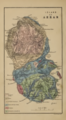
 GeologicalRaasay.gif 1,027 × 1,608; 407 KB
-
 MacGregor Midland Valley Scotland Plate 2.jpg 3,340 × 2,878; 1.12 MB
-

-
 Peach Horne Orkney Geological Map 1883 orkneysshetlandt00tudo 0234.jpg 1,468 × 2,067; 363 KB
-
 Peach Horne Shetland Geological Map 1883.jpg 1,395 × 2,447; 421 KB
-
 Read Page030 Dalradian.jpg 3,064 × 2,859; 669 KB
-
 Special reports on the mineral resources of Great Britain (1915) (14770745321).jpg 1,850 × 2,546; 726 KB
-
 The oil-shales of the Lothians 0096 Fig 21.png 1,314 × 898; 1.31 MB
-
 The oil-shales of the Lothians geological map.png 3,695 × 2,273; 10.86 MB
-
 The Quarterly journal of the Geological Society of London (1904) (14598489058).jpg 2,544 × 1,980; 418 KB
-
 The Quarterly journal of the Geological Society of London (1913) (14804574383).jpg 1,332 × 2,584; 375 KB
-
 The Quarterly journal of the Geological Society of London (1916) (14781827581).jpg 1,202 × 3,211; 524 KB
-
 The Quarterly journal of the Geological Society of London (1916) (14784622702).jpg 2,164 × 2,505; 711 KB
-
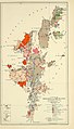
 Unst Geological Map, Published 1931.jpg 1,776 × 2,826; 435 KB
.jpg)
%27_(11074602143).jpg)
%27_(11052619543).jpg)
%27_(11134567856).jpg)
.jpg)
.jpg)


_(14800338573).jpg)


_(14770745321).jpg)


_(14598489058).jpg)
_(14804574383).jpg)
_(14784622702).jpg)

%27_(11071358944).jpg)
_(14781827581).jpg)