Category:Old Mountfield Road, Omagh
Jump to navigation
Jump to search
Media in category "Old Mountfield Road, Omagh"
The following 44 files are in this category, out of 44 total.
-
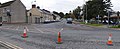 "Crossroads", Omagh - geograph.org.uk - 582982.jpg 640 × 264; 31 KB
-
 Archer, Omagh - geograph.org.uk - 1196543.jpg 640 × 480; 16 KB
-

-
 Carpetland, Omagh - geograph.org.uk - 137861.jpg 640 × 499; 109 KB
-
 Castle Pharmacy, Omagh - geograph.org.uk - 112744.jpg 640 × 479; 79 KB
-
 Cottage, Old Mountfield Road - geograph.org.uk - 1119543.jpg 640 × 480; 81 KB
-
 Cottage, Old Mountfield Road, Omagh - geograph.org.uk - 1119550.jpg 640 × 480; 63 KB
-
 Cottages - geograph.org.uk - 68247.jpg 640 × 479; 133 KB
-
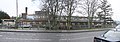
 Extension to nursing home, Omagh - geograph.org.uk - 839126.jpg 640 × 331; 43 KB
-
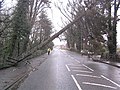 Fallen tree, Omagh - geograph.org.uk - 309161.jpg 640 × 480; 83 KB
-
 Gibson Primary School - geograph.org.uk - 69749.jpg 640 × 285; 72 KB
-

-
 Hillside Nursing Home, Omagh - geograph.org.uk - 64565.jpg 640 × 479; 163 KB
-
 Millburn Terrace, Omagh - geograph.org.uk - 611307.jpg 640 × 274; 28 KB
-
 Millview Terrace, Omagh - geograph.org.uk - 611303.jpg 640 × 286; 30 KB
-
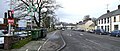
 Mountjoy Road, Omagh - geograph.org.uk - 357986.jpg 640 × 264; 27 KB
-
 Mullaghmore Post Office, near Omagh - geograph.org.uk - 69745.jpg 640 × 479; 127 KB
-
 Nursing Home extension, Omagh - geograph.org.uk - 1196406.jpg 640 × 480; 63 KB
-

-
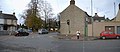
 Old Mountfield Road, Killyclogher - geograph.org.uk - 155567.jpg 640 × 479; 105 KB
-
 Old Mountfield Road, Omagh - geograph.org.uk - 1119472.jpg 640 × 480; 55 KB
-
 Old Mountfield Road, Omagh - geograph.org.uk - 1119567.jpg 640 × 480; 81 KB
-
 Old Mountfield Road, Omagh - geograph.org.uk - 1119569.jpg 640 × 480; 50 KB
-
 Old Mountfield Road, Omagh - geograph.org.uk - 1119573.jpg 640 × 480; 55 KB
-
 Old Mountfield Road, Omagh - geograph.org.uk - 1196410.jpg 640 × 480; 68 KB
-
 Old Mountfield Road, Omagh - geograph.org.uk - 1196478.jpg 640 × 480; 47 KB
-
 Old Mountfield Road, Omagh - geograph.org.uk - 1196485.jpg 640 × 480; 50 KB
-
 Old Mountfield Road, Omagh - geograph.org.uk - 1196525.jpg 640 × 480; 43 KB
-
 Old Mountfield Road, Omagh - geograph.org.uk - 1196537.jpg 640 × 480; 68 KB
-
 Old Mountfield Road, Omagh - geograph.org.uk - 130172.jpg 640 × 479; 148 KB
-
 Old Mountfield Road, Omagh - geograph.org.uk - 357881.jpg 640 × 480; 60 KB
-
 Old Mountfield Road, Omagh - geograph.org.uk - 357976.jpg 640 × 480; 76 KB
-
 Old Mountfield Road, Omagh - geograph.org.uk - 357983.jpg 640 × 274; 41 KB
-
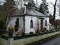
 Omagh Evangelical Church - geograph.org.uk - 53585.jpg 512 × 384; 37 KB
-
-
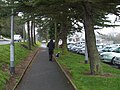 Pathway, Old Mountfield Road, Omagh - geograph.org.uk - 1119468.jpg 640 × 480; 62 KB
-

-
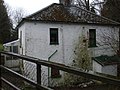
 Site of Soldier's Cottages, Omagh - geograph.org.uk - 611316.jpg 640 × 288; 41 KB
-
-

-
 Spar Supermarket, Omagh - geograph.org.uk - 199409.jpg 640 × 371; 36 KB
-
 Sunbeam Terrace, Omagh - geograph.org.uk - 611314.jpg 640 × 275; 32 KB
-
 Sunnyside Terrace, Omagh - geograph.org.uk - 611313.jpg 640 × 281; 31 KB
-
 The Grange Dental Care, Omagh - geograph.org.uk - 137860.jpg 398 × 640; 83 KB


_-_%22Tanyard%22,_Omagh_-_geograph.org.uk_-_199411.jpg)


