Category:Old Linguistic maps
Jump to navigation
Jump to search
This category is for old maps showing linguistics. See subcategories for more special topics.
- "Old maps" means maps made over seventy (70) years ago.
| Where to categorize or find Linguistic maps made in the last 70 years: |
|---|
| Category: Linguistic maps or its subcategories |
Please sort by date of map
Subcategories
This category has the following 3 subcategories, out of 3 total.
Media in category "Old Linguistic maps"
The following 59 files are in this category, out of 59 total.
-
 Bonaparte euskalki mapa.jpg 7,072 × 5,940; 10.01 MB
-
 BonaparteEuskara.png 1,154 × 945; 2.19 MB
-
 MapaTortolon.jpeg 1,227 × 1,054; 266 KB
-
 Isoglosse alt - al.jpg 1,118 × 653; 266 KB
-
 Isoglosse bin-sei.jpg 1,001 × 489; 312 KB
-
 Isoglosse treib-treiw.jpg 1,113 × 481; 193 KB
-
 Isoglosse wor-woa.jpg 1,101 × 464; 189 KB
-
 Isoglosse wär-war.jpg 1,118 × 481; 205 KB
-
 Isoglosse zu - ze.jpg 1,126 × 479; 223 KB
-
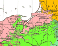 OstpreussenWestpreussenSprachen1880.png 491 × 387; 42 KB
-
 Polish language1880.png 788 × 746; 131 KB
-
 Tschechen1880 mit Schönhengstgau.jpg 886 × 589; 874 KB
-
 Tschechen1880.gif 886 × 589; 185 KB
-
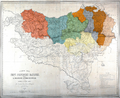
 Austria-Hungary (ethnic).jpg 4,314 × 2,820; 3.63 MB
-
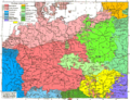 Sprachenkarte Deutschland1880.png 1,513 × 1,166; 356 KB
-
 St. Goarer Linie (Südwestfalen).png 975 × 859; 1.23 MB
-
 Walser Italien.JPG 1,968 × 2,121; 918 KB
-
 Meyers b12 s0486a.jpg 2,048 × 1,683; 1.35 MB
-
 Meyers b5 s0919a.jpg 2,048 × 1,529; 590 KB
-
 Gorizia mappa linguistica 1880.JPG 633 × 519; 121 KB
-
 Istria (ethnic).JPG 877 × 1,391; 1,010 KB
-
 Krain SCHPRACHEN-KARTE 1880 Pict 1.JPG 763 × 632; 250 KB
-
 Slovenia and surroundings (languages).jpg 3,497 × 2,550; 4.16 MB
-
 Austro-Ungaria si Romania (harta etnica).jpg 6,245 × 3,505; 6.73 MB
-
 Southern Austria-Hungary (Kiepert).JPG 1,322 × 504; 765 KB
-
 Brockhaus 1894 Deutsche Mundarten Sorbisch.jpg 900 × 675; 464 KB
-
 Brockhaus 1894 Deutsche Mundarten.jpg 3,551 × 2,866; 1.17 MB
-
 Austria-Hungary (ethnic).JPG 5,150 × 3,395; 4.73 MB
-
 Balkan map 1895 Richard Andree.jpg 1,371 × 1,771; 559 KB
-
 PSM V50 D475 Languages and dialects surrounding Iberia.jpg 1,762 × 1,607; 469 KB
-
 PSM V50 D476 Languages and dialects in the united kingdom.jpg 1,447 × 1,737; 299 KB
-
 Ethnographic map of Slavs, Lubor Niederle.JPG 1,017 × 847; 366 KB
-
 Central Europe (ethnic).JPG 2,230 × 1,436; 2.81 MB
-
 Mitteleuropa – Völker u. Sprachgebiete.jpg 5,613 × 4,147; 15.16 MB
-
 Mitteleuropa – Völker und Sprachgebiete 1904.jpg 5,625 × 4,153; 16.82 MB
-
 Sprachenkarte Kozenn 1906.jpg 1,528 × 1,550; 2.06 MB
-
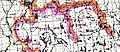
 East European population and languages - Russian map of 1907.jpg 900 × 874; 371 KB
-
 Ethnic map East Prussia 1907.jpeg 1,682 × 2,139; 4.75 MB
-
 Europe linguistic map 1907.JPG 2,464 × 1,613; 1.27 MB
-
 Karte der deutschen Mundarten (Brockhaus).jpg 6,638 × 5,057; 21.36 MB
-
 Balkan map 1910 Adolf Marx.jpg 6,400 × 4,800; 4.11 MB
-
 Languages in Central Europe 1910.jpg 1,049 × 1,031; 429 KB
-
 Austria hungary 1911 and post war borders.jpg 1,525 × 1,166; 389 KB
-
 Austria hungary 1911.gif 907 × 687; 397 KB
-
 Austria hungary 1911.jpg 1,521 × 1,155; 1.76 MB
-
 PSM V78 D513 North american ute aztecan language family.png 1,624 × 1,964; 225 KB
-
 PSM V78 D516 North american inuit algonquin and athabascan language map.png 1,635 × 1,975; 405 KB
-
 Polska1912.jpg 2,180 × 1,941; 811 KB
-
 Balkan dialects belic 1914.jpg 1,037 × 1,449; 248 KB
-
 Dialektologicheskaia Karta 1914 goda.jpeg 9,104 × 10,928; 17.09 MB
-
 Ethnic map (1914).jpg 1,396 × 998; 562 KB
-
 MapaCarbóArticleSalat.jpg 443 × 675; 55 KB
-
 London-geographical-institute the-peoples-atlas 1920 europe-racial-and-linguistic.jpg 3,992 × 3,012; 2.05 MB
-
 Mapa del Diccionari català-valencià-balear.jpg 6,873 × 8,125; 10.92 MB
-
 MapaAlcover.jpg 912 × 537; 202 KB
-
 The story of a word.jpg 2,677 × 1,991; 1.83 MB
-
 Lange diercke sachsen deutschtum erde.jpg 2,553 × 1,213; 1.91 MB
-
 Alibèrt - dialecte languedocien.tiff 1,929 × 1,366; 1.85 MB
-
 Kildin Saami map.JPG 299 × 242; 32 KB


.jpg)

.png)


.JPG)

.jpg)
.jpg)


.JPG)


.JPG)


.jpg)


.jpg)


.JPG)