Category:Old Fletton
Jump to navigation
Jump to search
settlement and unparished area in Peterborough, Cambridgeshire, England | |||||
| Upload media | |||||
| Instance of | |||||
|---|---|---|---|---|---|
| Part of |
| ||||
| Location | City of Peterborough, Cambridgeshire, East of England, England | ||||
 | |||||
Subcategories
This category has the following 2 subcategories, out of 2 total.
W
Media in category "Old Fletton"
The following 72 files are in this category, out of 72 total.
-
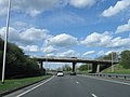 A1139 northbound - geograph.org.uk - 4536311.jpg 640 × 480; 53 KB
-
 Barn to the rear of The Woolpack, Stanground - geograph.org.uk - 5424476.jpg 3,000 × 4,000; 5.25 MB
-
 Beer garden of The Woolpack, Stanground - geograph.org.uk - 5739007.jpg 4,608 × 3,456; 3.35 MB
-
 Benchmark on the Fletton Centre - geograph.org.uk - 5992217.jpg 672 × 1,024; 304 KB
-
 Boat moorings at The Woolpack, Stanground - geograph.org.uk - 5738985.jpg 4,608 × 3,456; 3.24 MB
-
 Boats on the Nene upstream of Fitzwilliam Bridge - geograph.org.uk - 5010354.jpg 1,024 × 768; 156 KB
-
 Bungalows on High Street, Fletton - geograph.org.uk - 5167624.jpg 1,024 × 768; 114 KB
-
 Cemetery, Fletton, Cambs. - geograph.org.uk - 6244998.jpg 3,192 × 2,809; 3.27 MB
-
 Church of St. John the Baptist, Stanground - geograph.org.uk - 4209979.jpg 3,000 × 4,000; 2.64 MB
-
 Down by the Cemetery fence - geograph.org.uk - 1275459.jpg 640 × 480; 128 KB
-
 East end of High Street, Fletton - geograph.org.uk - 5167614.jpg 1,024 × 768; 124 KB
-
 Fletton Cemetery, Peterborough, Cambs. - geograph.org.uk - 6245021.jpg 4,018 × 3,013; 2.6 MB
-
 Fletton Cemetery, Peterborough, Cambs. - geograph.org.uk - 6245034.jpg 4,017 × 3,013; 3.96 MB
-
 Fletton ex Servicemen's Club - geograph.org.uk - 5020266.jpg 640 × 480; 54 KB
-
 Footpath to Church Street, Fletton - geograph.org.uk - 5167684.jpg 1,024 × 768; 243 KB
-
 Frank Perkins Parkway - geograph.org.uk - 6331520.jpg 640 × 476; 34 KB
-
 Frank Perkins Parkway - geograph.org.uk - 6331522.jpg 640 × 478; 31 KB
-
 Frank Perkins Parkway flyover, Fletton - geograph.org.uk - 5167631.jpg 1,024 × 768; 118 KB
-
 High Street, Old Fletton, Peterborough, Cambs. - geograph.org.uk - 6243924.jpg 2,797 × 3,089; 1.53 MB
-
 House on Church Street, Stanground - geograph.org.uk - 5167698.jpg 1,024 × 768; 139 KB
-
 IKEA Distribution Centre - geograph.org.uk - 4203737.jpg 640 × 430; 44 KB
-
 IKEA Distribution Centre - geograph.org.uk - 4203739.jpg 640 × 366; 35 KB
-
 Inside St Margaret, Fletton (a) - geograph.org.uk - 5019198.jpg 480 × 640; 56 KB
-
 Inside St Margaret, Fletton (b) - geograph.org.uk - 5019200.jpg 480 × 640; 55 KB
-
 Inside St Margaret, Fletton (c) - geograph.org.uk - 5019201.jpg 480 × 640; 52 KB
-

-

-

-

-

-
 OSBM Flush Bracket 1179 - Fletton, The White Hart - geograph.org.uk - 4800361.jpg 1,456 × 2,592; 623 KB
-
 OSBM Flush Bracket 1179 - Fletton, The White Hart - geograph.org.uk - 4800367.jpg 2,592 × 1,456; 551 KB
-
 River Nene - geograph.org.uk - 4340882.jpg 640 × 430; 41 KB
-
 Roman stone child's coffin, Stanground - geograph.org.uk - 5353796.jpg 3,000 × 4,000; 5.16 MB
-
 St Margaret, Fletton, altar - geograph.org.uk - 5019183.jpg 480 × 640; 61 KB
-
 St Margaret, Fletton, choir stalls - geograph.org.uk - 5019194.jpg 640 × 480; 78 KB
-

-
 St Margaret, Fletton, font - geograph.org.uk - 5019195.jpg 480 × 640; 58 KB
-
 St Margaret, Fletton, gravestones - geograph.org.uk - 5019178.jpg 640 × 480; 89 KB
-
 St Margaret, Fletton, late June 2016 - geograph.org.uk - 5019179.jpg 640 × 480; 64 KB
-

-

-
 St Margaret, Fletton, memorial (a) - geograph.org.uk - 5019189.jpg 480 × 640; 49 KB
-
 St Margaret, Fletton, memorial (b) - geograph.org.uk - 5019191.jpg 640 × 480; 60 KB
-
 St Margaret, Fletton, memorial (c) - geograph.org.uk - 5019192.jpg 640 × 480; 65 KB
-
 St Margaret, Fletton, memorial (d) - geograph.org.uk - 5019196.jpg 640 × 480; 64 KB
-
 St Margaret, Fletton, memorial (e) - geograph.org.uk - 5019203.jpg 640 × 480; 53 KB
-
 St Margaret, Fletton, memorial (f) - geograph.org.uk - 5019209.jpg 480 × 640; 58 KB
-
 St Margaret, Fletton, noticeboard - geograph.org.uk - 5019175.jpg 640 × 480; 122 KB
-
 St Margaret, Fletton, path - geograph.org.uk - 5019176.jpg 640 × 480; 130 KB
-
 St Margaret, Fletton, pulpit - geograph.org.uk - 5019210.jpg 480 × 640; 58 KB
-

-

-

-

-
 Stanground Baptist Church - geograph.org.uk - 5167691.jpg 1,024 × 768; 125 KB
-
 Stanground Lock - geograph.org.uk - 1324051.jpg 640 × 480; 105 KB
-
 Stanground Lock, Peterborough - geograph.org.uk - 83443.jpg 640 × 480; 92 KB
-
 Stanground Lode, Fletton (1) - geograph.org.uk - 5167671.jpg 1,024 × 768; 272 KB
-
 Stanground Lode, Fletton (2) - geograph.org.uk - 5167678.jpg 1,024 × 768; 353 KB
-

-
 Surviving Medieval wall, Stanground - geograph.org.uk - 5353782.jpg 4,000 × 3,000; 5.17 MB
-
 Swan's nest behind The Woolpack, Stanground - geograph.org.uk - 5739047.jpg 4,608 × 3,456; 3.6 MB
-
 Thatched cottage, South Street, Stanground - geograph.org.uk - 5167707.jpg 1,024 × 768; 105 KB
-
 The edge of Peterborough - geograph.org.uk - 4391071.jpg 640 × 426; 39 KB
-
 The Fletton Centre, St Margaret's Church - geograph.org.uk - 5992421.jpg 663 × 1,024; 140 KB
-
 The Glen, Fletton - geograph.org.uk - 5167609.jpg 1,024 × 768; 130 KB
-
 The Golden Lion, Stanground - geograph.org.uk - 5167702.jpg 1,024 × 768; 126 KB
-
 The Wonky Donkey, Fletton, Peterborough - geograph.org.uk - 6134978.jpg 1,632 × 920; 370 KB
-
 The Woolpack, Stanground - geograph.org.uk - 4209956.jpg 4,000 × 3,000; 2.7 MB
-
 Whittlesey Road, Fletton - geograph.org.uk - 5167637.jpg 1,024 × 768; 190 KB
-
 ^100 High Street - geograph.org.uk - 5989439.jpg 1,024 × 665; 124 KB


_-_geograph.org.uk_-_5019198.jpg)
_-_geograph.org.uk_-_5019200.jpg)
_-_geograph.org.uk_-_5019201.jpg)


_-_geograph.org.uk_-_5019189.jpg)
_-_geograph.org.uk_-_5019191.jpg)
_-_geograph.org.uk_-_5019192.jpg)
_-_geograph.org.uk_-_5019196.jpg)
_-_geograph.org.uk_-_5019203.jpg)
_-_geograph.org.uk_-_5019209.jpg)


_-_geograph.org.uk_-_5167671.jpg)
_-_geograph.org.uk_-_5167678.jpg)


