Category:Olbernhau
Jump to navigation
Jump to search
Urban municipalities:
Annaberg-Buchholz · Aue-Bad Schlema · Marienberg · Schwarzenberg · Stollberg · Zschopau · Ehrenfriedersdorf · Eibenstock · Elterlein · Geyer · Grünhain-Beierfeld · Johanngeorgenstadt · Jöhstadt · Lauter-Bernsbach · Lugau · Lößnitz · Oberwiesenthal · Oelsnitz · Olbernhau · Pockau-Lengefeld · Scheibenberg · Schlettau · Schneeberg · Thalheim · Thum · Wolkenstein · Zwönitz
Rural municipalities:
Amtsberg · Auerbach · Bockau · Breitenbrunn · Burkhardtsdorf · Bärenstein · Börnichen · Crottendorf · Deutschneudorf · Drebach · Gelenau · Gornau · Gornsdorf · Großolbersdorf · Großrückerswalde · Grünhainichen · Heidersdorf · Hohndorf · Jahnsdorf · Königswalde · Mildenau · Neukirchen · Niederdorf · Niederwürschnitz · Raschau-Markersbach · Schönheide · Sehmatal · Seiffen · Stützengrün · Tannenberg · Wiesenbad · Zschorlau
Former municipalities:
Aue · Bernsbach · Borstendorf · Erlbach-Kirchberg · Hormersdorf · Lauter · Lengefeld · Pfaffroda · Pobershau · Pockau · Schlema · Sosa · Venusberg · Waldkirchen · Zöblitz
municipality of Germany .jpg)   | |||||
| Upload media | |||||
| Instance of |
| ||||
|---|---|---|---|---|---|
| Location | Erzgebirgskreis, Saxony, Germany | ||||
| Population |
| ||||
| Area |
| ||||
| Elevation above sea level |
| ||||
| official website | |||||
 | |||||
Subcategories
This category has the following 17 subcategories, out of 17 total.
Media in category "Olbernhau"
The following 9 files are in this category, out of 9 total.
-
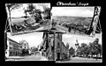 19680713100AR Olbernhau Fotopostkarte.jpg 4,909 × 3,080; 2.83 MB
-
 Dampf-Lokomobile Typ ZG (1).jpg 4,032 × 2,268; 1.71 MB
-
De-Olbernhau.ogg 1.9 s; 19 KB
-
 Fundgrube Roter Hirsch.jpg 1,337 × 1,201; 406 KB
-
 Olbernhau in ERZ.png 299 × 299; 8 KB
-
 OLBERNHAU nieder.svg 512 × 427; 21 KB
-
 Ornamentpflanzung ADvS 1929 bei Olbernhau.jpg 4,080 × 2,223; 2.43 MB
-
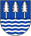 Wappen Olbernhau plain.svg 500 × 578; 19 KB
-
 Wappen Olbernhau.png 233 × 282; 10 KB

.jpg)


