Category:Ogbourne Maizey
Jump to navigation
Jump to search
village in Wiltshire, United Kingdom | |||||
| Upload media | |||||
| Instance of | |||||
|---|---|---|---|---|---|
| Location | Ogbourne St Andrew, Wiltshire, South West England, England | ||||
 | |||||
English: Ogbourne Maizey is a tiny hamlet in Wiltshire. It is at the Marlborough end of the village of Ogbourne St. Andrew. The hamlet on the banks of the River Og is dominated by commuter housing and race horse stables on the narrow road that leads over the downs to Rockley. Local primary-level children usually go to the school in Ogbourne St. George or to Marlborough. A map of 1773 shows an almost continuous ribbon of buildings along it between Ogbourne Maizey and Ogbourne St. Andrew.
Media in category "Ogbourne Maizey"
The following 40 files are in this category, out of 40 total.
-

-

-
 Byway near Bay Bridge, Ogbourne Maizey - geograph.org.uk - 885401.jpg 640 × 480; 127 KB
-
 Farmland near Ogbourne Maizey - geograph.org.uk - 922419.jpg 640 × 480; 138 KB
-

-
 Pasture, near Ogbourne Maizey - geograph.org.uk - 885405.jpg 640 × 480; 121 KB
-
 Sheep grazing, near Ogbourne Maizey - geograph.org.uk - 1435336.jpg 640 × 480; 100 KB
-

-

-
 Weather vane, Maizey Farm - geograph.org.uk - 1435314.jpg 640 × 480; 46 KB
-

-

-

-
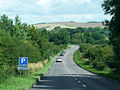 A346 Port Hill, north of Marlborough - geograph.org.uk - 1497047.jpg 640 × 480; 107 KB
-
 Byway above Rockley - geograph.org.uk - 412129.jpg 640 × 480; 125 KB
-
 Byway beside the gallops, near Rockley - geograph.org.uk - 1435683.jpg 640 × 481; 142 KB
-
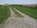
 Byway, Ogbourne Maizey - geograph.org.uk - 1435294.jpg 640 × 480; 167 KB
-
 Coloured horses near Rockley - geograph.org.uk - 632786.jpg 640 × 509; 85 KB
-
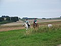 Competitive Trail Riders near Rockley - geograph.org.uk - 1435668.jpg 640 × 480; 101 KB
-

-
 Competitive Trail Riders, Rockley - geograph.org.uk - 1435643.jpg 640 × 480; 134 KB
-
 Competitive Trail Riders, Rockley - geograph.org.uk - 1435654.jpg 640 × 481; 148 KB
-
 Cottages, Rockley, Marlborough - geograph.org.uk - 385598.jpg 640 × 480; 129 KB
-
 Footpath, Ogbourne Maizey - geograph.org.uk - 1435305.jpg 640 × 480; 133 KB
-
-
 Gallop on Barton Down - geograph.org.uk - 422946.jpg 640 × 480; 84 KB
-
 Hay making, Ogbourne Maizey - geograph.org.uk - 1435326.jpg 640 × 481; 159 KB
-

-
 Milestone, Rockley, Marlborough (1) - geograph.org.uk - 385627.jpg 480 × 640; 157 KB
-
 Milestone, Rockley, Marlborough (2) - geograph.org.uk - 386656.jpg 480 × 640; 156 KB
-
 Milestone, Rockley, Marlborough (3) - geograph.org.uk - 386657.jpg 480 × 640; 153 KB
-
 Ogbourne Down - geograph.org.uk - 412167.jpg 640 × 480; 151 KB
-
 Ogbourne Down - geograph.org.uk - 412170.jpg 640 × 480; 168 KB
-
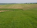
 Ogbourne Maizey Down - geograph.org.uk - 408886.jpg 640 × 480; 151 KB
-
 Ogbourne Maizey Down - geograph.org.uk - 412158.jpg 640 × 480; 139 KB
-
 Resurfacing the A346 - geograph.org.uk - 527566.jpg 640 × 480; 88 KB
-
 Track and old windpump, Ogbourne Down - geograph.org.uk - 408893.jpg 640 × 480; 143 KB
-
 Track near Ogbourne St Andrew - geograph.org.uk - 412174.jpg 640 × 480; 146 KB
-
 Wessex Ridgeway on Rough Down - geograph.org.uk - 423643.jpg 640 × 480; 96 KB
-
 Yellow downland, Ogbourne St Andrew - geograph.org.uk - 412187.jpg 640 × 320; 77 KB


_-_geograph.org.uk_-_385627.jpg)
_-_geograph.org.uk_-_386656.jpg)
_-_geograph.org.uk_-_386657.jpg)


