Category:Offham, Kent
Jump to navigation
Jump to search
English: Offham is a village in the local government district of Tonbridge and Malling in Kent, England.
village and civil parish in Kent, UK  | |||||
| Upload media | |||||
| Instance of | |||||
|---|---|---|---|---|---|
| Location | Tonbridge and Malling, Kent, South East England, England | ||||
| Population |
| ||||
| Said to be the same as | Offham (Wikimedia duplicated page, civil parish) | ||||
 | |||||
Subcategories
This category has the following 8 subcategories, out of 8 total.
C
K
- The Kings Arms, Offham (3 F)
M
O
- Offham War Memorial, Kent (2 F)
Q
- Quintain House, Offham (6 F)
- Quintain, Offham (12 F)
V
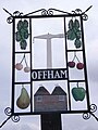
- Offham Village Sign (9 F)
Media in category "Offham, Kent"
The following 200 files are in this category, out of 225 total.
(previous page) (next page)-
 A cleared area in Mereworth Woods - geograph.org.uk - 2644360.jpg 640 × 430; 98 KB
-
 Akeoffham.jpg 1,466 × 1,179; 206 KB
-
 Aldon Barn, Aldon Lane - geograph.org.uk - 2066458.jpg 640 × 430; 178 KB
-
 Aldon Farmhouse, Aldon Lane - geograph.org.uk - 2066447.jpg 640 × 430; 171 KB
-
 Aldon House, Aldon Lane - geograph.org.uk - 2066433.jpg 640 × 430; 123 KB
-
 Aldon Lane - geograph.org.uk - 2066451.jpg 640 × 430; 160 KB
-
 Aldon Lane - geograph.org.uk - 2067333.jpg 640 × 430; 138 KB
-
 Aldon Lane - geograph.org.uk - 2067563.jpg 640 × 430; 180 KB
-
 Aldon Lane - geograph.org.uk - 2067566.jpg 640 × 430; 158 KB
-
 Aldon Lane, with high hedge - geograph.org.uk - 2067544.jpg 640 × 430; 155 KB
-
 Approach to Comp Wood Camp Site - geograph.org.uk - 4911950.jpg 4,608 × 3,456; 3.55 MB
-
 Badger's Mount - geograph.org.uk - 2074981.jpg 640 × 430; 131 KB
-
 Barn, Aldon Farm, Aldon Lane - geograph.org.uk - 2066481.jpg 640 × 430; 137 KB
-
 Blaise Farm Quarry - geograph.org.uk - 2985100.jpg 640 × 480; 131 KB
-
 Blaise Farm Quarry composting plant - geograph.org.uk - 3826153.jpg 640 × 480; 114 KB
-
 Blaise Farm Quarry, near Offham - geograph.org.uk - 6263346.jpg 1,600 × 1,200; 2.82 MB
-
 Bramble Hall Road - geograph.org.uk - 2945312.jpg 4,000 × 3,000; 4.27 MB
-
 Bridleway in Great Leybourne Wood - geograph.org.uk - 2644611.jpg 640 × 430; 136 KB
-
 Bridleway in Great Leybourne Wood - geograph.org.uk - 2644623.jpg 640 × 430; 130 KB
-
 Bridleway in Great Leybourne Wood - geograph.org.uk - 2644648.jpg 640 × 430; 121 KB
-

-
 Bridleway junction on Lord's Walk - geograph.org.uk - 1200219.jpg 640 × 481; 126 KB
-
 Bridleway junction, Great Leybourne Wood - geograph.org.uk - 2644660.jpg 640 × 430; 129 KB
-
 Bridleway next to Comp Wood Camp Site - geograph.org.uk - 4911960.jpg 4,608 × 3,456; 3.6 MB
-
 Bridleway through Comp Wood - geograph.org.uk - 4911954.jpg 4,608 × 3,456; 3.64 MB
-
 Church Farm (Entrance), Church Lane - geograph.org.uk - 2074828.jpg 640 × 430; 163 KB
-
 Church Rd, Offham - geograph.org.uk - 2073805.jpg 640 × 430; 163 KB
-
 Church Rd, Offham - geograph.org.uk - 2073809.jpg 640 × 430; 158 KB
-
 Church Road, Offham - geograph.org.uk - 4940817.jpg 3,264 × 2,448; 1.59 MB
-
 Church Road, Offham - geograph.org.uk - 4940819.jpg 3,264 × 2,448; 2.17 MB
-
 Church Road, Offham - geograph.org.uk - 4940834.jpg 3,264 × 2,448; 2.06 MB
-
 Comp Corner - geograph.org.uk - 2976958.jpg 640 × 480; 105 KB
-
 Comp Corner, Seven Mile Lane, near Wrotham Heath - geograph.org.uk - 2214349.jpg 4,320 × 3,240; 3.82 MB
-
 Comp Lane Offham - geograph.org.uk - 5187873.jpg 640 × 480; 83 KB
-
 Comp Lane Offham - geograph.org.uk - 5204333.jpg 640 × 480; 110 KB
-
 Comp Wood Camp Site - geograph.org.uk - 4911946.jpg 4,608 × 3,456; 3.56 MB
-
 Conifers, Mereworth Woods - geograph.org.uk - 2504968.jpg 640 × 430; 144 KB
-
 Coppiced trees, Moorlands Wood - geograph.org.uk - 2073466.jpg 640 × 430; 217 KB
-
 Coppiced trees, Moorlands Wood - geograph.org.uk - 2073486.jpg 640 × 430; 200 KB
-
 Coppicing, Great Leybourne Wood - geograph.org.uk - 2644633.jpg 640 × 430; 151 KB
-
 Coppicing, Great Leybourne Wood - geograph.org.uk - 2644635.jpg 640 × 430; 133 KB
-
 Coppicing, Great Leybourne Wood - geograph.org.uk - 2644685.jpg 640 × 430; 146 KB
-
 Coppicing, Mereworth Woods - geograph.org.uk - 2644592.jpg 640 × 430; 157 KB
-
 Copse protecting Chapel of St Blaise - geograph.org.uk - 1200227.jpg 640 × 481; 112 KB
-
 Cornfield alongside Fartherwell Road - geograph.org.uk - 3064236.jpg 4,000 × 3,000; 4.16 MB
-
 Cottage in Comp Lane, Offham - geograph.org.uk - 3692542.jpg 4,000 × 3,000; 4.07 MB
-
 Cottage in Offham - geograph.org.uk - 2376607.jpg 1,280 × 960; 628 KB
-
 Cottage in Offham - geograph.org.uk - 2376627.jpg 1,280 × 960; 630 KB
-
 Cottage on Aldon Lane - geograph.org.uk - 2067326.jpg 640 × 430; 142 KB
-
 Cottages on Teston Road, Offham - geograph.org.uk - 6263849.jpg 1,600 × 1,174; 2.15 MB
-
 Disused buildings near Blaise Farm - geograph.org.uk - 3692452.jpg 4,000 × 3,000; 4.18 MB
-
 Duck house on a pond in Offham - geograph.org.uk - 6260653.jpg 480 × 640; 107 KB
-
 Endives, near Offham - geograph.org.uk - 6263641.jpg 1,600 × 1,158; 3.52 MB
-
 Entering Offham, Teston Rd - geograph.org.uk - 2067577.jpg 640 × 430; 141 KB
-

-
 Entrance to the Old Rectory, Aldon Lane - geograph.org.uk - 2066441.jpg 640 × 430; 150 KB
-
 Explanation of the quintain at Offham - geograph.org.uk - 6518231.jpg 4,000 × 3,000; 4.69 MB
-
 Extensive wheat - geograph.org.uk - 2647076.jpg 640 × 430; 43 KB
-
 Extensive wheat - geograph.org.uk - 2647083.jpg 640 × 430; 53 KB
-
 Extensive wheat field, Godwell Farm - geograph.org.uk - 2074922.jpg 640 × 430; 131 KB
-
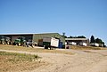
 Farmyard, Church Farm - geograph.org.uk - 2073724.jpg 640 × 376; 68 KB
-
 Fartherwell Rd - geograph.org.uk - 2077350.jpg 640 × 430; 205 KB
-
 Fartherwell Rd, south - geograph.org.uk - 2077351.jpg 640 × 430; 196 KB
-
 Fartherwell Road - geograph.org.uk - 2984925.jpg 640 × 480; 117 KB
-
 Fartherwell Road - geograph.org.uk - 3064241.jpg 4,000 × 3,000; 4.36 MB
-
 Fartherwell Road - geograph.org.uk - 3064247.jpg 4,000 × 3,000; 4.16 MB
-
 Fartherwell Road, near West Malling - geograph.org.uk - 4941876.jpg 3,264 × 2,448; 3.03 MB
-
 Field of beans - geograph.org.uk - 3826125.jpg 640 × 480; 122 KB
-
 Field of Church farm - geograph.org.uk - 4173816.jpg 640 × 427; 82 KB
-
 Fields ready for harvest, near Offham - geograph.org.uk - 33015.jpg 640 × 480; 114 KB
-
 Fire Beaters, Mereworth Woods - geograph.org.uk - 2504967.jpg 640 × 430; 149 KB
-
 Flying the flag, Teston Rd - geograph.org.uk - 2067592.jpg 640 × 430; 178 KB
-

-
 Footpath east of Godwell Farm - geograph.org.uk - 2074915.jpg 640 × 430; 140 KB
-
 Footpath junction in Mereworth Woods - geograph.org.uk - 1200080.jpg 640 × 481; 101 KB
-
 Footpath near Offham - geograph.org.uk - 3692434.jpg 4,000 × 3,000; 4.18 MB
-
 Footpath near Offham - geograph.org.uk - 3692437.jpg 4,000 × 3,000; 4.28 MB
-
 Footpath off Aldon Lane - geograph.org.uk - 2067549.jpg 640 × 430; 143 KB
-
 Footpath off Church Lane - geograph.org.uk - 2074832.jpg 640 × 430; 188 KB
-
 Footpath off Pepingstraw Close - geograph.org.uk - 2067642.jpg 640 × 430; 212 KB
-
 Footpath off Teston Rd - geograph.org.uk - 2067598.jpg 640 × 430; 208 KB
-
 Footpath out of Offham - geograph.org.uk - 4173830.jpg 640 × 427; 93 KB
-
 Footpath through Moorlands Wood - geograph.org.uk - 2073465.jpg 640 × 430; 190 KB
-
 Footpath through Moorlands Wood - geograph.org.uk - 2073503.jpg 640 × 430; 191 KB
-
 Footpath to Church Farm - geograph.org.uk - 2073594.jpg 640 × 430; 158 KB
-
 Footpath to Offham - geograph.org.uk - 2985084.jpg 640 × 480; 100 KB
-
 Footpath towards Godwell Farm - geograph.org.uk - 3692447.jpg 4,000 × 3,000; 3.94 MB
-
 Footpath towards Offham - geograph.org.uk - 3826107.jpg 640 × 480; 104 KB
-
 Footpath towards West Malling - geograph.org.uk - 2074984.jpg 640 × 430; 149 KB
-
 Footpath waymark east of Godwell Farm - geograph.org.uk - 2074949.jpg 640 × 430; 179 KB
-
 Footpath waymark, Church Farm - geograph.org.uk - 2073646.jpg 640 × 430; 156 KB
-
 Footpath west of Church Farm - geograph.org.uk - 2073654.jpg 640 × 430; 119 KB
-
 Footpath west to Godwell Farm - geograph.org.uk - 2074928.jpg 640 × 430; 124 KB
-
 Gateway to Long Meadow, near Offham - geograph.org.uk - 32946.jpg 640 × 480; 176 KB
-
 Godwell Farm, Offham - geograph.org.uk - 6260589.jpg 640 × 487; 71 KB
-
 Godwell Farm, Offham - geograph.org.uk - 6260595.jpg 640 × 407; 52 KB
-
 Gone to seed^ - geograph.org.uk - 2077336.jpg 640 × 430; 176 KB
-
 Gone to seed^ - geograph.org.uk - 2077347.jpg 640 × 430; 158 KB
-
 Grain Silos, Godwell Farm - geograph.org.uk - 2074846.jpg 640 × 430; 124 KB
-
 Graves, St Michael's Church, Offham - geograph.org.uk - 2073796.jpg 640 × 430; 166 KB
-
 Great Leybourne Wood - geograph.org.uk - 2644642.jpg 640 × 430; 116 KB
-
 Great Leybourne Wood - geograph.org.uk - 2644657.jpg 640 × 430; 143 KB
-
 Great Leybourne Wood - geograph.org.uk - 2644679.jpg 640 × 430; 143 KB
-
 Heading to West Malling - geograph.org.uk - 2074988.jpg 640 × 430; 200 KB
-
 High hedges along Aldon Lane - geograph.org.uk - 2067320.jpg 640 × 430; 167 KB
-
 High hedges, Aldon Lane - geograph.org.uk - 2067328.jpg 640 × 430; 141 KB
-
 In Great Leybourne Wood - geograph.org.uk - 2644651.jpg 640 × 430; 112 KB
-
 Irrigating vegetables - geograph.org.uk - 2075005.jpg 640 × 430; 129 KB
-
 Junction on Seven Mile Lane, Wrotham Heath - geograph.org.uk - 4942345.jpg 2,044 × 1,532; 752 KB
-
 Lambards Oast - geograph.org.uk - 2512832.jpg 640 × 347; 54 KB
-
 Lambards Oast - geograph.org.uk - 2512834.jpg 640 × 399; 69 KB
-
 Large wheat field - geograph.org.uk - 2074956.jpg 640 × 430; 136 KB
-
 Large wheat field - geograph.org.uk - 2647071.jpg 640 × 430; 49 KB
-
 Lettuce Field, Church Farm - geograph.org.uk - 2073565.jpg 640 × 430; 145 KB
-
 London Countryway in Kent (100) - geograph.org.uk - 5045916.jpg 800 × 600; 122 KB
-
 London Countryway in Kent (101) - geograph.org.uk - 5045969.jpg 800 × 600; 171 KB
-
 London Countryway in Kent (102) - geograph.org.uk - 5045984.jpg 800 × 600; 109 KB
-
 London Countryway in Kent (103) - geograph.org.uk - 5045991.jpg 800 × 600; 109 KB
-
 London Countryway in Kent (104) - geograph.org.uk - 5045998.jpg 800 × 600; 150 KB
-
 London Countryway in Kent (105) - geograph.org.uk - 5046006.jpg 800 × 600; 170 KB
-
 London Countryway in Kent (97) - geograph.org.uk - 5045908.jpg 800 × 600; 141 KB
-
 London Countryway in Kent (98) - geograph.org.uk - 5045909.jpg 800 × 600; 181 KB
-
 London Countryway in Kent (99) - geograph.org.uk - 5045912.jpg 800 × 600; 153 KB
-
 Looking down Comp Lane towards Comp Farm - geograph.org.uk - 2945286.jpg 4,000 × 3,000; 3.93 MB
-
 Looking towards Comp Farm from Lord's Walk - geograph.org.uk - 2939406.jpg 4,000 × 3,000; 3.96 MB
-
 Looking towards Great Leybourne Wood - geograph.org.uk - 4911963.jpg 4,608 × 3,456; 3.33 MB
-
 Lord's Walk - geograph.org.uk - 2647074.jpg 640 × 430; 95 KB
-
 Lord's Walk - geograph.org.uk - 2647079.jpg 640 × 430; 101 KB
-
 Lord's Walk - geograph.org.uk - 2647087.jpg 640 × 430; 86 KB
-
 Lord's Walk towards Great Leybourne Wood - geograph.org.uk - 2945309.jpg 4,000 × 3,000; 4.16 MB
-
 Lord's Walk, Great Leybourne Wood - geograph.org.uk - 2644666.jpg 640 × 430; 140 KB
-
 Lord's Walk, Great Leybourne Wood - geograph.org.uk - 2644673.jpg 640 × 430; 141 KB
-
 Lots of lettuces - geograph.org.uk - 2077344.jpg 640 × 430; 148 KB
-
 Mereworth Woods - geograph.org.uk - 2644578.jpg 640 × 430; 142 KB
-
 Mereworth Woods - geograph.org.uk - 2644582.jpg 640 × 430; 139 KB
-
 Mereworth Woods - geograph.org.uk - 2644587.jpg 640 × 430; 148 KB
-
 Mereworth Woods - geograph.org.uk - 2644628.jpg 640 × 430; 147 KB
-
 Mobile Phone Mast in Church Farm - geograph.org.uk - 1178195.jpg 481 × 640; 121 KB
-
 New use for redundant phone box - geograph.org.uk - 5131417.jpg 640 × 480; 109 KB
-
 New workshop, Offham Wood - geograph.org.uk - 2607357.jpg 640 × 480; 63 KB
-
 Newly planted trees near Godwell Farm - geograph.org.uk - 2074940.jpg 640 × 430; 139 KB
-
 North Meadow, Offham - geograph.org.uk - 4940836.jpg 3,264 × 2,448; 2.39 MB
-
 Offham Methodist Church - geograph.org.uk - 1188024.jpg 640 × 481; 67 KB
-
 Offham Methodist Church - geograph.org.uk - 2067627.jpg 640 × 430; 123 KB
-
 Offham Quarry.jpg 1,467 × 1,068; 286 KB
-
 Offham School across a field of Lettuces - geograph.org.uk - 2073575.jpg 640 × 430; 131 KB
-
 Offham Village Cricket Ground - geograph.org.uk - 21530.jpg 640 × 405; 36 KB
-
 Offham.jpg 480 × 640; 55 KB
-
 Oil Seed Rape, gone to seed - geograph.org.uk - 2074995.jpg 640 × 430; 160 KB
-
 Orchard adjacent to Aldon Lane - geograph.org.uk - 2067337.jpg 640 × 430; 161 KB
-
 Orchard by Aldon Lane - geograph.org.uk - 2067330.jpg 640 × 430; 186 KB
-
 Packing shed, ChurchFarm - geograph.org.uk - 2073682.jpg 640 × 430; 120 KB
-
 Packing sheds, Church Farm - geograph.org.uk - 2073638.jpg 640 × 430; 118 KB
-
 Path in Mereworth Woods - geograph.org.uk - 2644596.jpg 640 × 430; 132 KB
-
 Path next to the disused Blaise Farm Quarry - geograph.org.uk - 3692460.jpg 4,000 × 3,000; 4.23 MB
-
 Pepingstraw Close - geograph.org.uk - 2067639.jpg 640 × 430; 146 KB
-
 Plastic covered fields - geograph.org.uk - 1196224.jpg 640 × 481; 73 KB
-
 Ploughed field, Church Farm - geograph.org.uk - 2073610.jpg 640 × 430; 141 KB
-
 Postern House, Tower Hill, Offham - geograph.org.uk - 6260639.jpg 640 × 480; 92 KB
-
 Private road off Fartherwell Road - geograph.org.uk - 3825960.jpg 640 × 480; 88 KB
-
 Quarry Works near St Leonard's Wood - geograph.org.uk - 1200221.jpg 640 × 481; 76 KB
-
 Railway line to Maidstone - geograph.org.uk - 2066371.jpg 640 × 430; 185 KB
-
 Residential barn, Aldon Farm - geograph.org.uk - 2066468.jpg 640 × 430; 148 KB
-
 Ripening wheat, Godwell Farm - geograph.org.uk - 2074839.jpg 640 × 430; 151 KB
-
 Ripening wheat, Godwell Farm - geograph.org.uk - 2074918.jpg 640 × 430; 157 KB
-
 Salad crop near Offham - geograph.org.uk - 6263840.jpg 1,600 × 1,189; 2.48 MB
-
 Salad crop, Church Farm - geograph.org.uk - 2073570.jpg 640 × 430; 138 KB
-
 Seven Mile Lane - geograph.org.uk - 2976981.jpg 640 × 480; 145 KB
-
 Seven Mile Lane - geograph.org.uk - 4750613.jpg 4,608 × 3,456; 3.48 MB
-
 Seven Mile Lane - geograph.org.uk - 4750615.jpg 4,608 × 3,456; 3.33 MB
-
 Seven Mile Lane, near Wrotham Heath - geograph.org.uk - 2214350.jpg 4,320 × 3,240; 4.22 MB
-
 Signpost at Offham - geograph.org.uk - 6518298.jpg 4,000 × 3,000; 4.79 MB
-
 Spray irrigation - geograph.org.uk - 2074943.jpg 640 × 430; 142 KB
-
 St Michael ^ All Angels Church, Offham - geograph.org.uk - 6263846.jpg 1,600 × 1,182; 2.24 MB
-
 Stile on footpath, near Quarry - geograph.org.uk - 1200224.jpg 640 × 481; 96 KB
-
 Telecommunications mast by the railway - geograph.org.uk - 2073628.jpg 640 × 430; 128 KB
-
 Teston Rd - geograph.org.uk - 2067572.jpg 640 × 430; 167 KB
-
 Teston Rd, Offham - geograph.org.uk - 2067609.jpg 640 × 430; 175 KB
-
 Teston Rd, Offham - geograph.org.uk - 2067613.jpg 640 × 430; 137 KB
-
 Teston Rd, Offham - geograph.org.uk - 2067616.jpg 640 × 430; 139 KB
-
 Teston Road - geograph.org.uk - 3825973.jpg 640 × 480; 147 KB
-
 Teston Road - geograph.org.uk - 5169299.jpg 640 × 428; 163 KB
-
 Teston Road Offham by the railway line - geograph.org.uk - 4650319.jpg 640 × 480; 120 KB
-
 Teston Road, near Offham - geograph.org.uk - 4941867.jpg 3,264 × 2,448; 2.15 MB
-
 Teston Road, near Wrotham Heath - geograph.org.uk - 4939198.jpg 3,264 × 2,448; 2.46 MB
-
 Teston Road, near Wrotham Heath - geograph.org.uk - 4939203.jpg 2,913 × 2,185; 1.42 MB
-
 Teston Road, Offham - geograph.org.uk - 4940840.jpg 3,264 × 2,448; 2.07 MB
-
 Teston Road, Offham - geograph.org.uk - 4941861.jpg 3,264 × 2,448; 2.67 MB
-

-

-

-

-
 The Lord's Walk in Great Leybourne Wood - geograph.org.uk - 1200204.jpg 481 × 640; 145 KB
-
 The Old Rectory - geograph.org.uk - 1196211.jpg 640 × 481; 135 KB
-
 The Omnibus Kitchen Co. bus, Offham - geograph.org.uk - 6260565.jpg 640 × 504; 79 KB
-
 The outskirts of West Malling - geograph.org.uk - 2984908.jpg 640 × 480; 91 KB
-
 The quintain at Offham - geograph.org.uk - 6518228.jpg 3,704 × 2,784; 2.5 MB
-
 The quintain at Offham - geograph.org.uk - 6518292.jpg 4,000 × 3,000; 4.45 MB
-
 The quintain on the village green at Offham - geograph.org.uk - 6518295.jpg 4,000 × 3,000; 4.51 MB
-
 The remains of St Blaise's Chapel - geograph.org.uk - 1200232.jpg 640 × 481; 135 KB


,_Church_Lane_-_geograph.org.uk_-_2074828.jpg)


_-_geograph.org.uk_-_5045916.jpg)
_-_geograph.org.uk_-_5045969.jpg)
_-_geograph.org.uk_-_5045984.jpg)
_-_geograph.org.uk_-_5045991.jpg)
_-_geograph.org.uk_-_5045998.jpg)
_-_geograph.org.uk_-_5046006.jpg)
_-_geograph.org.uk_-_5045908.jpg)
_-_geograph.org.uk_-_5045909.jpg)
_-_geograph.org.uk_-_5045912.jpg)


