Category:Offchurch
Jump to navigation
Jump to search
village in the United Kingdom  | |||||
| Upload media | |||||
| Instance of | |||||
|---|---|---|---|---|---|
| Location | Warwick, Warwickshire, West Midlands, England | ||||
| official website | |||||
 | |||||
English: Offchurch is a village and civil parish on the River Leam, east of Leamington Spa in Warwickshire.
Subcategories
This category has the following 2 subcategories, out of 2 total.
O
- Offchurch Bury (18 F)
S
- St Gregory's, Offchurch (22 F)
Media in category "Offchurch"
The following 200 files are in this category, out of 331 total.
(previous page) (next page)-
 'Newhaven', a cottage in Hunningham - geograph.org.uk - 1480907.jpg 640 × 466; 137 KB
-
 'Step-Aside', a cottage in Hunningham - geograph.org.uk - 1480911.jpg 640 × 427; 106 KB
-
 'Sunrise', Snowford Hill - geograph.org.uk - 1121574.jpg 640 × 456; 60 KB
-
 'Tudor House', Welsh Road, Offchurch - geograph.org.uk - 1579375.jpg 640 × 426; 109 KB
-
 A belt of trees north of Offchurch - geograph.org.uk - 1568562.jpg 640 × 426; 119 KB
-
 A new hedge near Ford Farm - geograph.org.uk - 1567681.jpg 640 × 427; 479 KB
-

-
 A stack of tractor tyres - geograph.org.uk - 1409842.jpg 1,280 × 1,278; 312 KB
-
 Across the valley of the Leam - geograph.org.uk - 4135058.jpg 1,024 × 768; 983 KB
-
 An April evening in Offchurch - geograph.org.uk - 3955385.jpg 1,024 × 736; 169 KB
-
 Ancient Crossroads - geograph.org.uk - 2281792.jpg 640 × 480; 63 KB
-

-
 Approaching Offchurch from Radford - geograph.org.uk - 1579327.jpg 640 × 426; 140 KB
-
 B4455 Fosse Way heading north - geograph.org.uk - 6237877.jpg 1,024 × 684; 365 KB
-
 B4455 Fosse Way heading north - geograph.org.uk - 6237900.jpg 1,024 × 684; 310 KB
-
 B4455 Fosse Way heading north - geograph.org.uk - 6237910.jpg 1,024 × 648; 425 KB
-
 Bench Mark on stone footbridge over River Leam - geograph.org.uk - 2648414.jpg 2,000 × 1,502; 360 KB
-
 Bluebell woods - geograph.org.uk - 720801.jpg 640 × 480; 131 KB
-
 Box in the Hedge - geograph.org.uk - 3254463.jpg 640 × 480; 144 KB
-
 Bridge House apartments, Hunningham - geograph.org.uk - 1480900.jpg 640 × 431; 120 KB
-
 Burnt Heath Farm - geograph.org.uk - 2614520.jpg 640 × 480; 84 KB
-
 Bury lodge, Offchurch Lane, Radford Semele - geograph.org.uk - 4555402.jpg 5,184 × 3,456; 6.39 MB
-
 Car park, Hilltop Farm shop and cafe - geograph.org.uk - 1404503.jpg 640 × 478; 92 KB
-
 Cat on an embankment - geograph.org.uk - 2460264.jpg 2,000 × 1,502; 582 KB
-

-
 Cottage beside the church, Offchurch - geograph.org.uk - 1579333.jpg 640 × 426; 117 KB
-
 Cottage on the corner, Offchurch - geograph.org.uk - 3045217.jpg 800 × 600; 108 KB
-
 Cottage, Welsh Road, Offchurch - geograph.org.uk - 1579383.jpg 640 × 426; 85 KB
-

-
 Cottages in Offchurch - geograph.org.uk - 2281781.jpg 640 × 480; 79 KB
-

-
 Course of Leamington - Rugby line - geograph.org.uk - 1213196.jpg 639 × 479; 64 KB
-
 Crossing the Leam - geograph.org.uk - 1213141.jpg 639 × 479; 68 KB
-
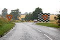
 Crossroads with B4455 - geograph.org.uk - 5232993.jpg 640 × 480; 74 KB
-
 Daffodils by the Welsh Road - geograph.org.uk - 4843877.jpg 1,600 × 1,066; 422 KB
-
 Detail of overflow weir, Welsh Road Lock - geograph.org.uk - 3081043.jpg 640 × 480; 119 KB
-

-
 Disused railway bridge - geograph.org.uk - 2035952.jpg 640 × 480; 153 KB
-

-
 Entering Offchurch - geograph.org.uk - 3154931.jpg 640 × 480; 114 KB
-
 Entrance to Welsh Road Farm - geograph.org.uk - 1410637.jpg 640 × 444; 111 KB
-

-
 Ex-railway cutting ^ bridge on NCN 41 - geograph.org.uk - 2036209.jpg 640 × 480; 159 KB
-
 Exercising horses near Ford Farm - geograph.org.uk - 1567682.jpg 640 × 427; 559 KB
-
 Farm entrance, Burnt Heath - geograph.org.uk - 1409835.jpg 640 × 432; 95 KB
-
 Farmland northeast of Offchurch - geograph.org.uk - 1568560.jpg 640 × 426; 144 KB
-
 Farmland off Long Itchington Road - geograph.org.uk - 3154956.jpg 640 × 480; 72 KB
-
 Farmland south of Offchurch - geograph.org.uk - 1571750.jpg 640 × 426; 122 KB
-
 Farmland south of Welsh Road - geograph.org.uk - 3906798.jpg 640 × 480; 69 KB
-
 Farmland towards Welsh Road Farm - geograph.org.uk - 3906794.jpg 640 × 480; 40 KB
-
 Farmland, Fosse Farm - geograph.org.uk - 3154967.jpg 640 × 480; 94 KB
-
 Farmland, Offchurch - geograph.org.uk - 3154942.jpg 640 × 480; 99 KB
-
 Fields near the Fosse Way - geograph.org.uk - 2835463.jpg 640 × 480; 82 KB
-
 Fields near Welsh Road Farm - geograph.org.uk - 2933033.jpg 640 × 480; 58 KB
-
 Footpath from Valley Fields to Fosse Farm - geograph.org.uk - 6443910.jpg 1,024 × 708; 278 KB
-
 Footpath to the Fosse Way - geograph.org.uk - 5323134.jpg 1,280 × 851; 539 KB
-
 Footpath towards Manor Farm - geograph.org.uk - 4843859.jpg 1,600 × 1,066; 519 KB
-
 Footpath towards Welsh Road Farm - geograph.org.uk - 3154952.jpg 640 × 480; 94 KB
-

-
 Ford at Offchurch - geograph.org.uk - 2980240.jpg 3,872 × 2,592; 2.43 MB
-
 Former railway bridge - Grand Union Canal - geograph.org.uk - 4661737.jpg 1,280 × 851; 367 KB
-
 Foss Road Locks - geograph.org.uk - 3468.jpg 640 × 480; 58 KB
-
 Fosse Farm, buildings - geograph.org.uk - 1268649.jpg 640 × 438; 90 KB
-
 Fosse Road Bridge, No 32 - geograph.org.uk - 5051478.jpg 640 × 427; 79 KB
-

-
 Fosse Way near Offchurch - geograph.org.uk - 1268646.jpg 640 × 426; 129 KB
-
 Fosse Way north of Grand Union Canal - geograph.org.uk - 2079970.jpg 640 × 480; 60 KB
-
 Fosse Way sunset - geograph.org.uk - 1130556.jpg 640 × 507; 65 KB
-
 Fosse Wharf - geograph.org.uk - 141826.jpg 640 × 480; 310 KB
-
 Fosse Wharf - geograph.org.uk - 3971213.jpg 640 × 480; 121 KB
-
 Fosse Wharf - geograph.org.uk - 4619625.jpg 1,280 × 851; 314 KB
-
 Fosse Wharf-Grand Union Canal - geograph.org.uk - 5747040.jpg 1,600 × 1,200; 687 KB
-
 From the top of School Hill - geograph.org.uk - 4579367.jpg 4,608 × 3,456; 2.75 MB
-
 Gable House, Offchurch - geograph.org.uk - 5440228.jpg 640 × 480; 126 KB
-

-
 Gated track off Welsh Road - geograph.org.uk - 3906796.jpg 640 × 480; 79 KB
-
 Gates into the churchyard, Offchurch - geograph.org.uk - 1579387.jpg 640 × 426; 151 KB
-
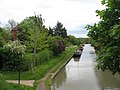
 Grand Union Canal - geograph.org.uk - 2281939.jpg 640 × 480; 88 KB
-
 Grand Union Canal - geograph.org.uk - 3154923.jpg 640 × 480; 104 KB
-
 Grand Union Canal - geograph.org.uk - 3254514.jpg 640 × 480; 107 KB
-
 Grand Union Canal - geograph.org.uk - 4541589.jpg 480 × 640; 77 KB
-
 Grand Union Canal -Wood Lock No19 - geograph.org.uk - 6316427.jpg 1,600 × 1,200; 560 KB
-
 Grand Union Canal at Butt Bridge - geograph.org.uk - 2932926.jpg 480 × 640; 90 KB
-
 Grand Union Canal at Fosse Wharf - geograph.org.uk - 3971222.jpg 640 × 480; 94 KB
-

-

-
 Grand Union Canal towards lock 19 - geograph.org.uk - 2460231.jpg 2,000 × 1,492; 552 KB
-
 Grand Union Canal Walk - geograph.org.uk - 5233267.jpg 640 × 480; 115 KB
-
 Grand Union Canal Walk - geograph.org.uk - 5233275.jpg 640 × 480; 66 KB
-
 Grand Union Canal Walk - geograph.org.uk - 5233327.jpg 640 × 480; 98 KB
-
 Grand Union Canal Walk - geograph.org.uk - 5233429.jpg 640 × 363; 61 KB
-

-

-

-
 Grand Union Canal, Radford Semele - geograph.org.uk - 5323088.jpg 1,280 × 851; 455 KB
-
 Grand Union Canal, Reach near Ufton - geograph.org.uk - 3173341.jpg 640 × 480; 57 KB
-
 Grand Union Canal, Reach near Ufton - geograph.org.uk - 3173354.jpg 640 × 480; 75 KB
-
 Grand Union Canal, Welsh Road Lock - geograph.org.uk - 3173237.jpg 640 × 434; 75 KB
-
 Grown out hedgerow, Snowford - geograph.org.uk - 332737.jpg 640 × 480; 131 KB
-

-

-

-
 Hedgelaying near the Offchurch Greenway - geograph.org.uk - 1567226.jpg 640 × 426; 143 KB
-

-

-

-

-

-

-
 Lane from Offchurch to Hunningham - geograph.org.uk - 5440243.jpg 640 × 480; 166 KB
-

-
 Lane to Hunningham - geograph.org.uk - 5323261.jpg 1,280 × 851; 446 KB
-
 Leamington - Rugby line - geograph.org.uk - 1213197.jpg 640 × 480; 63 KB
-
 Leamington to Rugby Railway - geograph.org.uk - 767912.jpg 640 × 480; 87 KB
-
 Leamington to Rugby Railway - geograph.org.uk - 767920.jpg 640 × 480; 88 KB
-
 Lock 19 - geograph.org.uk - 5255.jpg 640 × 480; 64 KB
-

-
 Lock Keepers House - geograph.org.uk - 3254506.jpg 640 × 480; 89 KB
-
 Lock on The Grand Union Canal - geograph.org.uk - 3906801.jpg 478 × 640; 75 KB
-
 Locks at Welsh Road Bridge - geograph.org.uk - 4541591.jpg 640 × 480; 75 KB
-
 Longhole Bridge - geograph.org.uk - 4541584.jpg 480 × 640; 103 KB
-
 Longhole Bridge from the canal - geograph.org.uk - 4541588.jpg 640 × 480; 115 KB
-
 Longhole Bridge No 31 - geograph.org.uk - 2639644.jpg 2,000 × 1,504; 599 KB
-

-

-

-

-

-

-

-

-

-

-
 Looking southeast to Welsh Road Farm - geograph.org.uk - 1410639.jpg 640 × 400; 107 KB
-

-
-

-
 Looking west to Park Gates, Offchurch - geograph.org.uk - 1579344.jpg 640 × 426; 138 KB
-

-

-
 Manor Farm Offchurch - geograph.org.uk - 2281777.jpg 640 × 480; 75 KB
-
 Merlot approaches lock 19 - geograph.org.uk - 2460341.jpg 2,000 × 1,499; 543 KB
-
 Missing bridge - geograph.org.uk - 1213201.jpg 640 × 480; 51 KB
-

-
 Muck Heap at Burnt Heath Farm - geograph.org.uk - 2836652.jpg 640 × 480; 67 KB
-

-
 Narrowboats leaving Radford Bottom Lock - geograph.org.uk - 5051429.jpg 640 × 427; 115 KB
-
 NCR 41 near Offchurch - geograph.org.uk - 2035953.jpg 640 × 480; 133 KB
-
 Near Fosse Wharf - geograph.org.uk - 3971220.jpg 640 × 480; 90 KB
-
-

-
-
-
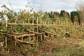
 Newly-laid hedge, Fosse Way - geograph.org.uk - 1268559.jpg 640 × 426; 158 KB
-
 Offa House - geograph.org.uk - 1213188.jpg 639 × 479; 95 KB
-
 Offa House - geograph.org.uk - 5440240.jpg 640 × 480; 156 KB
-
 Offa House, Offchurch - geograph.org.uk - 1579341.jpg 640 × 421; 134 KB
-
 Offchurch - geograph.org.uk - 3479.jpg 640 × 480; 42 KB
-
 Offchurch - geograph.org.uk - 356591.jpg 640 × 360; 52 KB
-
 Offchurch - geograph.org.uk - 5323350.jpg 1,280 × 851; 420 KB
-
 Offchurch - geograph.org.uk - 5323481.jpg 1,280 × 851; 456 KB
-
 Offchurch -Welsh Road - geograph.org.uk - 1556889.jpg 640 × 480; 75 KB
-
 Offchurch Cutting - geograph.org.uk - 1552680.jpg 640 × 480; 69 KB
-
 Offchurch Cutting footbridge - geograph.org.uk - 1556866.jpg 640 × 480; 133 KB
-
 Offchurch farmland - geograph.org.uk - 1556911.jpg 640 × 480; 103 KB
-
 Offchurch Greenway - geograph.org.uk - 2036213.jpg 640 × 480; 154 KB
-
 Offchurch Greenway - geograph.org.uk - 5003840.jpg 1,600 × 1,200; 746 KB
-
 Offchurch Greenway - geograph.org.uk - 5232997.jpg 640 × 480; 80 KB
-
 Offchurch Greenway - geograph.org.uk - 5233001.jpg 640 × 480; 65 KB
-
 Offchurch Greenway - geograph.org.uk - 6443879.jpg 783 × 1,024; 380 KB
-
 Offchurch Greenway picnic area - geograph.org.uk - 1571772.jpg 640 × 420; 127 KB
-

-
-

-

-
 Offchurch Greenway, overbridge - geograph.org.uk - 1571739.jpg 640 × 426; 126 KB
-

-

-
 Offchurch Greeway, cycleway routes sign - geograph.org.uk - 1571818.jpg 532 × 640; 211 KB
-
 Offchurch Lane by Valley Fields - geograph.org.uk - 6443915.jpg 1,024 × 796; 289 KB
-
 Offchurch Lane near Shakers Lane - geograph.org.uk - 1293138.jpg 640 × 490; 87 KB
-
 Offchurch Sports Club cricket pitch - geograph.org.uk - 1535767.jpg 640 × 431; 117 KB
-
 Offchurch Sports Club pavilion - geograph.org.uk - 1535763.jpg 640 × 416; 80 KB
-
 Offchurch Sports Club tennis court - geograph.org.uk - 1535766.jpg 640 × 426; 68 KB
-
 Offchurch Thatched Cottage - geograph.org.uk - 4137356.jpg 1,024 × 768; 181 KB
-
 Offchurch Village Hall - geograph.org.uk - 1556901.jpg 640 × 480; 90 KB
-
 Offchurch village hall - geograph.org.uk - 1579378.jpg 640 × 419; 107 KB
-
 Offchurch, new thatch at The Stag - geograph.org.uk - 4910146.jpg 1,024 × 1,024; 1.22 MB
-
 Offchurch, September sunset - geograph.org.uk - 5112544.jpg 878 × 1,024; 787 KB
-
 Offchurch, Tudor Cottage - geograph.org.uk - 5746995.jpg 1,024 × 1,024; 1.19 MB
-
 Offchurch, up School Hill - geograph.org.uk - 5746997.jpg 1,024 × 1,024; 1.05 MB
-
 Offchurch, Welsh Road - geograph.org.uk - 4910153.jpg 866 × 1,024; 1.21 MB
-
 Offchurch-Manor Farm - geograph.org.uk - 2349345.jpg 640 × 480; 77 KB
-
 Offchurch-River Leam - geograph.org.uk - 1552668.jpg 640 × 480; 97 KB
-
 Offchurch-School Hill - geograph.org.uk - 1554187.jpg 640 × 480; 128 KB
-
 Offchurch-School Hill - geograph.org.uk - 1581207.jpg 640 × 480; 81 KB
-
 Offchurch-Village Street - geograph.org.uk - 1554195.jpg 640 × 521; 108 KB
-
 Oilseed rape crop - geograph.org.uk - 3906790.jpg 640 × 480; 74 KB
-

-
 Old railway, Fosse Way, Offchurch - geograph.org.uk - 1268662.jpg 640 × 512; 172 KB


,_geograph_6951867_by_Simon_Tomson.jpg)


_-_geograph.org.uk_-_1568554.jpg)
_-_geograph.org.uk_-_1568555.jpg)


_-_geograph.org.uk_-_1568343.jpg)
_-_geograph.org.uk_-_1568346.jpg)
_-_geograph.org.uk_-_1568351.jpg)
_-_geograph.org.uk_-_1568358.jpg)


