Category:Ofenhaus (Kirchstrasse 8a, Bolligen)
Jump to navigation
Jump to search
| Object location | | View all coordinates using: OpenStreetMap |
|---|
building in Bolligen im Kanton Bern, Schweiz  | |||||
| Upload media | |||||
| Instance of | |||||
|---|---|---|---|---|---|
| Part of | |||||
| Location | Downtown Bolligen, Bolligen, Bern-Mittelland administrative district, Bernese Mittelland administrative region, Bern, Switzerland | ||||
| Street address |
| ||||
| Heritage designation |
| ||||
| Inception |
| ||||
 | |||||
Media in category "Ofenhaus (Kirchstrasse 8a, Bolligen)"
The following 2 files are in this category, out of 2 total.
-
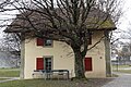 Ofenhaus Kirchstrasse 8a 2.jpg 2,275 × 1,517; 1.53 MB
-
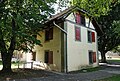 Ofenhaus Kirchstrasse 8a.jpg 2,565 × 1,722; 1.87 MB
