Category:October 2009 in County Antrim
Jump to navigation
Jump to search
English: Images taken in County Antrim, Northern Ireland in this month of 2009 (not the date of the upload).
| Jan | Feb | Mar | Apr | May | Jun | Jul | Aug | Sep | Oct | Nov | Dec | ||
| ← | 12 | 27 | 9 | 30 | 19 | 11 | 23 | 17 | 35 | 32 | 36 | 24 | → |
|---|
Media in category "October 2009 in County Antrim"
The following 32 files are in this category, out of 32 total.
-
 Autumn leaves, Lisburn - geograph.org.uk - 1517694.jpg 614 × 409; 115 KB
-
 B95, Mallusk Road - geograph.org.uk - 1536308.jpg 640 × 479; 54 KB
-
 Bales near Cargan - geograph.org.uk - 1547814.jpg 640 × 494; 302 KB
-
 Ballycraigy Townland - geograph.org.uk - 1536348.jpg 640 × 479; 41 KB
-

-
 Ballyeaston Townland - geograph.org.uk - 1528418.jpg 640 × 479; 59 KB
-
 Boghill Road - geograph.org.uk - 1536161.jpg 640 × 479; 57 KB
-
 Burnt out car, Dungonnell Road - geograph.org.uk - 1542901.jpg 640 × 409; 234 KB
-
 Carnalee Road - geograph.org.uk - 1536344.jpg 640 × 479; 46 KB
-
 Countryside near Cargan - geograph.org.uk - 1545702.jpg 640 × 436; 257 KB
-
 Countryside near Cargan - geograph.org.uk - 1545776.jpg 640 × 453; 256 KB
-
 Countryside near Cargan - geograph.org.uk - 1547824.jpg 640 × 415; 226 KB
-
 Cow near Cargan - geograph.org.uk - 1545709.jpg 640 × 474; 321 KB
-
 Disused mines near Cargan - geograph.org.uk - 1545695.jpg 640 × 480; 267 KB
-
 Dungonnell Road - geograph.org.uk - 1543511.jpg 640 × 443; 240 KB
-
 Dungonnell Road near Cargan - geograph.org.uk - 1547821.jpg 640 × 480; 316 KB
-
 Dungonnell Road near Cargan - geograph.org.uk - 1547832.jpg 640 × 515; 300 KB
-

-
 Fields near Cargan - geograph.org.uk - 1547800.jpg 640 × 377; 201 KB
-
 Fungus, Dunmurry - geograph.org.uk - 1558479.jpg 640 × 385; 85 KB
-
 Lane Ashmore Farm - geograph.org.uk - 1536341.jpg 640 × 479; 55 KB
-
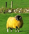
 Ram near Cargan - geograph.org.uk - 1547810 (cropped).jpg 380 × 380; 151 KB
-
 Ram near Cargan - geograph.org.uk - 1547810.jpg 542 × 640; 364 KB
-
 Rathbeg Road - geograph.org.uk - 1556944.jpg 640 × 480; 46 KB
-
 Stile near Edenderry, Belfast - geograph.org.uk - 1555636.jpg 632 × 424; 144 KB
-
 The Dungonnell Road near Cargan - geograph.org.uk - 1545780.jpg 640 × 405; 228 KB
-
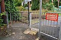
 The Meeting House crossing, Dunmurry (2) - geograph.org.uk - 1558648.jpg 640 × 393; 114 KB
-

-

-
 The Meeting House crossing, Dunmurry - geograph.org.uk - 1558635.jpg 640 × 414; 132 KB
-
 Track, Glenariff Forest Park - geograph.org.uk - 1543518.jpg 640 × 463; 281 KB
-
 Train, Dunmurry station - geograph.org.uk - 1558797.jpg 640 × 401; 100 KB


.jpg)


_-_geograph.org.uk_-_1558648.jpg)
_-_geograph.org.uk_-_1558675.jpg)
_-_geograph.org.uk_-_1558710.jpg)


