Category:October 2005 in Highland (council area)
Jump to navigation
Jump to search
Council areas (municipalities) of Scotland: Aberdeen · Aberdeenshire · Angus · Argyll and Bute · Dumfries and Galloway · Edinburgh · Fife · Glasgow · Highland · Moray · Perth and Kinross · Scottish Borders · South Lanarkshire ·
Deutsch: Bilder, die im Oktober 2005 in Highland (council area) aufgenommen worden sind. Bitte beachten Sie, dass dies weder das Datum des Uploads noch das Datum des Scannens eines Fotos ist.
English: Images/pictures taken in Highland (council area) during October 2005. Note this is not the date of the upload, nor the date a photo was scanned.
Español: Fotografías o imágenes tomadas en Highland (council area) durante octubre 2005. No es la fecha de subida ni escaneo, sino la fecha en que las fotografías o imágenes se crearon.
Esperanto: Bildoj faritaj en Highland (council area) en oktobro 2005. Tio ne estas la dato, kiam la bildoj estis alŝutitaj aŭ skanitaj.
Français : Photographies ou images prises en Highland (council area) durant octobre 2005. Ce n'est pas la date du téléchargement ou du scan.
Galego: Fotografías ou imaxes tomadas en Highland (council area) durante outubro 2005. Non é a data de subida nin escaneamento, senón a data na que se crearon as fotografías ou imaxes.
Italiano: Fotografie o immagini scattate a Highland (council area) nel ottobre 2005. Nota bene: la data non si riferisce né a quella di upload né a quella in cui la foto è stata digitalizzata.
Norsk bokmål: Bilder tatt i Highland (council area) i løpet av oktober 2005. Merk at dette ikke er datoen for opplasting, eller når et bilde har blitt skannet.
Norsk nynorsk: Bilete teke i Highland (council area) i løpet av oktober 2005. Merk at dette ikkje er datoen for opplasting, eller når eit bilete har vorte skanna.
Русский: Изображения, сделанные в Highland (council area) в течение октябрь 2005 (не дата загрузки изображения).
Українська: Зображення, зроблені в Highland (council area) протягом жовтень 2005. Зауважте, що це не дата завантаження чи дата сканування фотографії.
| October 2004 | ← | October 2005 | → | October 2006 | |||||||
| Jan | Feb | Mar | Apr | May | Jun | Jul | Aug | Sep | Oct | Nov | Dec |
| 7 | 3 | 29 | 22 | 25 | 44 | 45 | 52 | 30 | 48 | 29 | 2 |
|---|---|---|---|---|---|---|---|---|---|---|---|
Media in category "October 2005 in Highland (council area)"
The following 47 files are in this category, out of 47 total.
-
 A Sheep Sale at Lairg Marketplace - geograph.org.uk - 61170.jpg 640 × 480; 173 KB
-

-
 A water Fall on the River Vagastie - geograph.org.uk - 71632.jpg 640 × 480; 128 KB
-
 Amazing things, Aros. - geograph.org.uk - 69909.jpg 640 × 563; 120 KB
-
 Arkle.jpg 566 × 270; 34 KB
-
 Balconie trig point - geograph.org.uk - 352927.jpg 639 × 479; 55 KB
-
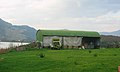 Barn, Loch Long. - geograph.org.uk - 68334.jpg 640 × 385; 36 KB
-
 Beach, Conchra. - geograph.org.uk - 68338.jpg 640 × 480; 79 KB
-
 Bridge over the line - geograph.org.uk - 66421.jpg 640 × 480; 283 KB
-
 Caledonian Canal enters Loch Ness at Fort Augustus.jpg 1,600 × 1,200; 262 KB
-
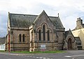 Chapel of Royal Northern Infirmary.jpg 640 × 455; 82 KB
-
 Corner of A835 road - geograph.org.uk - 255981.jpg 640 × 425; 153 KB
-
 Dun-da-Lamh - geograph.org.uk - 73546.jpg 640 × 427; 117 KB
-
 Dunvegan Castle - geograph.org.uk - 315920.jpg 640 × 480; 78 KB
-

-
 Inverness Airport.jpg 2,576 × 1,932; 1.29 MB
-
 Kyle of Lochalsh - Skye Bridge - geograph.org.uk - 752275.jpg 640 × 480; 89 KB
-

-
 Loch Achaidh na h-Inich - geograph.org.uk - 751198.jpg 640 × 480; 105 KB
-
 Loch Long - geograph.org.uk - 68328.jpg 640 × 480; 94 KB
-
 Loch Long road. - geograph.org.uk - 68333.jpg 640 × 459; 69 KB
-
 Loch Long, Sallachy. - geograph.org.uk - 68324.jpg 640 × 480; 81 KB
-
 Loch Long.jpg 640 × 480; 65 KB
-
 Loch Shin.jpg 640 × 480; 52 KB
-
 Loch Stack and Arkle - geograph.org.uk - 66082.jpg 640 × 480; 81 KB
-
 Longay.jpg 640 × 303; 56 KB
-
 North shore, Camas Tianavaig. - geograph.org.uk - 68925.jpg 640 × 480; 96 KB
-
 Old Garva Bridge (north side) - geograph.org.uk - 247577.jpg 640 × 480; 115 KB
-
 Old Garva Bridge (south side) - geograph.org.uk - 247575.jpg 640 × 480; 56 KB
-
 Pebble beach at Skerry Bay - geograph.org.uk - 306103.jpg 640 × 480; 88 KB
-
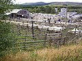
 Penning area Dingwall Auction Mart - geograph.org.uk - 67821.jpg 480 × 640; 112 KB
-
 Poll an Eoin Mor - geograph.org.uk - 64992.jpg 640 × 480; 95 KB
-
 Rays - panoramio.jpg 1,280 × 960; 645 KB
-
 Road junction, Drochaid Lusa. - geograph.org.uk - 70601.jpg 640 × 480; 52 KB
-
 Sign care - geograph.org.uk - 70607.jpg 640 × 523; 39 KB
-
 Strathspey Railway Aviemore.jpg 1,600 × 1,200; 203 KB
-
 Sulphuric acid. - geograph.org.uk - 63917.jpg 640 × 480; 93 KB
-
 Woodland, Abhainn Lusa. - geograph.org.uk - 70596.jpg 640 × 444; 59 KB
-
 Allt a' Mhuillin, Broadford. - geograph.org.uk - 68619.jpg 640 × 480; 141 KB
-
 Arable land, Bundalloch. - geograph.org.uk - 68335.jpg 640 × 480; 50 KB
-
 Biallidbeg - geograph.org.uk - 247377.jpg 640 × 480; 65 KB
-
 Biallidbeg Cemetery - geograph.org.uk - 247374.jpg 640 × 480; 97 KB
-
 Biallidbeg cottage - geograph.org.uk - 247367.jpg 480 × 640; 111 KB
-
 Duirinish - geograph.org.uk - 752413.jpg 640 × 480; 113 KB
-
 Duirinish Lodges - geograph.org.uk - 752427.jpg 640 × 480; 95 KB
-
 Signpost on forest walk near Achterneed - geograph.org.uk - 280706.jpg 640 × 425; 179 KB
-
 Somerby, Loch Ussie, near Dingwall - geograph.org.uk - 255957.jpg 640 × 425; 107 KB


_-_geograph.org.uk_-_247577.jpg)
_-_geograph.org.uk_-_247575.jpg)


