Category:Oborne
Jump to navigation
Jump to search
English: Oborne is a village in north west Dorset, England, situated in the Blackmore Vale close to the border with Somerset, on the A30 road adjacent to the town of Sherborne. The village has a population of 115 . Oborne is in the group parish of Yeo Head together with the three villages of Castleton, Goathill and Poyntington. This parish is within the district of West Dorset.
village and civil parish in Dorset, United Kingdom  | |||||
| Upload media | |||||
| Instance of | |||||
|---|---|---|---|---|---|
| Location | Dorset, South West England, England | ||||
| Population |
| ||||
 | |||||
Subcategories
This category has the following 2 subcategories, out of 2 total.
C
Media in category "Oborne"
The following 62 files are in this category, out of 62 total.
-
-
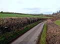
 A farm on the A30 near Oborne - geograph.org.uk - 3490702.jpg 800 × 600; 182 KB
-
 Arable land near Sherborne - geograph.org.uk - 4463333.jpg 800 × 450; 186 KB
-
 Barn at Oborne Wood - geograph.org.uk - 2813695.jpg 640 × 480; 96 KB
-
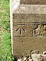 Bench Mark, St Cuthbert's Church - geograph.org.uk - 1989131.jpg 480 × 640; 194 KB
-

-
 Chancel, St Cuthbert's Church - geograph.org.uk - 1989128.jpg 640 × 480; 97 KB
-
 Church Over The Meadow - geograph.org.uk - 3239364.jpg 1,600 × 1,199; 642 KB
-
 Cottages, on the, at Oborne - geograph.org.uk - 1570174.jpg 640 × 480; 99 KB
-
 County Boundary Post, A30 - geograph.org.uk - 6558468.jpg 543 × 900; 510 KB
-
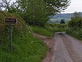
 Crossroads at Higher Oborne - geograph.org.uk - 4045285.jpg 640 × 459; 48 KB
-
 Donkey Lane on Oborne Hill - geograph.org.uk - 5251039.jpg 640 × 427; 42 KB
-
 Fields at Crackmore Farm - geograph.org.uk - 6309346.jpg 1,024 × 768; 68 KB
-
 Font in St Cuthbert's Church, Oborne - geograph.org.uk - 4355237.jpg 480 × 640; 53 KB
-
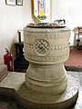 Font, St Cuthbert's Church - geograph.org.uk - 2608598.jpg 480 × 640; 81 KB
-
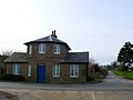 Former Toll House - geograph.org.uk - 2813728.jpg 640 × 480; 47 KB
-
 Grange Cottage, Oborne - geograph.org.uk - 3239374.jpg 3,410 × 2,734; 2.45 MB
-
 Grange Cottage, Oborne - geograph.org.uk - 4355259.jpg 640 × 480; 87 KB
-
 Higher Clatcombe Farm - geograph.org.uk - 2813738.jpg 640 × 480; 60 KB
-
 Lane to Milborne Wick - geograph.org.uk - 2813775.jpg 640 × 476; 84 KB
-
 Oborne - geograph.org.uk - 2239075.jpg 1,000 × 706; 251 KB
-
 Oborne - geograph.org.uk - 2813652.jpg 640 × 480; 51 KB
-
 Oborne - geograph.org.uk - 2990205.jpg 640 × 480; 91 KB
-
 Oborne, by Grange Farm - geograph.org.uk - 3109540.jpg 640 × 427; 478 KB
-

-
 Oborne, entrance to Grange Farm - geograph.org.uk - 3109555.jpg 640 × 418; 453 KB
-

-
 Oborne, main village lane - geograph.org.uk - 2803024.jpg 640 × 480; 86 KB
-
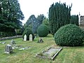
 Oborne, New St Cuthbert's (churchyard 1) - geograph.org.uk - 3698347.jpg 640 × 480; 114 KB
-
 Oborne, New St Cuthbert's (churchyard 2) - geograph.org.uk - 3698351.jpg 640 × 480; 109 KB
-
 Oborne, New St Cuthbert's (churchyard 3) - geograph.org.uk - 3698353.jpg 640 × 480; 132 KB
-

-

-

-
 Oborne, postbox № DT9 41 - geograph.org.uk - 2803042.jpg 640 × 480; 127 KB
-
 Oborne, postbox № DT9 84 - geograph.org.uk - 2803033.jpg 481 × 640; 133 KB
-
 Oborne, thatched farmhouse and hillside - geograph.org.uk - 2803018.jpg 480 × 640; 103 KB
-
 Oborne, towards Grange Farm - geograph.org.uk - 3109552.jpg 640 × 427; 447 KB
-
 Old Car in Oborne - geograph.org.uk - 3221523.jpg 2,552 × 1,720; 1.37 MB
-

-
 Old School House, Oborne - geograph.org.uk - 3239358.jpg 3,189 × 2,432; 1.99 MB
-
 Passing a postbox at Oborne - geograph.org.uk - 3690669.jpg 640 × 480; 79 KB
-
 Play area near the new church - geograph.org.uk - 3698486.jpg 640 × 480; 116 KB
-
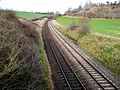 Railway Track near Milborne Port - geograph.org.uk - 2813799.jpg 640 × 480; 121 KB
-
 Sign and Barn, Oborne - geograph.org.uk - 3233727.jpg 3,648 × 2,736; 2.22 MB
-

-

-

-
 The A30 near Oborne - geograph.org.uk - 3490709.jpg 800 × 600; 154 KB
-
 The lake, Sherborne Castle - geograph.org.uk - 458358.jpg 640 × 429; 85 KB
-
 The Lane from Milborne Wick - geograph.org.uk - 2813781.jpg 640 × 480; 88 KB
-
 The lane to Oborne - geograph.org.uk - 4929691.jpg 2,592 × 1,944; 939 KB
-
 The Old Rectory - Oborne - geograph.org.uk - 408916.jpg 640 × 480; 159 KB
-
 The Old Schoolhouse - Oborne - geograph.org.uk - 408919.jpg 640 × 480; 169 KB
-
 The road to Poyntington - geograph.org.uk - 2137539.jpg 2,592 × 1,944; 1.56 MB
-
 Toll house, north of Sherborne - geograph.org.uk - 1025553.jpg 640 × 480; 63 KB
-
 Trigpoint in hedge at Higher Oborne - geograph.org.uk - 4848518.jpg 640 × 480; 122 KB
-
 Underdown Lane, Oborne - geograph.org.uk - 4355188.jpg 640 × 480; 132 KB
-
 Vale View Farm - geograph.org.uk - 2815896.jpg 640 × 480; 89 KB
-
 Village street, Oborne - geograph.org.uk - 1767040.jpg 1,000 × 798; 134 KB
-
 Wall, Lower Boyston Lane, Oborne - geograph.org.uk - 4355169.jpg 480 × 640; 100 KB
-
 White Post Toll House (geograph 6114881).jpg 640 × 425; 104 KB


_-_geograph.org.uk_-_3698347.jpg)
_-_geograph.org.uk_-_3698351.jpg)
_-_geograph.org.uk_-_3698353.jpg)
_-_geograph.org.uk_-_3698359.jpg)
_-_geograph.org.uk_-_3698363.jpg)
_-_geograph.org.uk_-_3698482.jpg)


.jpg)