Category:Obertor (Ortenberg, Hesse)
Jump to navigation
Jump to search
This is the category of the Hessian Kulturdenkmal (cultural monument) with the ID 3096 (Wikidata)
|
| Object location | | View all coordinates using: OpenStreetMap |
|---|
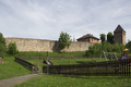
_Obertor_122.JPG) | |||||
| Upload media | |||||
| Instance of | |||||
|---|---|---|---|---|---|
| Location | Ortenberg, Wetteraukreis, Darmstadt Government Region, Hesse, Germany | ||||
| Heritage designation | |||||
 | |||||
Media in category "Obertor (Ortenberg, Hesse)"
The following 16 files are in this category, out of 16 total.
-
 DE Ortenberg-Hessen Obertor by Steschke.jpg 1,063 × 709; 260 KB
-
 DE Ortenberg-Hessen Obertor innen by Steschke.jpg 709 × 1,063; 263 KB
-
 Ortenberg (Hessen) 120.JPG 2,592 × 3,888; 9.46 MB
-
 Ortenberg (Hessen) Obertor 0420.jpg 1,544 × 1,028; 864 KB
-
 Ortenberg (Hessen) Obertor 121.JPG 3,888 × 2,592; 8.52 MB
-
 Ortenberg (Hessen) Obertor 122.JPG 2,592 × 3,888; 8.45 MB
-
 Ortenberg Obertor 320 SAM 0970 20200506.jpg 3,264 × 2,448; 2.65 MB
-
 Ortenberg Ortenberg Obertor CityWall Playground df.png 5,200 × 3,468; 23.81 MB
-
 Ortenberg Ortenberg Obertor f.png 3,468 × 5,200; 28.14 MB
-
 Ortenberg, Stadtbefestigung, Kasinostraße 23, Obertor, Stadtseite-20160908-001.jpg 4,003 × 5,996; 17.89 MB
-
 Ortenberg, Stadtbefestigung, Kasinostraße 23, Obertor-20160908-001.jpg 5,996 × 4,003; 16.69 MB
-
 Ortenberg, Stadtbefestigung, Kasinostraße 23, Obertor-20160908-002.jpg 4,003 × 5,996; 12.39 MB
-
 Ortenberg, Stadtbefestigung, Kasinostraße 23, Obertor-20160908-003.jpg 4,002 × 5,995; 13.79 MB
-
 Ortenberg, Stadtbefestigung, Kasinostraße 23, Obertor-20160908-004.jpg 5,996 × 4,003; 14.5 MB
-
 Ortenberg, Stadtbefestigung, Kasinostraße 23, Obertor-20160908-005.jpg 5,996 × 4,003; 16.23 MB
-
 Ortenberg-15001.jpg 2,140 × 3,199; 8.54 MB


_120.JPG)
_Obertor_0420.jpg)
_Obertor_121.JPG)


