Category:Obere Kelter
Jump to navigation
Jump to search
| Object location | | View all coordinates using: OpenStreetMap |
|---|
| Address |
|
Media in category "Obere Kelter"
The following 4 files are in this category, out of 4 total.
-
 Markgröningen Obere Kelter+Wimpelinhaus+Oberes Tor PF.jpg 907 × 508; 447 KB
-
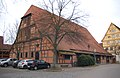
 Obere Kelter Grüningen Web.jpg 794 × 814; 582 KB
-
 Obere Kelter Markgröningen 0140Web.jpg 1,138 × 736; 912 KB
-
 Obere Kelter MG PF0317A.jpg 2,800 × 1,811; 3.53 MB


