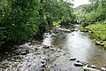
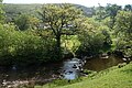
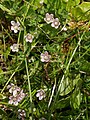
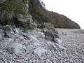
Category:Oare, Somerset
Jump to navigation
Jump to search
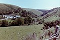
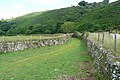
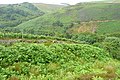
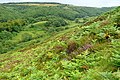
English: Oare is a village and civil parish on Oare Water on Exmoor in the West Somerset district of Somerset, England. The parish includes the hamlet of Oareford and the village of Culbone which contains its own tiny church.
village and civil parish in Somerset, UK  | |||||
| Upload media | |||||
| Instance of | |||||
|---|---|---|---|---|---|
| Location | Somerset West and Taunton, Somerset, South West England, England | ||||
| Population |
| ||||
 | |||||
Subcategories
This category has the following 3 subcategories, out of 3 total.
C
M
- St Mary's church, Oare, Somerset (10 F)
Media in category "Oare, Somerset"
The following 200 files are in this category, out of 439 total.
(previous page) (next page)-
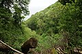
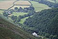
 "Doone Valley" and Cloud Farm, 1981 - geograph.org.uk - 4556351.jpg 4,416 × 2,944; 2.25 MB
-

-
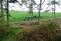
 A field of sheep near Broomstreet Farm - geograph.org.uk - 5860401.jpg 6,000 × 4,000; 5.72 MB
-
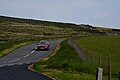
 A39 above Clanel Combe - geograph.org.uk - 5911104.jpg 1,024 × 683; 221 KB
-
 A39 approaching County Gate - geograph.org.uk - 2185573.jpg 800 × 600; 80 KB
-

-
 A39 near Lillycombe - geograph.org.uk - 2177877.jpg 800 × 600; 122 KB
-
 A39 passing Oare House Allotment - geograph.org.uk - 6399069.jpg 1,600 × 1,200; 587 KB
-
 A39 traffic from County Gate car park - geograph.org.uk - 5120197.jpg 2,781 × 1,666; 2.35 MB
-
 A39 west of New Road Gate - geograph.org.uk - 6033688.jpg 1,600 × 1,200; 650 KB
-
 A39 Yenworthy Common - geograph.org.uk - 2185513.jpg 800 × 600; 66 KB
-
 Above Culbone Wood - geograph.org.uk - 1402293.jpg 640 × 480; 60 KB
-
 Above Weir Water - geograph.org.uk - 1987542.jpg 640 × 427; 221 KB
-
 Above Weir Water valley - geograph.org.uk - 3926335.jpg 1,024 × 768; 228 KB
-
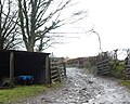
 Access point at Oareford - geograph.org.uk - 1986110.jpg 640 × 426; 226 KB
-
 Access road to Kemps Farm - geograph.org.uk - 6033668.jpg 1,600 × 1,200; 781 KB
-
 Across Weir Water - geograph.org.uk - 1987559.jpg 640 × 426; 238 KB
-
 Across Weir Water - geograph.org.uk - 1987568.jpg 640 × 428; 257 KB
-
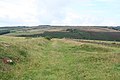
 Ashton Cleave - geograph.org.uk - 2186929.jpg 800 × 600; 200 KB
-

-
 Badgworthy Water - geograph.org.uk - 1981953.jpg 640 × 426; 237 KB
-
 Badgworthy Water - geograph.org.uk - 4421956.jpg 1,024 × 768; 194 KB
-
 Badgworthy Water - geograph.org.uk - 5852164.jpg 6,000 × 4,000; 4.67 MB
-
 Badgworthy Water - geograph.org.uk - 5852194.jpg 6,000 × 4,000; 6.33 MB
-
 Badgworthy Water valley at Cloud Farm.jpg 4,056 × 2,848; 5.86 MB
-
 Beeches near Black Barrow - geograph.org.uk - 496964.jpg 640 × 480; 131 KB
-
 Benchmark on St Mary's Church, Oare - geograph.org.uk - 5339862.jpg 640 × 427; 104 KB
-
 Blindwell Combe - geograph.org.uk - 3928735.jpg 1,024 × 768; 220 KB
-
 Bog Pimpernel - geograph.org.uk - 500691.jpg 480 × 640; 119 KB
-
 Boulders on the beach, below Culbone Wood - geograph.org.uk - 3767958.jpg 1,024 × 768; 171 KB
-
 Boulders, below Embelle Wood - geograph.org.uk - 3767939.jpg 1,024 × 768; 189 KB
-
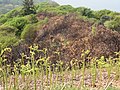 Bracken Prevails - geograph.org.uk - 2467252.jpg 1,024 × 768; 392 KB
-
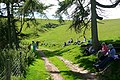
 Brendon, view to Cloud Farm camp site - geograph.org.uk - 44209.jpg 640 × 424; 147 KB
-
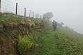
 Bridleway above Oare - geograph.org.uk - 1981925.jpg 640 × 426; 211 KB
-
 Bridleway above Oare - geograph.org.uk - 1981933.jpg 640 × 426; 230 KB
-
 Bridleway to Malmsmead from County Gate - geograph.org.uk - 6287382.jpg 4,000 × 3,000; 4.59 MB
-
 Broomstreet Combe - geograph.org.uk - 1980216.jpg 640 × 427; 257 KB
-
 Broomstreet Farm - geograph.org.uk - 1402309.jpg 640 × 480; 105 KB
-
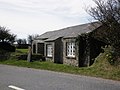
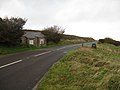
 Buildings at County Gate, Exmoor - geograph.org.uk - 3007696.jpg 1,600 × 1,200; 318 KB
-
 By the East Lyn River - geograph.org.uk - 1306001.jpg 640 × 480; 133 KB
-
-
 Campsite at Cloud Farm - geograph.org.uk - 3066368.jpg 1,024 × 768; 307 KB
-
 Car crash on Embelle Beach - geograph.org.uk - 1980240.jpg 640 × 426; 206 KB
-
 Car park in valley of Weir Water - geograph.org.uk - 6032553.jpg 1,600 × 1,200; 1.04 MB
-
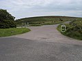
 Car park near Robber's Bridge - geograph.org.uk - 1986100.jpg 640 × 427; 200 KB
-
 Cars parked at Yenworthy - geograph.org.uk - 6125908.jpg 1,024 × 715; 138 KB
-
 Castle Green, near Oare - geograph.org.uk - 3781540.jpg 1,024 × 755; 289 KB
-
 Cattle on the coast path - geograph.org.uk - 1461215.jpg 640 × 480; 101 KB
-
 Chalk Water - geograph.org.uk - 1986124.jpg 640 × 427; 232 KB
-
 Chalk Water - geograph.org.uk - 1986136.jpg 640 × 426; 233 KB
-
 Chalk Water - geograph.org.uk - 496530.jpg 480 × 640; 136 KB
-
 Chalk Water - geograph.org.uk - 500653.jpg 640 × 480; 145 KB
-
 Chalk Water Valley - geograph.org.uk - 3926370.jpg 1,024 × 768; 172 KB
-
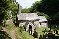
 Church of St Mary, Oare, W. Somerset - geograph.org.uk - 5691898.jpg 1,200 × 1,600; 344 KB
-
 Clanna Combe - geograph.org.uk - 6149651.jpg 1,024 × 768; 242 KB
-
 Cliff at Glenthorne Beach - geograph.org.uk - 2007702.jpg 4,000 × 3,000; 2.85 MB
-
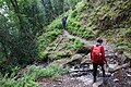
 Climbing through Coscombe Woods - geograph.org.uk - 2345534.jpg 1,024 × 768; 359 KB
-
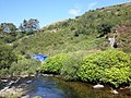
 Cloud Farm and Badgeworthy Water - geograph.org.uk - 3401626.jpg 1,990 × 1,574; 1.27 MB
-
 Clouds above Stowford Bottom - geograph.org.uk - 3923181.jpg 1,024 × 768; 98 KB
-
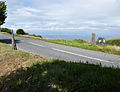
 Coast Path at Yenworthy - geograph.org.uk - 1980280.jpg 426 × 640; 236 KB
-
 Coast path below Sugarloaf Hill - geograph.org.uk - 1461284.jpg 480 × 640; 157 KB
-
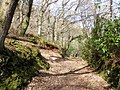
 Coast path in Culbone Wood, Oare - geograph.org.uk - 35044.jpg 597 × 400; 100 KB
-
 Coffee stop above Oare - geograph.org.uk - 3174755.jpg 640 × 427; 235 KB
-
 Coleridge Way in Deddy Combe - geograph.org.uk - 6149821.jpg 1,024 × 774; 227 KB
-
 Commemorative plaque on the wall near Twitchin - geograph.org.uk - 3767471.jpg 1,024 × 768; 238 KB
-

-
 Coscombe - geograph.org.uk - 2344060.jpg 1,024 × 768; 218 KB
-
 Coscombe and Glenthorne Plantation - geograph.org.uk - 565086.jpg 640 × 480; 136 KB
-
 Coscombe and Old Burrow Hill - geograph.org.uk - 565091.jpg 640 × 480; 144 KB
-
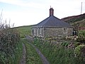 Cottage near Broomstreet Farm - geograph.org.uk - 3767229.jpg 1,024 × 768; 175 KB
-
 Cottage near Yenworthy Lodge - geograph.org.uk - 565105.jpg 640 × 480; 130 KB
-
 Countisbury, on Cosgate Hill - geograph.org.uk - 601218.jpg 640 × 427; 150 KB
-
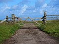
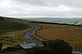
 County Gate - geograph.org.uk - 1979945.jpg 640 × 427; 177 KB
-
 County Gate - geograph.org.uk - 2701368.jpg 640 × 480; 61 KB
-
 County Gate - geograph.org.uk - 2988927.jpg 1,600 × 1,067; 385 KB
-
 County Gate - geograph.org.uk - 4467021.jpg 1,600 × 1,200; 399 KB
-
 County Gate moorland towards the upper Oare valley - geograph.org.uk - 5120203.jpg 3,648 × 2,432; 4.07 MB
-
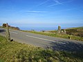
 County Gate on the A39 - geograph.org.uk - 3735991.jpg 3,264 × 2,448; 3.61 MB
-
 County Gate, Exmoor.jpg 3,490 × 2,672; 3.4 MB
-
 Crossing Badgworthy Water - geograph.org.uk - 224391.jpg 640 × 431; 128 KB
-
 Crossing Broomstreet Combe - geograph.org.uk - 5860258.jpg 6,000 × 4,000; 6.37 MB
-
 Crossing Weir Water - geograph.org.uk - 1987574.jpg 640 × 426; 239 KB
-
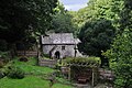 Culbone , Culbone Church - geograph.org.uk - 4651325.jpg 4,288 × 2,848; 6.23 MB
-
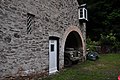 Culbone , Culbone Lodge - geograph.org.uk - 4651332.jpg 4,288 × 2,848; 6.72 MB
-
 Culbone Church - geograph.org.uk - 5844427.jpg 6,000 × 4,000; 4.92 MB
-
 Deddy Combe - geograph.org.uk - 6149824.jpg 1,024 × 768; 230 KB
-
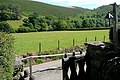 Deddy Combe from Oare church - geograph.org.uk - 1981914.jpg 640 × 427; 210 KB
-
 Deddy Combe, north-east of Oare - geograph.org.uk - 6033671.jpg 1,600 × 1,200; 798 KB
-
 Derelict Buildings - geograph.org.uk - 2007697.jpg 4,000 × 3,000; 3.1 MB
-
 Downstream at Robbers Bridge - geograph.org.uk - 5123266.jpg 3,648 × 2,432; 7.36 MB
-
 East Lyn River - geograph.org.uk - 1306034.jpg 640 × 480; 147 KB
-
 East Lyn valley - geograph.org.uk - 565078.jpg 640 × 480; 133 KB
-
 East Lyn Valley from County Gate - geograph.org.uk - 3527971.jpg 1,500 × 1,000; 265 KB
-
 Embelle Wood Beach - geograph.org.uk - 3767763.jpg 1,024 × 768; 170 KB
-
 Entrance drive, Yenworthy Lodge - geograph.org.uk - 3783093.jpg 1,024 × 768; 262 KB
-
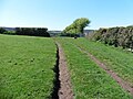
 Entrance to private road over Oare Water, Oare - geograph.org.uk - 3003026.jpg 1,600 × 1,200; 849 KB
-
 Ewe with newly born lamb - geograph.org.uk - 3923123.jpg 1,024 × 768; 241 KB
-
 Exmoor. The Ivystone. - geograph.org.uk - 643471.jpg 480 × 640; 80 KB
-
 Fallen tree on Badgworthy Water - geograph.org.uk - 3066308.jpg 1,024 × 768; 348 KB
-
 Farm access road, on Culbone Hill - geograph.org.uk - 2343932.jpg 1,024 × 768; 332 KB
-
 Farm track above Culbone Wood - geograph.org.uk - 5860392.jpg 6,000 × 4,000; 7.22 MB
-
 Farmhouse, Broomstreet - geograph.org.uk - 3767224.jpg 1,024 × 768; 186 KB
-
 Farmland near Malmsmead - geograph.org.uk - 5857868.jpg 6,000 × 4,000; 7.72 MB
-
 Field above Withy Combe - geograph.org.uk - 5845387.jpg 6,000 × 4,000; 7.22 MB
-
 Fields down to Lillycombe house - geograph.org.uk - 522360.jpg 640 × 425; 83 KB
-
 Flock of sheep on Stowey Ridge - geograph.org.uk - 3923113.jpg 1,024 × 768; 217 KB
-
 Footbridge over Badgworthy Water - geograph.org.uk - 4421949.jpg 768 × 1,024; 210 KB
-
 Footbridge over Badgworthy Water - geograph.org.uk - 6148010.jpg 1,024 × 762; 228 KB
-
 Footbridge over Badgworthy Water - geograph.org.uk - 976409.jpg 640 × 427; 93 KB
-
 Footbridge, Oareford - geograph.org.uk - 6149849.jpg 1,024 × 768; 383 KB
-
 Footbridge, over the Oare Water - geograph.org.uk - 2619887.jpg 1,024 × 768; 270 KB
-
 Footpath above Coscombe - geograph.org.uk - 5861224.jpg 6,000 × 4,000; 7.16 MB
-
 Footpath above Oare - geograph.org.uk - 6149673.jpg 1,024 × 768; 250 KB
-
 Footpath at Silcombe Farm - geograph.org.uk - 3659198.jpg 640 × 480; 95 KB
-
 Footpath beside Lillycombe, at Robber's Bridge - geograph.org.uk - 3003045.jpg 1,600 × 1,200; 833 KB
-
 Footpath down to Glenthorne Beach - geograph.org.uk - 2345085.jpg 1,024 × 768; 395 KB
-
 Footpath from County Gate - geograph.org.uk - 5911122.jpg 1,024 × 683; 232 KB
-
 Footpath south of Oareford - geograph.org.uk - 6032569.jpg 1,600 × 1,282; 927 KB
-
 Ford at Robber's Bridge - geograph.org.uk - 500288.jpg 640 × 470; 140 KB
-
 Ford next to Robber's Bridge - geograph.org.uk - 685374.jpg 640 × 480; 164 KB
-
 Former trout pond, above Glenthorne - geograph.org.uk - 2345074.jpg 1,024 × 768; 365 KB
-
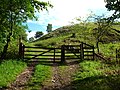
 Gated road to Broomstreet Farm - geograph.org.uk - 3007659.jpg 1,600 × 1,200; 486 KB
-
 Gateway on South Common - geograph.org.uk - 3923444.jpg 1,024 × 768; 164 KB
-
 Gateway on Stowey Allotment - geograph.org.uk - 3923151.jpg 1,024 × 768; 180 KB
-
 Glade, in Yenworthy Combe - geograph.org.uk - 2345069.jpg 1,024 × 768; 375 KB
-
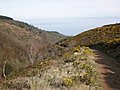
 Glenthorne Beach - geograph.org.uk - 2345095.jpg 1,024 × 768; 196 KB
-
 Glenthorne Beach and the Bristol Channel - geograph.org.uk - 2345100.jpg 1,024 × 768; 235 KB
-
 Glenthorne House - geograph.org.uk - 2345450.jpg 1,024 × 768; 285 KB
-
 Gnarled old beech tree on North Common - geograph.org.uk - 6149837.jpg 1,024 × 751; 301 KB
-
 Grazing at County Gate - geograph.org.uk - 1979938.jpg 640 × 427; 209 KB
-
 Grazing sheep, above Blindwell Combe - geograph.org.uk - 3923106.jpg 1,024 × 768; 164 KB
-
 Hay feeder on Stowey Allotment - geograph.org.uk - 3923418.jpg 1,024 × 768; 201 KB
-
 Head of Deddy Combe - geograph.org.uk - 1981896.jpg 640 × 427; 226 KB
-
 Heather by Weir Water - geograph.org.uk - 500702.jpg 640 × 480; 156 KB
-
 Hedgebank on south side of A39 on North Common - geograph.org.uk - 6399060.jpg 1,600 × 1,143; 825 KB
-
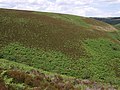 Hillside above Weir Water - geograph.org.uk - 500669.jpg 640 × 480; 130 KB
-
 Hillside, below County Gate - geograph.org.uk - 3062047.jpg 1,024 × 768; 279 KB
-
 Holmer's Combe - geograph.org.uk - 5859535.jpg 6,000 × 4,000; 5.55 MB
-
 Home Farm, Glenthorne - geograph.org.uk - 2345502.jpg 1,024 × 768; 216 KB
-
 In Copper Wood - geograph.org.uk - 6033667.jpg 1,600 × 1,200; 1.01 MB
-
 In Yenworthy Combe - geograph.org.uk - 1979966.jpg 640 × 426; 236 KB
-
 Inner Alscott Combe - geograph.org.uk - 3926353.jpg 1,024 × 768; 223 KB
-
 Inside Oare church, looking east - geograph.org.uk - 6033675.jpg 1,600 × 1,200; 737 KB
-
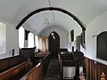 Inside Oare church, looking west - geograph.org.uk - 6033674.jpg 1,600 × 1,200; 719 KB
-
 Ivystone Traverse. Exmoor - geograph.org.uk - 643494.jpg 480 × 640; 60 KB
-
 Land Combe - geograph.org.uk - 1986181.jpg 640 × 427; 176 KB
-
 Landslide diversion - geograph.org.uk - 5859451.jpg 6,000 × 4,000; 6.15 MB
-
 Landslide Diversion on the Coast Path - geograph.org.uk - 2465360.jpg 1,024 × 768; 435 KB
-
 Landslip at Yenworthy 1 - geograph.org.uk - 1980192.jpg 640 × 427; 214 KB
-
 Landslip at Yenworthy 2 - geograph.org.uk - 1980194.jpg 640 × 427; 211 KB
-
 Landslip at Yenworthy 3 - geograph.org.uk - 1980196.jpg 640 × 427; 208 KB
-
 Landslip at Yenworthy 4 - geograph.org.uk - 1980200.jpg 640 × 427; 221 KB
-
 Landslip at Yenworthy 5 - geograph.org.uk - 1980203.jpg 640 × 427; 218 KB
-
 Landslip at Yenworthy 6 - geograph.org.uk - 1980207.jpg 640 × 427; 214 KB
-
 Lane at Silcombe Farm - geograph.org.uk - 3659208.jpg 640 × 465; 74 KB
-
 Lane by Parsonage Farm - geograph.org.uk - 5845408.jpg 6,000 × 4,000; 4.65 MB
-
 Lane to Oareford - geograph.org.uk - 497663.jpg 640 × 480; 140 KB
-
 Lane towards Stent Hill - geograph.org.uk - 5845396.jpg 6,000 × 4,000; 5.72 MB
-
 Left to Robbers Bridge, Right to Malmsmead - geograph.org.uk - 5123177.jpg 3,038 × 2,037; 4.72 MB
-
 Lillycombe meets Weir Water - geograph.org.uk - 685346.jpg 640 × 480; 185 KB
-
 Llamas at Glenthorne - geograph.org.uk - 2345417.jpg 1,024 × 768; 340 KB
-
 Logs on the track to Yenworthy, opposite County Gate - geograph.org.uk - 6287377.jpg 4,000 × 3,000; 5.1 MB
-
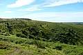
 Looking across moorland to the Bristol Channel - geograph.org.uk - 3527976.jpg 1,500 × 1,000; 189 KB
-
 Looking across the A39 to the road to Lillycombe House - geograph.org.uk - 3007653.jpg 1,600 × 1,200; 542 KB
-
 Looking across the Valley - geograph.org.uk - 1479178.jpg 640 × 427; 70 KB
-
 Looking down Coscombe and over the Bristol Channel - geograph.org.uk - 2988928.jpg 1,600 × 1,067; 299 KB
-
 Looking down The Coombe - geograph.org.uk - 2130851.jpg 1,024 × 682; 246 KB
-
 Looking east from Embelle Wood to Yellow Stone - geograph.org.uk - 1737314.jpg 1,600 × 1,196; 495 KB
-
 Looking east to Ivy Stone - geograph.org.uk - 1739268.jpg 2,816 × 2,112; 549 KB
-
 Maimsmead - Cosgates Viewpoint - geograph.org.uk - 3792113.jpg 3,872 × 2,592; 3.81 MB
-
 Maimsmead - Cosgates Viewpoint - geograph.org.uk - 3792143.jpg 3,872 × 2,592; 2.82 MB
-
 Memorial in Oare church - geograph.org.uk - 6033678.jpg 1,200 × 1,600; 707 KB
-
 Mill at Culbone - geograph.org.uk - 5844436.jpg 5,653 × 3,769; 4.22 MB
-
 Mill Barrow - geograph.org.uk - 3928786.jpg 1,024 × 772; 298 KB
-
 Mill Hill - geograph.org.uk - 1987514.jpg 640 × 426; 235 KB
-
 Mill Hill - geograph.org.uk - 1987520.jpg 640 × 428; 241 KB
-
 Mill Hill - geograph.org.uk - 1987524.jpg 640 × 427; 233 KB
-
 Mill Hill - geograph.org.uk - 3926358.jpg 1,024 × 768; 231 KB
-
 Minor road to Oare - geograph.org.uk - 3781528.jpg 1,024 × 768; 351 KB
-
 Molinia grass on Manor Allotment - geograph.org.uk - 3923478.jpg 1,024 × 768; 246 KB
-
 Moorland above Oareford - geograph.org.uk - 6149842.jpg 1,024 × 768; 288 KB
-
 Moorland south of Weir Water - geograph.org.uk - 500423.jpg 640 × 480; 74 KB
-
 Near Black Hill - geograph.org.uk - 1986140.jpg 640 × 427; 199 KB
-
 Nearing the end of Somerset - geograph.org.uk - 1980303.jpg 640 × 426; 175 KB
-
 Newly born lambs, Stowey Ridge - geograph.org.uk - 3923095.jpg 1,024 × 768; 206 KB
-
 North Common - geograph.org.uk - 6149830.jpg 1,024 × 768; 193 KB
-
 North Devon , The A39 - geograph.org.uk - 5057109.jpg 6,000 × 4,000; 6.96 MB
-
 North Devon , The A39 ^ Gate Pier - geograph.org.uk - 5057112.jpg 6,000 × 4,000; 7.46 MB
-
 North Devon , Toll House - geograph.org.uk - 5057113.jpg 6,000 × 4,000; 7.52 MB
-
 Oare - From Cosgates Hill viewpoint - geograph.org.uk - 3792126.jpg 3,872 × 2,592; 3.46 MB
-
 Oare church - geograph.org.uk - 6033680.jpg 1,600 × 1,200; 1.05 MB
-
 Oare House Allotment, Yenworthy Common - geograph.org.uk - 2184290.jpg 800 × 600; 107 KB
-
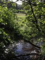
 Oare Water - geograph.org.uk - 1986116.jpg 640 × 427; 228 KB
-
 Oare Water - geograph.org.uk - 6191412.jpg 2,048 × 1,536; 1.37 MB
-
 Oare Water valley - geograph.org.uk - 497652.jpg 640 × 480; 115 KB
-
 Oare Water.jpg 480 × 640; 148 KB
-
 Oare, looking across to Deddy Combe from the church - geograph.org.uk - 2497560.jpg 1,600 × 1,064; 319 KB
-
 Oare, looking down the valley from the church - geograph.org.uk - 2497566.jpg 1,600 × 1,064; 358 KB
-
 Oare, looking north across the valley from the church - geograph.org.uk - 2497558.jpg 1,600 × 1,064; 438 KB
-
 Oare, on Stowey Ridge - geograph.org.uk - 221407.jpg 640 × 427; 158 KB

.jpg)


