Category:Oakridge, Basingstoke
Jump to navigation
Jump to search
village in Hampshire, England | |||||
| Upload media | |||||
| Instance of | |||||
|---|---|---|---|---|---|
| Location | Basingstoke, Basingstoke and Deane, Hampshire, South East England, England | ||||
 | |||||
English: Oakridge is a district of Basingstoke in Hampshire, England, and is located in the north of Basingstoke within the ringroad.
Subcategories
This category has the following 8 subcategories, out of 8 total.
B
- Oakridge Church (3 F)
- Bay Tree Way (5 F)
M
- Millard Close, Basingstoke (19 F)
- Mullins Close, Basingstoke (2 F)
O
- Oakridge Road, Basingstoke (41 F)
- Osborne Close, Basingstoke (16 F)
S
- Stratfield Road, Basingstoke (10 F)
U
- Upton Crescent, Basingstoke (17 F)
Media in category "Oakridge, Basingstoke"
The following 97 files are in this category, out of 97 total.
-
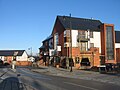
 A closed pub - geograph.org.uk - 1133442.jpg 640 × 471; 50 KB
-
 A misty bend - Vivian Road - geograph.org.uk - 981274.jpg 640 × 478; 32 KB
-
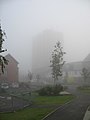 A misty Oakridge Tower - geograph.org.uk - 981364.jpg 482 × 640; 28 KB
-
 A shrouded Oakridge Tower - geograph.org.uk - 981261.jpg 492 × 640; 26 KB
-
 Access ramp - Ringway North - geograph.org.uk - 1269914.jpg 640 × 467; 61 KB
-
 Aldermaston roundabout - geograph.org.uk - 656471.jpg 640 × 465; 54 KB
-
 Approaching Reading Road roundabout - geograph.org.uk - 1710209.jpg 800 × 600; 76 KB
-
 Aspen Way - geograph.org.uk - 647386.jpg 640 × 436; 48 KB
-
 Darlington Close - geograph.org.uk - 650001.jpg 640 × 480; 99 KB
-
 Early morning light - geograph.org.uk - 1515825.jpg 640 × 479; 68 KB
-
 Electric Sub-station - geograph.org.uk - 656408.jpg 640 × 451; 53 KB
-
-
 Entrance to Sherborne playing fields - geograph.org.uk - 656421.jpg 640 × 457; 64 KB
-
 Exit ramp for the A33 - Reading Road - geograph.org.uk - 670031.jpg 640 × 458; 64 KB
-

-
 Flats along Cherry Tree Walk - geograph.org.uk - 820149.jpg 640 × 480; 77 KB
-

-
 Footpath and Mist - geograph.org.uk - 981352.jpg 640 × 473; 42 KB
-
 Footpath behind Nash Close - geograph.org.uk - 817718.jpg 640 × 470; 87 KB
-

-
 Forsythia Walk - geograph.org.uk - 670021.jpg 640 × 496; 59 KB
-
 Forsythia Walk - new development - geograph.org.uk - 670019.jpg 640 × 475; 54 KB
-
 Grounds of Sherborne House - geograph.org.uk - 650012.jpg 640 × 480; 103 KB
-
 High density housing - geograph.org.uk - 1071873.jpg 640 × 457; 64 KB
-
 Houses in Wateridge Road - geograph.org.uk - 1071864.jpg 640 × 474; 74 KB
-
 Housing on Forsythia Walk - geograph.org.uk - 670043.jpg 640 × 461; 62 KB
-
 Jefferson Road - geograph.org.uk - 650460.jpg 640 × 474; 53 KB
-
 Jefferson Road - geograph.org.uk - 738026.jpg 640 × 458; 55 KB
-
 Kids playground and some snow - geograph.org.uk - 1183869.jpg 640 × 468; 55 KB
-
 Len Smart Court - geograph.org.uk - 1515857.jpg 640 × 461; 62 KB
-
 Look no leaves - geograph.org.uk - 1085205.jpg 501 × 640; 121 KB
-
 Looking along Jefferson Road - geograph.org.uk - 1034825.jpg 640 × 480; 72 KB
-
 Middle of the estate - geograph.org.uk - 1071401.jpg 640 × 473; 76 KB
-

-
 New Flats - Oakridge - geograph.org.uk - 817686.jpg 640 × 461; 95 KB
-
 No ball games - geograph.org.uk - 1085163.jpg 640 × 459; 84 KB
-
 Normanton Road - 128 to 154 - geograph.org.uk - 656109.jpg 640 × 467; 54 KB
-
 Normanton Road - 180 to 193 - geograph.org.uk - 656115.jpg 640 × 444; 66 KB
-
 Normanton Road - geograph.org.uk - 656102.jpg 640 × 443; 53 KB
-
 Normanton Road 2 - geograph.org.uk - 650468.jpg 640 × 455; 63 KB
-
 Oakridge Community Hall - geograph.org.uk - 670039.jpg 640 × 456; 49 KB
-
 Oakridge Footpath - geograph.org.uk - 647371.jpg 640 × 472; 76 KB
-
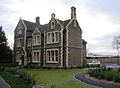
 Oakridge Hall - geograph.org.uk - 820154.jpg 640 × 480; 69 KB
-
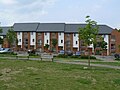
 Oakridge Housing - geograph.org.uk - 1071735.jpg 640 × 467; 82 KB
-
 Oakridge Housing - geograph.org.uk - 647376.jpg 640 × 450; 63 KB
-
 Oakridge housing estate - geograph.org.uk - 782187.jpg 640 × 471; 67 KB
-
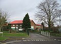
 Oakridge Infant School - geograph.org.uk - 1008670.jpg 640 × 473; 56 KB
-
 Oakridge Infant School - geograph.org.uk - 1133451.jpg 640 × 467; 47 KB
-
 Oakridge Infant School - geograph.org.uk - 1180482.jpg 640 × 471; 29 KB
-
 Oakridge Infant School - geograph.org.uk - 650004.jpg 640 × 463; 58 KB
-
 Oakridge Infant School - geograph.org.uk - 656315.jpg 640 × 443; 55 KB
-
 Oakridge Infant School Boiler House - geograph.org.uk - 656415.jpg 640 × 463; 75 KB
-
 Oakridge Infant School playground - geograph.org.uk - 1262141.jpg 640 × 411; 65 KB
-
 Oakridge Infants playground - geograph.org.uk - 656331.jpg 640 × 441; 71 KB
-
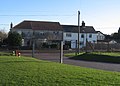
 Oakridge Junior School - geograph.org.uk - 1180477.jpg 640 × 470; 47 KB
-
 Oakridge Junior School - geograph.org.uk - 1192664.jpg 640 × 472; 60 KB
-
 Oakridge junior school - geograph.org.uk - 670071.jpg 640 × 480; 130 KB
-
 Oakridge Playground - geograph.org.uk - 817678.jpg 640 × 456; 56 KB
-
 Oakridge Primary School - geograph.org.uk - 650006.jpg 640 × 458; 73 KB
-
 Oakridge Tower - geograph.org.uk - 1071925.jpg 481 × 640; 52 KB
-
 Oakridge Tower - geograph.org.uk - 603671.jpg 480 × 640; 86 KB
-
 Oakridge Tower - geograph.org.uk - 820160.jpg 640 × 469; 75 KB
-
 Old and the new - geograph.org.uk - 647384.jpg 640 × 466; 83 KB
-

-
 Open land in Oakridge - geograph.org.uk - 1079726.jpg 640 × 468; 99 KB
-
 Original wall for Sherborne House - geograph.org.uk - 745706.jpg 640 × 450; 76 KB
-
 Parking off Jefferson Road - geograph.org.uk - 1034809.jpg 640 × 472; 120 KB
-
 Path and cut hedge - geograph.org.uk - 1133457.jpg 640 × 470; 67 KB
-
 Pear Tree Way - geograph.org.uk - 851918.jpg 640 × 471; 64 KB
-
 Pear Tree Way and Oakridge Tower - geograph.org.uk - 802877.jpg 640 × 470; 86 KB
-
 Evening light - geograph.org.uk - 1515785.jpg 640 × 466; 59 KB
-
 Public Footpath - geograph.org.uk - 647369.jpg 640 × 477; 96 KB
-

-
 Residential parking space - Oakridge - geograph.org.uk - 1034813.jpg 640 × 478; 115 KB
-
-
 Ringway East exit ramp - geograph.org.uk - 664084.jpg 640 × 460; 57 KB
-
 Ringway North A 33 - geograph.org.uk - 655901.jpg 640 × 477; 62 KB
-
 Ringway North heading west. - geograph.org.uk - 655906.jpg 640 × 475; 65 KB
-
 Setting sun on Forsythia Walk - geograph.org.uk - 1262159.jpg 640 × 461; 61 KB
-
 Sharp corner in Vyne Road - geograph.org.uk - 668630.jpg 640 × 457; 118 KB
-
 Sherborne House - 2008 version - geograph.org.uk - 745714.jpg 640 × 471; 66 KB
-
 Sherborne House - geograph.org.uk - 1085203.jpg 640 × 485; 65 KB
-
 Sherborne playing fields - geograph.org.uk - 656434.jpg 640 × 452; 63 KB
-
 Sherborne playing fields and pavilion - geograph.org.uk - 656430.jpg 640 × 436; 49 KB
-
 Snow clad hill - Oakridge - geograph.org.uk - 1710206.jpg 800 × 600; 111 KB
-
 Snowscene in Oakridge - geograph.org.uk - 1193646.jpg 640 × 468; 34 KB
-
 Soldiers Return and Xmas Trees - geograph.org.uk - 656416.jpg 640 × 456; 69 KB
-
 Steevens House - geograph.org.uk - 650564.jpg 640 × 477; 71 KB
-
 Terraced estate houses - geograph.org.uk - 1071866.jpg 640 × 463; 58 KB
-
 The Oak - Oakridge - geograph.org.uk - 1192666.jpg 640 × 478; 58 KB
-
 The Oak - Oakridge - geograph.org.uk - 1515830.jpg 423 × 640; 50 KB
-
 The Soldiers Return again - geograph.org.uk - 74378.jpg 640 × 480; 91 KB
-
 Trees by Forsythia Walk - geograph.org.uk - 1124146.jpg 640 × 468; 121 KB
-
 Typical new housing in Oakridge - geograph.org.uk - 782191.jpg 640 × 470; 73 KB
-
 Vivian Road - geograph.org.uk - 1152806.jpg 640 × 480; 60 KB
-
 Vyne School playing fields - geograph.org.uk - 667842.jpg 640 × 455; 39 KB
-
 Wateridge Road - geograph.org.uk - 738071.jpg 640 × 478; 77 KB


