Category:Nunburnholme
Jump to navigation
Jump to search
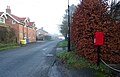
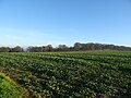
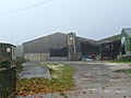
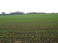
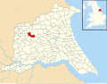
English: Nunburnholme is a village and civil parish in the East Riding of Yorkshire, England. It is situated approximately 3 miles (4.8 km) east of the market town of Pocklington.
a village located in East Riding of Yorkshire, United Kingdom  | |||||
| Upload media | |||||
| Instance of | |||||
|---|---|---|---|---|---|
| Location | East Riding of Yorkshire, Yorkshire and the Humber, England | ||||
| Population |
| ||||
 | |||||
Subcategories
This category has the following 6 subcategories, out of 6 total.
Media in category "Nunburnholme"
The following 200 files are in this category, out of 353 total.
(previous page) (next page)-
 A Fence Taken - geograph.org.uk - 590013.jpg 464 × 640; 116 KB
-
 A lane leading to Kilnwick Percy - geograph.org.uk - 2325585.jpg 800 × 600; 303 KB
-
 A memorial to a cow^ - geograph.org.uk - 2137982.jpg 800 × 600; 279 KB
-
 A minor road at Nunburnholme Wold - geograph.org.uk - 2460538.jpg 800 × 600; 181 KB
-
 A minor road at Nunburnholme Wold - geograph.org.uk - 2460540.jpg 800 × 600; 170 KB
-

-
 A popular route^ - geograph.org.uk - 1430340.jpg 640 × 480; 134 KB
-
 A track to Kilnwick Percy Wood - geograph.org.uk - 2137998.jpg 800 × 600; 237 KB
-
 Access road to Low Warrendale Farm - geograph.org.uk - 5314730.jpg 2,304 × 1,728; 1.12 MB
-
 Along Fishpond Hill - geograph.org.uk - 5102132.jpg 640 × 427; 128 KB
-
 Along Londesborough Hill - geograph.org.uk - 5102179.jpg 640 × 427; 119 KB
-
 Along Lowfield Lane - geograph.org.uk - 5102157.jpg 640 × 427; 109 KB
-
 Along the B1246 - geograph.org.uk - 5102130.jpg 640 × 427; 161 KB
-
 Along Town Street - geograph.org.uk - 5102162.jpg 640 × 427; 128 KB
-
 Approach to Thorns Wood - geograph.org.uk - 1429339.jpg 640 × 480; 79 KB
-
 Approaching Low Warrendale Farm - geograph.org.uk - 4191622.jpg 1,024 × 768; 201 KB
-
 Approaching Nunburnholme - geograph.org.uk - 2084219.jpg 1,744 × 1,308; 1.59 MB
-
 Approaching Wolds Farm - geograph.org.uk - 4191607.jpg 1,024 × 768; 147 KB
-
 Autumn colour - geograph.org.uk - 4191678.jpg 1,024 × 768; 223 KB
-
 Back Lane - geograph.org.uk - 3766400.jpg 640 × 427; 68 KB
-
 Back Lane near Nunburnholme - geograph.org.uk - 1563464.jpg 640 × 480; 66 KB
-
 Barns at Wold Farm - geograph.org.uk - 4390534.jpg 1,600 × 1,062; 602 KB
-
 Barns near Nunburnholme - geograph.org.uk - 4390397.jpg 1,600 × 1,062; 391 KB
-
 Barns near Nunburnholme - geograph.org.uk - 4390402.jpg 1,600 × 1,062; 615 KB
-
 Bench on the Wolds Way near Low Warrendale Farm - geograph.org.uk - 4390569.jpg 1,600 × 1,062; 482 KB
-
 Best cow memorial - geograph.org.uk - 1028924.jpg 640 × 480; 136 KB
-
 Bird sculptures at Warrendale Farm - geograph.org.uk - 4391627.jpg 1,600 × 1,062; 893 KB
-
 Book stop on green, Nunburnholme (geograph 7046594).jpg 1,024 × 768; 137 KB
-
 Bratt Lane towards Wold Farm - geograph.org.uk - 4390497.jpg 1,600 × 1,062; 901 KB
-
 Bratt Lane towards Wold Farm - geograph.org.uk - 4390501.jpg 1,600 × 1,062; 893 KB
-
 Bratt Lane towards Wold Farm - geograph.org.uk - 4390502.jpg 1,600 × 1,062; 742 KB
-
 Bratt Wood, Nunburnholme - geograph.org.uk - 1430320.jpg 640 × 409; 93 KB
-
 Bridge over Nunburnholme Beck - geograph.org.uk - 1253638.jpg 426 × 640; 225 KB
-
 Bridleway on Nunburnholme Wold - geograph.org.uk - 1251629.jpg 492 × 640; 167 KB
-
 Brook Farm, Nunburnholme - geograph.org.uk - 4196699.jpg 1,024 × 768; 199 KB
-
 Buildings at Wold Farm - geograph.org.uk - 4390525.jpg 1,600 × 1,062; 716 KB
-
 Butt Lane - geograph.org.uk - 261131.jpg 640 × 480; 49 KB
-
 Butt Lane, Nunburnholme - geograph.org.uk - 1253525.jpg 640 × 415; 207 KB
-
 By Poor Wood, near Millington - geograph.org.uk - 1976802.jpg 459 × 640; 202 KB
-
 By Warrendale Plantation, Millington - geograph.org.uk - 1975412.jpg 491 × 640; 196 KB
-
 Chalky fields of Totterdown Hill - geograph.org.uk - 5102163.jpg 640 × 427; 126 KB
-
 Church Lane - geograph.org.uk - 3766402.jpg 640 × 427; 85 KB
-
 Church Lane, Nunburnholme (geograph 7046585).jpg 640 × 413; 74 KB
-
 Church Lane, Nunburnholme - geograph.org.uk - 1429389.jpg 640 × 480; 61 KB
-
 Church Lane, Nunburnholme - geograph.org.uk - 1563784.jpg 640 × 480; 52 KB
-
 Church Lane, Nunburnholme - geograph.org.uk - 589053.jpg 640 × 451; 107 KB
-

-

-
 Clump of trees at Kilnwick Percy - geograph.org.uk - 2754682.jpg 3,264 × 1,632; 873 KB
-
 Corner on the Wolds Way - geograph.org.uk - 2754690.jpg 1,634 × 2,176; 661 KB
-
 Corrugated iron sheds - geograph.org.uk - 4195348.jpg 1,024 × 768; 199 KB
-
 Cottage Farm - geograph.org.uk - 1563758.jpg 640 × 480; 69 KB
-
 Country road from Nunburnholme to Warter - geograph.org.uk - 67565.jpg 640 × 480; 137 KB
-
 Crop field off Kilnwick Percy Hill (B1246) (geograph 7054658).jpg 1,024 × 768; 215 KB
-
 Crossroads on the hill - geograph.org.uk - 5102172.jpg 640 × 427; 104 KB
-
 Crow Wood from Kilnwick Percy Hill - geograph.org.uk - 2101018.jpg 3,648 × 2,736; 1.97 MB
-
 Cultivated field - geograph.org.uk - 4195883.jpg 1,024 × 768; 178 KB
-
 Deep Dale and Deepdale Head - geograph.org.uk - 2157093.jpg 4,000 × 3,000; 2.56 MB
-
 Defibrillator on Church Lane, Nunburnholme (geograph 7046599).jpg 1,024 × 739; 156 KB
-
 Derelict buildings, Wold Farm - geograph.org.uk - 4195848.jpg 1,024 × 768; 155 KB
-
 Descending through Bratt Wood - geograph.org.uk - 4195865.jpg 1,024 × 768; 320 KB
-
 Disused pit - geograph.org.uk - 4195859.jpg 1,024 × 768; 260 KB
-
 Down Nunburnholme Hill - geograph.org.uk - 5102167.jpg 640 × 427; 125 KB
-
 Down the hill - geograph.org.uk - 5102170.jpg 640 × 427; 117 KB
-
 Downhill towards Nunburnholme. - geograph.org.uk - 6197569.jpg 1,024 × 683; 224 KB
-
 Driveway to Kilnwick Percy Hall - geograph.org.uk - 4195334.jpg 1,024 × 768; 361 KB
-
 East End, Nunburnholme - geograph.org.uk - 6386477.jpg 1,024 × 768; 159 KB
-
 Electricity line above Loaningdale - geograph.org.uk - 4293580.jpg 1,024 × 768; 183 KB
-
 Elizabeth II postbox on Church Lane, Nunburnholme (geograph 7046582).jpg 560 × 1,024; 155 KB
-
 Entering Nunburnholme - geograph.org.uk - 2137923.jpg 800 × 600; 241 KB
-

-
 Entrance to The Old Rectory - geograph.org.uk - 1430329.jpg 640 × 480; 111 KB
-

-
 Farm Building, Methill Hall Farm - geograph.org.uk - 1563477.jpg 640 × 480; 75 KB
-
 Farm Buildings at Nunburnholme Wold - geograph.org.uk - 2157099.jpg 4,000 × 3,000; 2.92 MB
-
-
 Farm Buildings, Nunburnholme Wold - geograph.org.uk - 1563442.jpg 640 × 480; 37 KB
-
 Farm track near Methill Hall Farm - geograph.org.uk - 5715535.jpg 1,024 × 768; 157 KB
-
 Farming on the Yorkshire Wolds - geograph.org.uk - 162504.jpg 640 × 480; 55 KB
-
 Farmland beside Featherbed Lane - geograph.org.uk - 5102133.jpg 640 × 427; 108 KB
-
 Farmland near Pocklington - geograph.org.uk - 1563718.jpg 640 × 480; 82 KB
-
 Farmland near Poor Wood - geograph.org.uk - 1563642.jpg 640 × 480; 71 KB
-
 Farmland near Stock Bridge - geograph.org.uk - 5102159.jpg 640 × 427; 128 KB
-
 Farmland-Coneyhouse Plantation - geograph.org.uk - 238058.jpg 640 × 480; 118 KB
-
 Featherdown Bed Lane near the B1246 - geograph.org.uk - 2137931.jpg 800 × 600; 219 KB
-
 Field boundary off Featherstone Lane - geograph.org.uk - 5102151.jpg 640 × 427; 109 KB
-
 Field by Brook Farm - geograph.org.uk - 261141.jpg 640 × 480; 49 KB
-
 Field edge footpath takes a right - geograph.org.uk - 5314715.jpg 2,260 × 1,668; 1.77 MB
-
 Field edge Singleton's Wood to the left - geograph.org.uk - 5314655.jpg 2,228 × 1,622; 1.81 MB
-
 Field off Lowfield Lane - geograph.org.uk - 5102158.jpg 640 × 427; 133 KB
-
 Fields above Deep Dale (geograph 7198325).jpg 1,024 × 683; 190 KB
-
 Fields at Kilnwick Percy - geograph.org.uk - 5808637.jpg 1,024 × 768; 184 KB
-
 Fields beside Kilnwick Percy Hill (geograph 7198338).jpg 1,024 × 683; 281 KB
-
 Finger post at Jenny Firkin Wood - geograph.org.uk - 4391643.jpg 1,600 × 1,062; 590 KB
-
 Finger post at Warrendale Plantation - geograph.org.uk - 4391676.jpg 1,600 × 1,062; 800 KB
-
 Fingerpost at Low Warrendale Farm - geograph.org.uk - 4390584.jpg 1,600 × 1,062; 557 KB
-
 Fingerpost on Bratt Lane at Bratt Wood - geograph.org.uk - 4390494.jpg 1,062 × 1,600; 907 KB
-
 Fingerpost on Butt Lane, Nunburnholme - geograph.org.uk - 4390490.jpg 1,062 × 1,600; 775 KB
-
 Fingerpost on Church Lane, Nunburnholme (geograph 7046566).jpg 1,024 × 768; 219 KB
-
 Fingerpost on Wolds Way near Nunburnholme - geograph.org.uk - 4390387.jpg 1,600 × 1,062; 812 KB
-
 Flame Bushes - geograph.org.uk - 4195702.jpg 1,024 × 768; 171 KB
-
 Flame Bushes, Nunburnholme - geograph.org.uk - 588884.jpg 640 × 474; 76 KB
-
 Footbridge on the Wolds Way, Nunburnholme - geograph.org.uk - 120110.jpg 640 × 480; 188 KB
-
 Footbridge over Nunburnholme Beck - geograph.org.uk - 1429376.jpg 640 × 480; 105 KB
-
 Footbridge over Nunburnholme Beck - geograph.org.uk - 4390393.jpg 1,600 × 1,062; 930 KB
-
 Footpath , Baggaby Hill - geograph.org.uk - 1563508.jpg 640 × 480; 138 KB
-
 Footpath alongside "The Belt" above Nunburnholme - geograph.org.uk - 3067949.jpg 3,367 × 2,405; 7.68 MB
-
 Footpath near Nunburnholme - geograph.org.uk - 1563458.jpg 640 × 480; 82 KB
-
 Footpath off Nunburnholme Hill - geograph.org.uk - 5102168.jpg 640 × 427; 138 KB
-
 Footpath through Nunburnholme - geograph.org.uk - 755679.jpg 640 × 361; 213 KB
-
 Footpath to Kilnwick Percy - geograph.org.uk - 4196716.jpg 1,024 × 768; 245 KB
-
 Footpath to Nunburnholme - geograph.org.uk - 237806.jpg 640 × 467; 102 KB
-
 Footpath to Pocklington - geograph.org.uk - 1563712.jpg 640 × 480; 57 KB
-

-
 Ford at Nunburnholme - geograph.org.uk - 5669679.jpg 4,032 × 3,024; 4.16 MB
-
 Former Kingston upon Hull lamppost in Nunburnholme - geograph.org.uk - 4390428.jpg 1,062 × 1,600; 966 KB
-
 Former Kingston upon Hull lamppost in Nunburnholme - geograph.org.uk - 4390429.jpg 1,042 × 1,600; 504 KB
-
 Former pit near Low Warrendale Farm - geograph.org.uk - 4195340.jpg 1,024 × 768; 360 KB
-
 From Nunburnholme Hill - geograph.org.uk - 5102178.jpg 640 × 427; 130 KB
-
 Garden Wall and St. James' church - geograph.org.uk - 4195890.jpg 1,024 × 768; 194 KB
-
 Gate above Bratt Wood - geograph.org.uk - 3067943.jpg 2,871 × 2,051; 5.79 MB
-
 Gate and footbridge over Nunburnholme Beck - geograph.org.uk - 4196694.jpg 1,024 × 768; 349 KB
-
 Gate and track going right into Bratt Wood - geograph.org.uk - 5314646.jpg 2,304 × 1,728; 1.09 MB
-
 Gate by Thorns Wood - geograph.org.uk - 4196147.jpg 1,024 × 768; 322 KB
-
 Gate off Back Lane - geograph.org.uk - 3766397.jpg 640 × 427; 123 KB
-
 Gate on the footpath from Thorns Wood - geograph.org.uk - 4195972.jpg 1,024 × 768; 170 KB
-
 Gate on the Yorkshire Wolds Way - geograph.org.uk - 4195858.jpg 1,024 × 768; 261 KB
-
 Gates and more gates - geograph.org.uk - 4191012.jpg 1,024 × 768; 270 KB
-
 Grazing Land near Garforth Farm - geograph.org.uk - 1563469.jpg 640 × 480; 137 KB
-
 Grazing near Kilnwick Percy Hall - geograph.org.uk - 6255258.jpg 800 × 600; 82 KB
-
 Guardians of the farm - geograph.org.uk - 4195344.jpg 1,024 × 768; 213 KB
-
 Head of the valley - geograph.org.uk - 4195697.jpg 1,024 × 768; 177 KB
-
 Hedgerow and Field - geograph.org.uk - 1563529.jpg 640 × 480; 67 KB
-
 Hessey Barn no more - geograph.org.uk - 5314675.jpg 2,304 × 1,728; 1.28 MB
-
 Hessey Barn, Nunburnholme - geograph.org.uk - 588929.jpg 640 × 488; 126 KB
-
 Hessey Barn, Nunburnholme - geograph.org.uk - 588939.jpg 464 × 640; 122 KB
-
 House on Church Lane, Nunburnholme (geograph 7046584).jpg 1,024 × 685; 97 KB
-
 House on Church Lane, Nunburnholme (geograph 7046609).jpg 1,024 × 762; 118 KB
-
 Junction on the Yorkshire Wolds - geograph.org.uk - 5314753.jpg 2,304 × 1,728; 1.51 MB
-
 Junction with the Pocklington Road (geograph 7198337).jpg 1,024 × 683; 182 KB
-
 Kilnwick Percy Golf Club - geograph.org.uk - 5314777.jpg 2,304 × 1,728; 1,018 KB
-
 Kilnwick Percy Hall - geograph.org.uk - 2754665.jpg 2,174 × 1,632; 768 KB
-
 Kilnwick Percy Hall - geograph.org.uk - 4191651.jpg 1,024 × 768; 225 KB
-
 Kilnwick Percy Hall - geograph.org.uk - 4195329.jpg 1,024 × 768; 168 KB
-
 Kilnwick Percy Hall - geograph.org.uk - 6255246.jpg 800 × 600; 107 KB
-
 Kilnwick Percy Hall - geograph.org.uk - 6255263.jpg 800 × 600; 118 KB
-
 Kilnwick Percy Hall - geograph.org.uk - 6255265.jpg 800 × 600; 95 KB
-
 Kilnwick Percy Hall - geograph.org.uk - 6255268.jpg 800 × 600; 108 KB
-
 Kilnwick Percy Hall, Pocklington - geograph.org.uk - 3387926.jpg 640 × 403; 159 KB
-
 Kilnwick Percy Hill (B1246) (geograph 7054663).jpg 640 × 481; 44 KB
-
 Kilnwick Percy Hill (geograph 7198722).jpg 1,024 × 683; 230 KB
-
 Kilnwick Percy Wood - geograph.org.uk - 5102153.jpg 640 × 427; 135 KB
-
 Kissing gate near Butt Lane, Nunburnholme - geograph.org.uk - 4390487.jpg 1,600 × 1,062; 680 KB
-
 Kissing gate on Church Lane, Nunburnholme - geograph.org.uk - 4390413.jpg 1,600 × 1,062; 590 KB
-
 Kissing gate on Church Lane, Nunburnholme - geograph.org.uk - 4390431.jpg 1,600 × 1,062; 820 KB
-
 Layby on Kilnwick Percy Hill (geograph 7198723).jpg 1,024 × 683; 231 KB
-
 Long narrow field - geograph.org.uk - 4191598.jpg 1,024 × 768; 193 KB
-

-
 Looking toward Nunburnholme Wold - geograph.org.uk - 7373.jpg 640 × 480; 48 KB
-
 Looking towards High Warrendale Farm - geograph.org.uk - 4195354.jpg 1,024 × 768; 180 KB
-
 Lowfield Lane - geograph.org.uk - 4196713.jpg 1,024 × 768; 160 KB
-
 Maize Near Newcote Farm - geograph.org.uk - 236818.jpg 640 × 426; 136 KB
-
 Manor Farm, Nunburnholme - geograph.org.uk - 1563459.jpg 640 × 458; 49 KB
-
 Masts at the top of Nunburnholme Wold - geograph.org.uk - 67557.jpg 640 × 480; 101 KB
-
 Meadow above Warter - geograph.org.uk - 3067946.jpg 3,322 × 2,373; 4.62 MB
-
 Methill Hall Farm, Nunburnholme - geograph.org.uk - 1252474.jpg 640 × 406; 227 KB
-
 Minor road junction at Nunburnholme - geograph.org.uk - 1429404.jpg 640 × 514; 78 KB
-
 Minor Road over Nunburnholme Wold - geograph.org.uk - 1563445.jpg 640 × 480; 32 KB
-
 Minor road to Nunburnholme - geograph.org.uk - 1430407.jpg 640 × 480; 65 KB
-
 Minor road toward Kilnwick Percy - geograph.org.uk - 5314762.jpg 2,304 × 1,728; 1.01 MB
-
 Minor Road Towards Huggate - geograph.org.uk - 1563518.jpg 640 × 480; 76 KB
-
 Minor Road Towards Huggate - geograph.org.uk - 1563524.jpg 640 × 480; 45 KB
-
 Minor Road towards Pocklington - geograph.org.uk - 1563766.jpg 640 × 480; 63 KB
-
 Minor Road Towards Warter - geograph.org.uk - 1563472.jpg 640 × 480; 76 KB
-
 Minor Road Towards Warter - geograph.org.uk - 1563480.jpg 640 × 480; 77 KB
-
 Minor road, Newcote Fields (geograph 5668562).jpg 640 × 480; 70 KB
-
 Near Nunburnholme, East Riding, Yorkshire (geograph 1647606).jpg 640 × 480; 96 KB
-
 New rearing shed at Wold Farm (geograph 6844551).jpg 4,608 × 3,456; 3.66 MB
-
 New woodland plantation - geograph.org.uk - 59109.jpg 640 × 480; 127 KB
-

-
 North-east of Nunburnholme - geograph.org.uk - 1253578.jpg 640 × 426; 201 KB
-
 Not the route - geograph.org.uk - 4195717.jpg 1,024 × 768; 182 KB
-
 Nunburnholme (geograph 1647634).jpg 640 × 480; 61 KB
-
 Nunburnholme - geograph.org.uk - 59116.jpg 640 × 480; 153 KB
-
 Nunburnholme Beck - geograph.org.uk - 589046.jpg 640 × 457; 172 KB
-
 Nunburnholme Beck and cottages - geograph.org.uk - 1885835.jpg 640 × 426; 102 KB
-
 Nunburnholme Beck Bridge - geograph.org.uk - 261145.jpg 640 × 480; 91 KB
-
 Nunburnholme Hill (road) at Nunburnholme - geograph.org.uk - 2325557.jpg 800 × 600; 268 KB
-
 Nunburnholme Hill - geograph.org.uk - 1563457.jpg 640 × 480; 49 KB
-
 Nunburnholme Hill - geograph.org.uk - 238056.jpg 640 × 480; 85 KB
-
 Nunburnholme Hill - geograph.org.uk - 5102166.jpg 640 × 427; 112 KB
-
 Nunburnholme Hill - geograph.org.uk - 590016.jpg 640 × 430; 89 KB
-
 Nunburnholme St James Church - geograph.org.uk - 1885827.jpg 640 × 426; 93 KB
-
 Nunburnholme to Warter lane - geograph.org.uk - 1027576.jpg 640 × 480; 116 KB
-
 Nunburnholme UK parish locator map.svg 1,425 × 1,107; 1.68 MB
-
 Nunburnholme Wold - geograph.org.uk - 1250312.jpg 640 × 426; 183 KB
-
 Nunburnholme Wold - geograph.org.uk - 5611768.jpg 640 × 480; 54 KB
-
 Nunburnholme Wold bridleway - geograph.org.uk - 1251644.jpg 498 × 640; 178 KB
-
 Nunburnholme.jpg 640 × 480; 105 KB
-
 Old quarry entrance - geograph.org.uk - 4293576.jpg 1,024 × 768; 210 KB


.jpg)


.jpg)


_(geograph_7054658).jpg)


.jpg)


.jpg)


.jpg)

.jpg)


.jpg)


.jpg)
.jpg)

.jpg)


_(geograph_7054663).jpg)
.jpg)


.jpg)


.jpg)
.jpg)
.jpg)


.jpg)


_at_Nunburnholme_-_geograph.org.uk_-_2325557.jpg)


