
Category:November 2006 in the City of Wakefield
Media in category "November 2006 in the City of Wakefield"
The following 38 files are in this category, out of 38 total.
-

-

-
-
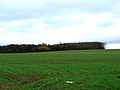 Beacon Covert, Upton - geograph.org.uk - 282357.jpg 640 × 480; 75 KB
-

-
 Chapel Hill Lane, Overton, Sitlington CP - geograph.org.uk - 280647.jpg 640 × 480; 164 KB
-
 Denby Dale Road, Crigglestone CP - geograph.org.uk - 280901.jpg 640 × 480; 64 KB
-
 East Hardwick Village Pump - geograph.org.uk - 275792.jpg 640 × 474; 121 KB
-

-
 Edge of Bullcliff Wood, West Bretton - geograph.org.uk - 280625.jpg 640 × 480; 138 KB
-
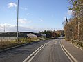
 Entering Warmfield from New Sharlston - geograph.org.uk - 286536.jpg 640 × 480; 71 KB
-

-

-

-
 Hague Lane, the B 6422 - geograph.org.uk - 286578.jpg 640 × 480; 88 KB
-

-
 Heath Farm, Hell Lane. - geograph.org.uk - 286551.jpg 640 × 480; 72 KB
-
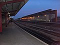 Kirkgate Station, Wakefield - panoramio.jpg 2,592 × 1,952; 1.39 MB
-

-
 Looks like Spring - geograph.org.uk - 370841.jpg 640 × 480; 99 KB
-
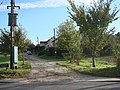
 Moor House, Ackworth - geograph.org.uk - 274490.jpg 640 × 480; 88 KB
-

-
 New Hall Lane, Midgley, Sitlington CP - geograph.org.uk - 282064.jpg 640 × 456; 75 KB
-
 North Lodge Lane, Darrington - geograph.org.uk - 274504.jpg 640 × 480; 132 KB
-

-
 Park Hill - geograph.org.uk - 286691.jpg 640 × 480; 64 KB
-
 Park Lodge Lane - geograph.org.uk - 286689.jpg 640 × 480; 67 KB
-
 Playing Fields, Eastmoor Estate. - geograph.org.uk - 286595.jpg 640 × 480; 74 KB
-

-

-

-

-

-

-

-

-

-


