Category:Nottingham Road (A6005), Long Eaton
Jump to navigation
Jump to search
Nottingham Road, a section of route A6005 in Long Eaton, Erewash, Derbyshire, England.
| Object location | | View all coordinates using: OpenStreetMap |
|---|
Media in category "Nottingham Road (A6005), Long Eaton"
The following 20 files are in this category, out of 20 total.
-

-
 Bicycle marking on Nottingham Road - geograph.org.uk - 5076655.jpg 768 × 1,024; 409 KB
-
 Colonnade Nottingham Road - geograph.org.uk - 1777451.jpg 1,024 × 683; 261 KB
-
 Dead hedgehog on Nottingham Road - geograph.org.uk - 5826605.jpg 960 × 1,280; 656 KB
-

-
 Long Eaton Railway Bridge - geograph.org.uk - 1078207.jpg 640 × 480; 65 KB
-

-
 New houses on Nottingham Road - geograph.org.uk - 5676775.jpg 640 × 480; 109 KB
-
 New houses taking shape - geograph.org.uk - 5601756.jpg 1,280 × 960; 557 KB
-
 New services under Nottingham Road - geograph.org.uk - 1955733.jpg 1,024 × 677; 311 KB
-
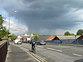
 Nottingham Road (A6005) - geograph.org.uk - 3573074.jpg 640 × 480; 64 KB
-
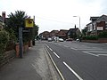 Nottingham Road (A6005) - geograph.org.uk - 3573083.jpg 640 × 480; 64 KB
-
 Nottingham Road - geograph.org.uk - 4292212.jpg 1,280 × 853; 419 KB
-
 Nottingham Road at dusk - geograph.org.uk - 4836495.jpg 1,280 × 960; 219 KB
-
 Nottingham Road has been re-surfaced - geograph.org.uk - 4978708.jpg 1,024 × 576; 163 KB
-
 Nottingham Road on a wet New Year's Day - geograph.org.uk - 5240795.jpg 1,280 × 854; 237 KB
-
 Nottingham Road railway bridge - geograph.org.uk - 5141916.jpg 903 × 1,204; 315 KB
-
 Nottingham Road, Long Eaton - geograph.org.uk - 1941463.jpg 1,280 × 854; 244 KB
-
 Railway bridge over Nottingham Road - geograph.org.uk - 3573075.jpg 640 × 480; 73 KB
-


_-_geograph.org.uk_-_3573074.jpg)
_-_geograph.org.uk_-_3573083.jpg)


