Category:Norwood Green, West Yorkshire
Jump to navigation
Jump to search
village in West Yorkshire, England, UK  | |||||
| Upload media | |||||
| Instance of | |||||
|---|---|---|---|---|---|
| Location | Calderdale, West Yorkshire, Yorkshire and the Humber, England | ||||
 | |||||
English: Norwood Green is a small village situated between Bradford, Halifax and Huddersfield in West Yorkshire, England. It is in the metropolitan borough of Calderdale. It once had a railway station on the Caldervale Line.
Subcategories
This category has the following 8 subcategories, out of 8 total.
Media in category "Norwood Green, West Yorkshire"
The following 92 files are in this category, out of 92 total.
-
 A quiet corner of Norwood Green - geograph.org.uk - 1287066.jpg 640 × 480; 82 KB
-

-
 Benchmark on Rookes Bridge, Whitehall Road - geograph.org.uk - 6021878.jpg 1,024 × 658; 240 KB
-
 Bradford to Halifax Railway - geograph.org.uk - 1286887.jpg 640 × 480; 141 KB
-
 Bradford-Halifax Line from Holmes Bridge, looking North East - geograph.org.uk - 5889599.jpg 5,184 × 3,456; 7.75 MB
-
 Bradford-Halifax Line from Holmes Bridge, looking South West - geograph.org.uk - 5889590.jpg 5,184 × 3,456; 6.38 MB
-
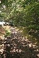
 Brick path, Norwood Green - geograph.org.uk - 835108.jpg 480 × 640; 129 KB
-

-
 Calderdale Way at Middle Ox Heys Farm - geograph.org.uk - 5163358.jpg 1,600 × 1,041; 714 KB
-
 Calderdale Way enters North Wood - geograph.org.uk - 5163379.jpg 1,600 × 1,065; 888 KB
-
 Calderdale Way enters Norwood Green - geograph.org.uk - 5163077.jpg 1,600 × 1,065; 896 KB
-
 Calderdale Way in North Wood - geograph.org.uk - 5163395.jpg 1,600 × 1,065; 830 KB
-
 Calderdale Way towards Norwood Green - geograph.org.uk - 5162984.jpg 1,600 × 1,065; 830 KB
-
 Calderdale Way towards Shelf - geograph.org.uk - 5163367.jpg 1,600 × 1,065; 607 KB
-
 Calderdale Way towards Shelf - geograph.org.uk - 5163372.jpg 1,600 × 1,138; 833 KB
-
 Coley Beck - geograph.org.uk - 6419224.jpg 1,331 × 2,000; 4.24 MB
-
 Coley Beck Valley - geograph.org.uk - 379857.jpg 640 × 415; 74 KB
-
 Cricket Pavilion, Norwood Green - geograph.org.uk - 5162987.jpg 1,600 × 1,065; 645 KB
-
 Driveway - Rookes Lane - geograph.org.uk - 2867036.jpg 640 × 480; 113 KB
-
 Entrance to Judy Woods - Station Road - geograph.org.uk - 1254937.jpg 640 × 480; 317 KB
-
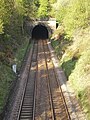 Entrance to Wyke Tunnel - geograph.org.uk - 1286874.jpg 480 × 640; 137 KB
-
 Fingerpost on Norwood Green Hill - geograph.org.uk - 5163348.jpg 1,600 × 1,065; 761 KB
-

-
 Footpath - Rookes Lane - geograph.org.uk - 2867041.jpg 640 × 480; 120 KB
-
 Footpath 12-9-4 passing a row of trees, Norwood Green - geograph.org.uk - 6611798.jpg 2,000 × 1,500; 1.37 MB
-
 Footpath 12-9-7 passing through a garden, Norwood Green - geograph.org.uk - 6611911.jpg 2,000 × 1,500; 1.77 MB
-
 Footpath in Rookes Wood - geograph.org.uk - 2849499.jpg 3,072 × 2,304; 1.21 MB
-
 Footpath leaving Norwood Green Hill, Norwood Green - geograph.org.uk - 6419081.jpg 1,650 × 2,000; 4.55 MB
-
 Footpath Norwood Green - geograph.org.uk - 1287082.jpg 480 × 640; 110 KB
-

-

-
 Footpath ^ Pylon - geograph.org.uk - 1890519.jpg 2,560 × 1,920; 787 KB
-

-

-
 Green Royd Farm - geograph.org.uk - 1287060.jpg 640 × 480; 74 KB
-
 Green Royd Farm House, Norwood Green - geograph.org.uk - 6416967.jpg 2,000 × 1,427; 3.39 MB
-
 Hill End Close - Village Street - geograph.org.uk - 1254883.jpg 640 × 433; 206 KB
-
 Hive of Industry (2986826637).jpg 1,946 × 1,675; 2.91 MB
-
 Leeds A58, Halifax A58.jpg 5,184 × 3,888; 5.55 MB
-
 Looking across the fields to Wyke - geograph.org.uk - 6417034.jpg 2,000 × 1,331; 3.72 MB
-
 Lower Ox Heys Farm, Norwood Green - geograph.org.uk - 5163354.jpg 1,600 × 1,065; 512 KB
-
 Lower Ox Heys, Norwood Green - geograph.org.uk - 5163351.jpg 1,600 × 1,065; 481 KB
-
 Meadow and woodland, Norwood Green - geograph.org.uk - 835114.jpg 640 × 480; 122 KB
-
 Norwood Green Mill - geograph.org.uk - 379835.jpg 640 × 389; 104 KB
-
 Norwood Green village - geograph.org.uk - 38660.jpg 640 × 480; 105 KB
-
 Old mineral line, Judy Woods - geograph.org.uk - 2531981.jpg 1,024 × 768; 275 KB
-
 Old stile on a 'lost path'. Norwood Green - geograph.org.uk - 6600891.jpg 2,000 × 1,501; 1.36 MB
-
 Ordnance Survey Cut Mark - geograph.org.uk - 4146955.jpg 2,560 × 1,536; 1.77 MB
-
 Path from Norwood Green Hill to Chapel Street, Norwood Green - geograph.org.uk - 6419018.jpg 1,734 × 2,000; 4.48 MB
-
 Path from Norwood Green Hill to Chapel Street, Norwood Green - geograph.org.uk - 6419019.jpg 1,617 × 2,000; 3.82 MB
-
 Path from Norwood Green Hill to Chapel Street, Norwood Green - geograph.org.uk - 6419021.jpg 1,331 × 2,000; 3.98 MB
-
 Path leading from Norwood Green towards Whitehall Road - geograph.org.uk - 6417019.jpg 2,000 × 1,300; 3.01 MB
-
 Path leading towards Judy Woods, Norwood Green - geograph.org.uk - 6416966.jpg 2,000 × 1,115; 1.06 MB
-
 Path, Norwood Green - geograph.org.uk - 6417040.jpg 1,411 × 2,000; 3.73 MB
-
 Play Area - Rookes Lane - geograph.org.uk - 2867025.jpg 640 × 480; 123 KB
-
 Prospect Place - Village Street - geograph.org.uk - 2866904.jpg 640 × 480; 65 KB
-
 Queen's Road - Norwood Green Hill - geograph.org.uk - 1254641.jpg 480 × 640; 194 KB
-
 Queen's Road - Norwood Green Hill - geograph.org.uk - 1254656.jpg 480 × 640; 202 KB
-
 Road junction - geograph.org.uk - 1287050.jpg 640 × 480; 59 KB
-
 Rookes Bridge MRB-38, Whitehall Road - geograph.org.uk - 6021880.jpg 1,024 × 683; 229 KB
-

-

-
 Rookes Hall - geograph.org.uk - 2849503.jpg 3,072 × 2,304; 1.14 MB
-
 Rookes Hall, Rookes Lane, Norwood Green - geograph.org.uk - 64891.jpg 480 × 640; 141 KB
-
 Rookes Lane - Village Street - geograph.org.uk - 1254879.jpg 640 × 425; 182 KB
-
 Rookes Lane - Whitehall Road - geograph.org.uk - 2867055.jpg 640 × 480; 69 KB
-
 Royds Hall Lane, Old Hanna Wood - geograph.org.uk - 47966.jpg 427 × 640; 169 KB
-
 Sowden Lane - geograph.org.uk - 1287037.jpg 480 × 640; 123 KB
-
 Sowden Lane, Norwood Green - geograph.org.uk - 64877.jpg 640 × 480; 170 KB
-
 Spring woodland by Norwood Green.jpg 5,184 × 3,888; 4.96 MB
-
 Station Road - Huddersfield Road - geograph.org.uk - 1254991.jpg 480 × 640; 257 KB
-
 Stile at footpath junction at Birks Close - geograph.org.uk - 6600913.jpg 2,000 × 1,500; 1.57 MB
-

-
 The Poplars - off Village Street - geograph.org.uk - 2866907.jpg 640 × 480; 90 KB
-
 Track - Rookes Lane - geograph.org.uk - 2867032.jpg 640 × 480; 123 KB
-
 Track - Village Street - geograph.org.uk - 2866900.jpg 640 × 480; 94 KB
-
 Track - Whitehall Road - geograph.org.uk - 2867069.jpg 640 × 480; 124 KB
-
 Track from Norwood Terrace to Rookes Lane, Norwood Green - geograph.org.uk - 6417006.jpg 2,000 × 1,331; 2.96 MB
-
 Track from Norwood Terrace to Village Street, Norwood Green - geograph.org.uk - 6417010.jpg 2,000 × 1,244; 2.69 MB
-
 Track through Judy Woods - Station Road - geograph.org.uk - 2866883.jpg 640 × 480; 146 KB
-
 View Eastwards towards Wyke - geograph.org.uk - 5889608.jpg 5,184 × 3,456; 7.56 MB
-
 View from Bridge MRB-44 - Station Road - geograph.org.uk - 1254989.jpg 480 × 640; 229 KB
-
 View towards Bradford on the Bradford-Halifax railway - geograph.org.uk - 6411345.jpg 1,600 × 1,596; 1.86 MB
-
 View towards Halifax on the Bradford-Halifax railway - geograph.org.uk - 6411355.jpg 2,000 × 1,259; 1.65 MB
-

-

-
 Village Street, Norwood Green - geograph.org.uk - 1287055.jpg 480 × 640; 65 KB
-
 Watford Avenue - Village Street - geograph.org.uk - 1254855.jpg 640 × 441; 189 KB
-
 Wells Terrace - off Village Street - geograph.org.uk - 1254874.jpg 640 × 480; 266 KB
-
 Wells Terrace, Norwood Green - geograph.org.uk - 1287042.jpg 640 × 480; 71 KB
-
 Woodland Track - Station Road - geograph.org.uk - 1254932.jpg 640 × 480; 347 KB
-
 Coley Beck, Norwood Green - geograph.org.uk - 379843.jpg 640 × 431; 87 KB


.jpg)


