Category:Norton, Northamptonshire
Jump to navigation
Jump to search
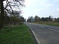
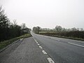
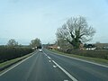
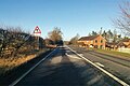
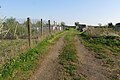
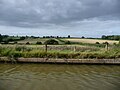
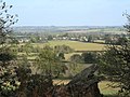
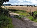
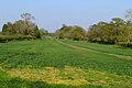
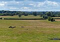
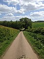
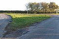
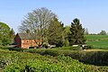
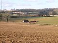
English: Norton is a village in the district of West Northamptonshire in the English County of Northamptonshire. The village is about to the east. Near the village, on Watling Street, is the Roman settlement of Bannaventa.
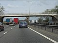
Nederlands: Norton is een dorp in het district West Northamptonshire in Northamptonshire. Het ligt ongeveer 3 kilometer ten oosten van Daventry en 11 kilometer ten zuidoosten van Northampton. Norton heeft 363 inwoners (2001). De snelweg M1 en de autoweg A5 lopen langs de oostkant van het dorp.
village and civil parish in Northamptonshire, UK  | |||||
| Upload media | |||||
| Instance of | |||||
|---|---|---|---|---|---|
| Location | West Northamptonshire, Northamptonshire, East Midlands, England | ||||
| Population |
| ||||
| Area |
| ||||
| Said to be the same as | Norton (Wikimedia duplicated page, civil parish) | ||||
 | |||||
Subcategories
This category has the following 4 subcategories, out of 4 total.
Media in category "Norton, Northamptonshire"
The following 195 files are in this category, out of 195 total.
-
 A gate in the middle of two other gates - geograph.org.uk - 3320530.jpg 2,560 × 1,920; 1,015 KB
-

-
 A5 heading north - geograph.org.uk - 3907655.jpg 640 × 480; 74 KB
-
 A5 heading north - geograph.org.uk - 5647533.jpg 640 × 428; 109 KB
-
 A5 heading north - geograph.org.uk - 5647544.jpg 640 × 428; 89 KB
-
 A5 heading north - geograph.org.uk - 5647550.jpg 640 × 428; 94 KB
-
 A5 lay-by - geograph.org.uk - 5633949.jpg 640 × 480; 50 KB
-
 A5 near the site of Bannaventa - geograph.org.uk - 4875901.jpg 640 × 480; 46 KB
-
 A5 northbound near Ivy House Farm - geograph.org.uk - 4873215.jpg 640 × 480; 47 KB
-
 A5 northbound near Watling Lodge - geograph.org.uk - 4875890.jpg 640 × 480; 42 KB
-
-
 A5 southbound - geograph.org.uk - 5633943.jpg 640 × 480; 77 KB
-
 Access bridge over Grand Union Canal - geograph.org.uk - 6720953.jpg 1,024 × 684; 155 KB
-
 Allotments on the edge of Norton - geograph.org.uk - 6129498.jpg 1,600 × 1,066; 517 KB
-
 Alms houses, Norton - geograph.org.uk - 4141987.jpg 4,320 × 3,240; 3.99 MB
-
 Barn, Watling Lodge - geograph.org.uk - 6755139.jpg 1,024 × 684; 89 KB
-
 Braunston 4 Miles sign - geograph.org.uk - 5073993.jpg 3,102 × 4,656; 3.91 MB
-
 Bridge 17, Grand Junction Canal - geograph.org.uk - 3077553.jpg 4,000 × 3,000; 4.67 MB
-
 Bridge over the Grand Union Canal - geograph.org.uk - 3866298.jpg 640 × 430; 57 KB
-
 Bridge over the Grand Union Canal - geograph.org.uk - 4911496.jpg 640 × 426; 56 KB
-
 Bridge under the railway - geograph.org.uk - 4737534.jpg 800 × 582; 147 KB
-
 Bridge, Grand Union Canal - geograph.org.uk - 2846271.jpg 640 × 430; 62 KB
-
 Bridge, Grand Union Canal - geograph.org.uk - 6503062.jpg 1,024 × 643; 118 KB
-
 Bridleway heading out of Norton - geograph.org.uk - 6129484.jpg 1,066 × 1,600; 492 KB
-
 Bridleway into Norton - geograph.org.uk - 6129475.jpg 1,600 × 1,066; 576 KB
-
 Bridleway off the Grand Union Canal - geograph.org.uk - 5216239.jpg 640 × 480; 145 KB
-
 Bridleway to Muscott - geograph.org.uk - 1705372.jpg 640 × 480; 114 KB
-
 Bridleway towards the A5 - geograph.org.uk - 6129241.jpg 1,600 × 1,066; 550 KB
-
 Bridleway towards the canal - geograph.org.uk - 6129472.jpg 1,600 × 1,066; 628 KB
-
 Brockhall-Gazewell Farm - geograph.org.uk - 1714634.jpg 640 × 480; 61 KB
-

-
 Cottage in Norton - geograph.org.uk - 3907628.jpg 640 × 480; 45 KB
-
 Cottages and lane near Muscott - geograph.org.uk - 4734218.jpg 800 × 581; 161 KB
-
 Country lane near Muscott - geograph.org.uk - 4734216.jpg 800 × 661; 161 KB
-
 Country lane to Muscott and the A5 - geograph.org.uk - 4734221.jpg 800 × 602; 155 KB
-
-
 Daventry Road and wall - geograph.org.uk - 6129444.jpg 1,600 × 1,066; 389 KB
-
 Daventry Road heading east - geograph.org.uk - 3907645.jpg 640 × 480; 107 KB
-
 Daventry Road, Norton - geograph.org.uk - 3907630.jpg 640 × 480; 64 KB
-
 Daventry-Borough Hill - geograph.org.uk - 1544200.jpg 640 × 480; 87 KB
-
 Dead tree by Borough Hill Farm - geograph.org.uk - 3320551.jpg 2,560 × 1,920; 1.01 MB
-
 Dirt track by the railway track - geograph.org.uk - 6128578.jpg 1,600 × 1,066; 517 KB
-
 Ditch field boundary - geograph.org.uk - 6755140.jpg 1,024 × 684; 98 KB
-
 Dodford transmitter fixings - geograph.org.uk - 4478033.jpg 480 × 640; 85 KB
-
 Door in the churchyard wall - geograph.org.uk - 6129443.jpg 1,600 × 1,066; 712 KB
-
 Entering Norton - geograph.org.uk - 3907619.jpg 640 × 480; 59 KB
-
 Entrance to Norton Lodge Farm - geograph.org.uk - 4735383.jpg 800 × 607; 166 KB
-
 Entrance to the shopping village - geograph.org.uk - 6129249.jpg 1,600 × 1,066; 488 KB
-
 Fallow fields near Burnt Walls - geograph.org.uk - 4141928.jpg 4,320 × 3,240; 3.62 MB
-
 Farm buildings at Muscott House Farm - geograph.org.uk - 6370255.jpg 800 × 533; 153 KB
-
 Farm track with trees by the stream - geograph.org.uk - 6129471.jpg 1,600 × 1,066; 414 KB
-
 Farmland by the West Coast Main Line - geograph.org.uk - 2496435.jpg 640 × 430; 42 KB
-
 Farmland by the West Coast Main Line - geograph.org.uk - 2734968.jpg 640 × 393; 31 KB
-
 Farmland by the West Coast Main Line - geograph.org.uk - 4761651.jpg 640 × 426; 42 KB
-
 Farmland near Weedon Bec - geograph.org.uk - 1801809.jpg 640 × 480; 48 KB
-
 Farmland next to the Grand Union Canal - geograph.org.uk - 4601665.jpg 800 × 559; 115 KB
-
 Farmland next to the Grand Union Canal - geograph.org.uk - 4601739.jpg 800 × 600; 143 KB
-
 Farmland towards the A5 - geograph.org.uk - 6129452.jpg 1,600 × 1,066; 394 KB
-
 Farmland west of Norton Junction - geograph.org.uk - 5537695.jpg 1,024 × 614; 98 KB
-

-
 Field boundary near Norton - geograph.org.uk - 5172001.jpg 1,024 × 768; 144 KB
-
 Field by Grand Union Canal - geograph.org.uk - 5075330.jpg 5,184 × 3,456; 5.52 MB
-
 Field by Grand Union Canal - geograph.org.uk - 5075332.jpg 5,184 × 3,456; 5.92 MB
-
 Field from the bridleway looking into Norton - geograph.org.uk - 6129479.jpg 1,600 × 1,067; 361 KB
-
 Field of sheep by Noborough Lodge - geograph.org.uk - 6129255.jpg 1,600 × 1,066; 457 KB
-
 Field Road to Dodford - geograph.org.uk - 4478026.jpg 480 × 640; 92 KB
-
 Field Road to Dodford - geograph.org.uk - 4478028.jpg 480 × 640; 78 KB
-
 Field Road to Dodford - geograph.org.uk - 4478030.jpg 480 × 640; 62 KB
-
 Fields east of the M1 - geograph.org.uk - 2413660.jpg 640 × 480; 53 KB
-
 Fields near Noborough Lodge farm - geograph.org.uk - 2490673.jpg 640 × 480; 99 KB
-
 Fields near Noborough Lodge farm - geograph.org.uk - 2490675.jpg 640 × 480; 109 KB
-
 Fields near Norton Junction - geograph.org.uk - 5075326.jpg 5,184 × 3,456; 7.79 MB
-
 Fog Cottage - geograph.org.uk - 5708526.jpg 640 × 426; 51 KB
-
 Footpath near Norton Junction - geograph.org.uk - 5075328.jpg 5,000 × 3,333; 4.39 MB
-
 Footpath to Norton - geograph.org.uk - 6690148.jpg 1,600 × 1,066; 274 KB
-
 Footpath to Norton - geograph.org.uk - 6690159.jpg 1,600 × 1,066; 399 KB
-
 Gate on the footpath to Norton - geograph.org.uk - 6690139.jpg 1,600 × 1,066; 541 KB
-
 Gated road to Norton - geograph.org.uk - 5196359.jpg 1,024 × 768; 136 KB
-
 Gazewell Spinney - geograph.org.uk - 6658182.jpg 1,600 × 1,066; 452 KB
-
 Grand Union Canal and M1 - geograph.org.uk - 3866301.jpg 640 × 430; 74 KB
-
 Grand Union Canal and M1 - geograph.org.uk - 6720950.jpg 1,024 × 957; 175 KB
-
 Grand Union Canal and M1, south of Whilton - geograph.org.uk - 4269469.jpg 1,600 × 677; 158 KB
-
 Grand Union Canal and M1, south of Whilton - geograph.org.uk - 4269477.jpg 1,600 × 879; 222 KB
-
 Grand Union Canal Leicester Section - geograph.org.uk - 3522958.jpg 640 × 427; 69 KB
-
 Grand Union Canal ^ M1 - geograph.org.uk - 3645749.jpg 640 × 303; 33 KB
-

-
 Grass triangle road junction - geograph.org.uk - 3737704.jpg 640 × 428; 86 KB
-
 Grazing and woodland - geograph.org.uk - 3907643.jpg 640 × 480; 86 KB
-
 Grazing by Noborough Lodge - geograph.org.uk - 6129243.jpg 1,600 × 1,066; 246 KB
-

-
 Hay Barn, Watling Lodge - geograph.org.uk - 4849109.jpg 640 × 386; 49 KB
-
 Heart of the Shires - geograph.org.uk - 2058867.jpg 640 × 480; 103 KB
-
 Heart of the shires shopping village Norton 22,04,2007.JPG 2,560 × 1,920; 1.17 MB
-
 Ivy House Cottages and paddocks - geograph.org.uk - 6129251.jpg 1,600 × 1,066; 554 KB
-

-
 Lane near Noborough Lodge farm - geograph.org.uk - 2490679.jpg 640 × 480; 77 KB
-
 Lane to A5 - geograph.org.uk - 2490663.jpg 640 × 480; 108 KB
-
 Lane towards Thrupp Lodge - geograph.org.uk - 6129259.jpg 1,600 × 1,066; 648 KB
-
 M1 and Grand Union Canal - geograph.org.uk - 2846297.jpg 640 × 422; 49 KB
-
 M1 motorway - Muscott bridge - geograph.org.uk - 2899413.jpg 640 × 480; 68 KB
-
 M1 motorway curving near Muscott - geograph.org.uk - 2899415.jpg 640 × 480; 53 KB
-
 M1 motorway from Muscott bridge - geograph.org.uk - 6128574.jpg 1,600 × 1,066; 254 KB
-
 M1 Motorway near Muscott - geograph.org.uk - 4737636.jpg 800 × 600; 136 KB
-
 M1 near Muscott - geograph.org.uk - 4318914.jpg 640 × 412; 61 KB
-
 M1, southbound - geograph.org.uk - 4694846.jpg 640 × 390; 39 KB
-
 Mast on the edge of the Borough Hill Plantation - geograph.org.uk - 6690154.jpg 1,600 × 1,066; 311 KB
-
 Muscott Bridleway - geograph.org.uk - 1709738.jpg 640 × 480; 107 KB
-
 Muscott-M1 Motorway - geograph.org.uk - 1709733.jpg 640 × 480; 59 KB
-
 Muscott-Windmill Barn - geograph.org.uk - 1705426.jpg 640 × 480; 86 KB
-
 New Inn, Buckby Wharf - geograph.org.uk - 6644995.jpg 1,280 × 851; 1.35 MB
-
 Noborough Farm in distance - geograph.org.uk - 4478031.jpg 480 × 640; 78 KB
-
 Noborough Lodge farm - geograph.org.uk - 2490667.jpg 640 × 480; 71 KB
-
 North along the A5 - geograph.org.uk - 4735390.jpg 800 × 611; 136 KB
-
 Northamptonshire Skittles - geograph.org.uk - 5871990.jpg 1,280 × 851; 308 KB
-
 Northbound M1, Muscott Bridge - geograph.org.uk - 6264143.jpg 800 × 533; 533 KB
-
 Norton 26g07.JPG 2,592 × 1,944; 2.73 MB
-
 Norton Fields Farm - geograph.org.uk - 2734957.jpg 640 × 361; 26 KB
-
 Norton Fields Farm - geograph.org.uk - 4761650.jpg 640 × 426; 42 KB
-
 Norton Fields Farm - geograph.org.uk - 5366760.jpg 640 × 426; 31 KB
-
 Norton Fields Farm - geograph.org.uk - 5708525.jpg 640 × 425; 28 KB
-
 Norton Fields Farm, from the railway - geograph.org.uk - 5041709.jpg 1,600 × 994; 151 KB
-
 Norton Village Hall - geograph.org.uk - 3320535.jpg 2,560 × 1,920; 1.14 MB
-
 Norton Village Hall - geograph.org.uk - 6129437.jpg 1,600 × 1,066; 329 KB
-
 Norton Village.jpg 640 × 480; 71 KB
-
 Norton-Byway to Dodford - geograph.org.uk - 1715752.jpg 640 × 480; 86 KB
-
 Notice board - Buckby Top Lock - geograph.org.uk - 4665006.jpg 1,280 × 851; 339 KB
-
 Oilseed rape crop - geograph.org.uk - 3907616.jpg 640 × 480; 88 KB
-
 Ponds at Borough Hill Farm - geograph.org.uk - 6690173.jpg 1,600 × 1,066; 480 KB
-

-
 Radio transmitter tower - geograph.org.uk - 4478135.jpg 480 × 640; 72 KB
-
 Redundant farm buildings south of Norton - geograph.org.uk - 3320544.jpg 2,560 × 1,920; 1.06 MB
-
 Road junction south of Norton village - geograph.org.uk - 3320511.jpg 2,560 × 1,920; 1.03 MB
-
 Sewage works - geograph.org.uk - 6129260.jpg 1,600 × 1,066; 369 KB
-
 Sewage Works near Norton - geograph.org.uk - 4478022.jpg 640 × 480; 79 KB
-
 Shade on the lane to Norton - geograph.org.uk - 6129467.jpg 1,600 × 1,066; 546 KB
-
 Shallow field drain - ditch - geograph.org.uk - 2734964.jpg 640 × 371; 26 KB
-
 Signpost at the junction of two canals - geograph.org.uk - 2041063.jpg 640 × 480; 115 KB
-
 South end of The Broadway, Norton - geograph.org.uk - 4141949.jpg 4,320 × 3,240; 4.15 MB
-
 The A5, Long Buckby Wharf - geograph.org.uk - 6161137.jpg 1,920 × 1,280; 1.93 MB
-
 The Dial House - geograph.org.uk - 4849118.jpg 640 × 426; 59 KB
-
 The New Inn - geograph.org.uk - 2061566.jpg 640 × 480; 75 KB
-
 The New Inn - geograph.org.uk - 3907674.jpg 640 × 480; 54 KB
-

-
 The New Inn on the Grand Union Canal - geograph.org.uk - 6797909.jpg 1,600 × 1,066; 380 KB
-
 The New Inn, Buckby Top Lock - geograph.org.uk - 4664023.jpg 851 × 1,280; 327 KB
-
 The Road to Muscott - geograph.org.uk - 1714662.jpg 640 × 480; 77 KB
-
 The road to Muscott - geograph.org.uk - 6658183.jpg 1,600 × 1,066; 315 KB
-
 The Village Of Norton 15,04,2007 (1).JPG 2,560 × 1,920; 1.06 MB
-
 The Village Of Norton 15,04,2007 (4).JPG 2,560 × 1,920; 1.16 MB
-
 The White Horse - geograph.org.uk - 6219031.jpg 1,024 × 680; 193 KB
-
 The White Horse pub, Norton - geograph.org.uk - 3907626.jpg 640 × 480; 86 KB
-
 The White Horse pub, Norton - geograph.org.uk - 4141962.jpg 4,320 × 3,240; 3.92 MB
-

-
 The Woodyard - geograph.org.uk - 4849117.jpg 640 × 426; 62 KB
-
 Thrupp Grounds - geograph.org.uk - 1960444.jpg 640 × 480; 62 KB
-
 Track by Fog Cottage - geograph.org.uk - 4849115.jpg 640 × 426; 59 KB
-
 Track down towards the railway - geograph.org.uk - 6129245.jpg 1,600 × 1,066; 540 KB
-
 Track heading over the motorway to Muscott - geograph.org.uk - 6128579.jpg 1,600 × 1,066; 575 KB
-
 Track through farmland - geograph.org.uk - 6129262.jpg 1,600 × 1,066; 646 KB
-
 Underhill Spinney - geograph.org.uk - 6129463.jpg 1,600 × 1,066; 491 KB
-
 War Memorial and All Saints Church, Norton (geograph 3907635).jpg 640 × 480; 98 KB
-
 War Memorial at Norton (cropped from geograph 3907635).jpg 140 × 231; 15 KB
-
 Warning Notice - geograph.org.uk - 4478032.jpg 640 × 480; 84 KB
-
 Watling Lodge - geograph.org.uk - 4360413.jpg 640 × 430; 45 KB
-
 Watling Street, Long Buckby Wharf - geograph.org.uk - 6161136.jpg 1,892 × 1,236; 1.22 MB
-
 Weedon-Heart of the Shires Shopping - geograph.org.uk - 4375975.jpg 1,600 × 1,200; 539 KB
-

-
 West of the West Coast Line - geograph.org.uk - 4360412.jpg 640 × 430; 44 KB
-
 Whilton Locks - geograph.org.uk - 709838.jpg 640 × 480; 94 KB
-
 Whilton Locks-West Coast Mainline - geograph.org.uk - 1705394.jpg 640 × 480; 58 KB
-
 Whilton Locks-West Coast Mainline - geograph.org.uk - 1715794.jpg 640 × 480; 61 KB
-
 Wind turbine - geograph.org.uk - 4478027.jpg 480 × 640; 54 KB
-
 Wind Turbine - geograph.org.uk - 4478137.jpg 480 × 640; 68 KB
-
 Windmill Barn near Whilton - geograph.org.uk - 4734223.jpg 800 × 560; 139 KB
-
 Woodland near Norton - geograph.org.uk - 4478025.jpg 480 × 640; 122 KB
-
 Woodyard - geograph.org.uk - 5708528.jpg 640 × 425; 44 KB
-

-
 Working Narrow Boat Hadar moored at Norton Junction - geograph.org.uk - 3127017.jpg 3,648 × 2,736; 4.05 MB
-
 Working Narrow Boat Hadar moored West of Norton Junction - geograph.org.uk - 3157794.jpg 3,648 × 2,736; 4.01 MB
-

-
 Farmland east of Norton - geograph.org.uk - 248448.jpg 640 × 480; 74 KB
-
 Farmland west of Whilton - geograph.org.uk - 238480.jpg 640 × 480; 82 KB
-
 Norton - geograph.org.uk - 108671.jpg 640 × 480; 147 KB
-
 Norton - geograph.org.uk - 108694.jpg 640 × 480; 69 KB
-
 Norton - geograph.org.uk - 108711.jpg 640 × 480; 114 KB
-
 Norton - geograph.org.uk - 108715.jpg 640 × 480; 65 KB
-
 Norton - geograph.org.uk - 118051.jpg 640 × 480; 134 KB
-
 Norton - geograph.org.uk - 127626.jpg 640 × 480; 139 KB
-
 Norton - geograph.org.uk - 128600.jpg 640 × 480; 95 KB
-
 Norton - geograph.org.uk - 128610.jpg 640 × 480; 68 KB
-
 Norton - geograph.org.uk - 249394.jpg 640 × 480; 109 KB
-
 Norton - geograph.org.uk - 88900.jpg 640 × 480; 60 KB
-

-
 Whilton - geograph.org.uk - 108771.jpg 640 × 480; 203 KB
-
 Whilton Locks - geograph.org.uk - 251134.jpg 640 × 480; 111 KB


.JPG)
.JPG)


.jpg)
.jpg)


