Category:Northrepps
Jump to navigation
Jump to search
Main Wikipedia article: Northrepps.
village in the United Kingdom .JPG)  | |||||
| Upload media | |||||
| Instance of | |||||
|---|---|---|---|---|---|
| Location | North Norfolk, Norfolk, East of England, England | ||||
| Population |
| ||||
| Area |
| ||||
 | |||||
Subcategories
This category has the following 11 subcategories, out of 11 total.
Pages in category "Northrepps"
This category contains only the following page.
Media in category "Northrepps"
The following 164 files are in this category, out of 164 total.
-
 26, Hungry Hill - geograph.org.uk - 3834281.jpg 640 × 430; 58 KB
-
 26, Hungry Hill - geograph.org.uk - 3834310.jpg 640 × 430; 76 KB
-
 A mound of Sugar Beet - geograph.org.uk - 3844353.jpg 640 × 430; 81 KB
-
 A pair of Sphinx adorning the Palladian facade - geograph.org.uk - 6377861.jpg 4,608 × 3,072; 3.53 MB
-
 Arable land - geograph.org.uk - 3834207.jpg 640 × 430; 90 KB
-
 Arable landscape in winter - geograph.org.uk - 3839649.jpg 640 × 430; 82 KB
-
 Avenue of trees at Templewood - geograph.org.uk - 6377871.jpg 4,465 × 2,932; 6.09 MB
-
 Bus station on Norwich Road, Crossdale Street - geograph.org.uk - 5412648.jpg 2,048 × 1,536; 1.07 MB
-
 Church Lane, Northrepps - geograph.org.uk - 6160561.jpg 5,337 × 3,628; 7.42 MB
-

-
 Coat of Arms on the pediment at Templewood - geograph.org.uk - 6377868.jpg 4,608 × 3,072; 3.6 MB
-
 Cottages, Sidestrand - geograph.org.uk - 4953606.jpg 640 × 480; 72 KB
-
 Craft Lane - geograph.org.uk - 3839725.jpg 640 × 430; 109 KB
-
 Craft Lane - geograph.org.uk - 3839727.jpg 640 × 430; 135 KB
-
 Craft Lane - geograph.org.uk - 3844356.jpg 640 × 430; 121 KB
-
 Craft Lane - geograph.org.uk - 3844358.jpg 640 × 430; 65 KB
-
 Cromer Road. Overstrand - geograph.org.uk - 4953960.jpg 640 × 480; 76 KB
-

-
 Details of the Northrepps men lost in WW2 - geograph.org.uk - 4604731.jpg 2,592 × 3,456; 2.55 MB
-
 Disused pit near Northrepps - geograph.org.uk - 5964752.jpg 1,600 × 1,200; 333 KB
-
 End of Pit Road - geograph.org.uk - 5964743.jpg 1,600 × 1,200; 557 KB
-
 End of Rectory Road - geograph.org.uk - 5964738.jpg 1,600 × 1,200; 321 KB
-
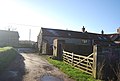
 Farm buildings - geograph.org.uk - 3834213.jpg 640 × 430; 84 KB
-
 Farmland near Fox Hill - geograph.org.uk - 3839664.jpg 640 × 430; 51 KB
-
 Farmland near Northrepps - geograph.org.uk - 3839597.jpg 640 × 430; 67 KB
-
 Farmland near Northrepps - geograph.org.uk - 3844337.jpg 640 × 430; 89 KB
-
 Farmland near Sidestrand - geograph.org.uk - 3834221.jpg 640 × 430; 76 KB
-
 Farmland near the Shrieking Pit - geograph.org.uk - 3839601.jpg 640 × 430; 92 KB
-
 Farmland near the Shrieking Pit - geograph.org.uk - 3839605.jpg 640 × 430; 98 KB
-
 Farmland south of Northrepps - geograph.org.uk - 3839772.jpg 640 × 318; 38 KB
-
 Farmland, Frogshall - geograph.org.uk - 3844345.jpg 640 × 430; 70 KB
-
 Farmland, Frogshall - geograph.org.uk - 3844347.jpg 640 × 430; 63 KB
-
 Farmland, Hungry Hill - geograph.org.uk - 3834247.jpg 640 × 408; 56 KB
-
 Farmland, Hungry Hill - geograph.org.uk - 3834321.jpg 640 × 420; 70 KB
-
 Field by Carr Lane - geograph.org.uk - 5126473.jpg 1,600 × 1,200; 800 KB
-
 Field by Paston Way - geograph.org.uk - 4924380.jpg 1,600 × 1,200; 871 KB
-
 Fields by Hungry Hill - geograph.org.uk - 5127229.jpg 1,600 × 1,200; 730 KB
-
 Fields by Northrepps - geograph.org.uk - 6438152.jpg 1,600 × 1,200; 402 KB
-
 Fields towards church - geograph.org.uk - 5095550.jpg 1,000 × 396; 361 KB
-
 Flat farmland - geograph.org.uk - 3839607.jpg 640 × 430; 94 KB
-
 Flint building near The Rectory - geograph.org.uk - 3844335.jpg 640 × 430; 57 KB
-
 Footpath through Heath Plantation - geograph.org.uk - 5964690.jpg 1,600 × 1,200; 757 KB
-
 Footpath to Crossdale Street - geograph.org.uk - 5964698.jpg 1,600 × 1,200; 435 KB
-
 Footpath to Northrepps - geograph.org.uk - 5964710.jpg 1,600 × 1,200; 594 KB
-
 Footpaths near Northrepps - geograph.org.uk - 5964748.jpg 1,600 × 1,200; 550 KB
-
 Former 'Northrepps International Airport' - geograph.org.uk - 5964706.jpg 1,600 × 1,200; 447 KB
-
 Fox Hill - geograph.org.uk - 3839650.jpg 640 × 430; 124 KB
-
 Fox Hill - geograph.org.uk - 3839665.jpg 640 × 430; 139 KB
-
 Fox Hill - geograph.org.uk - 3839669.jpg 640 × 430; 97 KB
-
 Fox Hill - geograph.org.uk - 3839672.jpg 640 × 430; 127 KB
-
 Fox Hill - geograph.org.uk - 3839719.jpg 640 × 430; 114 KB
-
 Frogshall Farm - geograph.org.uk - 3844363.jpg 640 × 430; 81 KB
-
 Frogshall Plantation - geograph.org.uk - 3844341.jpg 640 × 430; 155 KB
-
 Frogshall Plantation - geograph.org.uk - 3844342.jpg 640 × 430; 127 KB
-
 Frogshall Plantation - geograph.org.uk - 3844346.jpg 640 × 430; 79 KB
-
 Furyhill Plantation - geograph.org.uk - 3839682.jpg 640 × 430; 162 KB
-
 Furyhill Plantation - geograph.org.uk - 3839718.jpg 640 × 430; 144 KB
-
 Gallus Fields - geograph.org.uk - 5127221.jpg 1,600 × 1,200; 601 KB
-
 Gallus Fields, Northrepps - geograph.org.uk - 5127217.jpg 1,600 × 1,200; 477 KB
-
 Garden wall by Paston Way - geograph.org.uk - 3839774.jpg 640 × 430; 61 KB
-
 George V postbox on Cromer Road. Overstrand - geograph.org.uk - 4953957.jpg 2,518 × 3,366; 2.05 MB
-
 Glasshouses, Hungry Hill - geograph.org.uk - 3834275.jpg 640 × 430; 68 KB
-
 Glasshouses, Hungry Hill - geograph.org.uk - 3834318.jpg 640 × 430; 62 KB
-
 Glover's Plantation - geograph.org.uk - 3844360.jpg 640 × 430; 85 KB
-
 Glover's Plantation - geograph.org.uk - 3844364.jpg 640 × 430; 169 KB
-
 Glover's Plantation - geograph.org.uk - 3844374.jpg 640 × 430; 170 KB
-
 Grassland near Northrepps - geograph.org.uk - 3844339.jpg 640 × 430; 65 KB
-
 Grassland, Frogshall Farm - geograph.org.uk - 3844359.jpg 640 × 430; 71 KB
-
 Grassy field by the Paston Way - geograph.org.uk - 3844375.jpg 640 × 430; 67 KB
-
 Hedge by the Paston Way - geograph.org.uk - 3839667.jpg 640 × 430; 99 KB
-
 Hedgerow by the Paston Way - geograph.org.uk - 3844349.jpg 640 × 430; 94 KB
-
 Highland Cattle - geograph.org.uk - 3834332.jpg 640 × 430; 69 KB
-
 House, Hungry Hill - geograph.org.uk - 3834329.jpg 640 × 430; 51 KB
-
 Houses on Craft Lane - geograph.org.uk - 5964723.jpg 1,600 × 1,200; 413 KB
-
 Houses on Norwich Road, Cromer - geograph.org.uk - 5417340.jpg 2,002 × 1,474; 1.35 MB
-
 Hungry Hill - geograph.org.uk - 3834270.jpg 640 × 430; 55 KB
-
 Hungry Hill - geograph.org.uk - 3834312.jpg 640 × 403; 48 KB
-
 Large crop field near Northrepps - geograph.org.uk - 4967990.jpg 640 × 442; 40 KB
-

-

-
 Maize strip by New Road - geograph.org.uk - 5127209.jpg 1,600 × 1,200; 765 KB
-
 Mast near Overstrand - geograph.org.uk - 6787624.jpg 1,024 × 685; 54 KB
-
 Memorial to the crew of 44 Sqn Hampden X3023 - geograph.org.uk - 6377846.jpg 4,608 × 3,072; 5.63 MB
-
 Memorial to three of the crew of 44 Sqn Hampden X3023 - geograph.org.uk - 6377845.jpg 4,608 × 3,072; 6.24 MB
-
 Muddy Paston Way - geograph.org.uk - 3839606.jpg 640 × 430; 103 KB
-
 Near Frogshall Farm - geograph.org.uk - 3844351.jpg 640 × 430; 66 KB
-
 New houses at Northrepps - geograph.org.uk - 6438164.jpg 1,600 × 1,200; 323 KB
-
 New houses at Northrepps - geograph.org.uk - 6438165.jpg 1,600 × 1,200; 309 KB
-
 North of Fox Hill - geograph.org.uk - 3839662.jpg 640 × 430; 42 KB
-
 North Repps village sign - geograph.org.uk - 6674136.jpg 1,747 × 1,747; 529 KB
-
 North Walsham Road near Winspurs Farm - geograph.org.uk - 6147993.jpg 3,456 × 2,592; 3.86 MB
-
 Northrepps Village Hall - geograph.org.uk - 5127210.jpg 1,600 × 1,200; 655 KB
-
 Northrepps village sign - geograph.org.uk - 4602746.jpg 640 × 480; 132 KB
-
 Northrepps village sign - geograph.org.uk - 4602752.jpg 640 × 480; 298 KB
-
 Northrepps Village Sign - geograph.org.uk - 5583049.jpg 640 × 480; 95 KB
-
 Northrepps War Memorial - geograph.org.uk - 4604730.jpg 3,456 × 2,592; 3.99 MB
-
 Norwich Road at the junction of North Walsham Road - geograph.org.uk - 5411662.jpg 2,048 × 1,536; 1.07 MB
-
 Norwich Road, Crossdale Street - geograph.org.uk - 5412657.jpg 2,048 × 1,536; 1.47 MB
-
 Norwich Road, Northrepps - geograph.org.uk - 5411667.jpg 2,048 × 1,536; 1.56 MB
-
 Norwich Road, Roughton - geograph.org.uk - 5411680.jpg 2,048 × 1,536; 1.52 MB
-
 Old trees by Sand Lane - geograph.org.uk - 5964731.jpg 1,600 × 1,200; 643 KB
-

-
 Ordnance Survey Flush Bracket S9593 - geograph.org.uk - 4292343.jpg 4,000 × 3,000; 4.62 MB
-
 Outbuildings, Frogshall Farm - geograph.org.uk - 3844354.jpg 640 × 430; 89 KB
-
 Overstrand radar station - geograph.org.uk - 4602811.jpg 640 × 471; 90 KB
-
 Overstrand radar tower - geograph.org.uk - 6488301.jpg 768 × 1,024; 102 KB
-
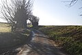
 Paston Way - geograph.org.uk - 3834244.jpg 640 × 430; 87 KB
-
 Paston Way - geograph.org.uk - 3834326.jpg 640 × 430; 106 KB
-
 Paston Way - geograph.org.uk - 3839611.jpg 640 × 430; 110 KB
-
 Paston Way - geograph.org.uk - 3839644.jpg 640 × 430; 89 KB
-
 Paston Way - geograph.org.uk - 3839671.jpg 640 × 430; 94 KB
-
 Paston Way - geograph.org.uk - 3839674.jpg 640 × 430; 135 KB
-
 Paston Way - geograph.org.uk - 3839678.jpg 640 × 430; 145 KB
-
 Paston Way - geograph.org.uk - 3844340.jpg 640 × 430; 122 KB
-
 Paston Way - geograph.org.uk - 3844350.jpg 640 × 430; 102 KB
-
 Paston Way - geograph.org.uk - 3844366.jpg 640 × 430; 118 KB
-
 Paston Way - geograph.org.uk - 4989532.jpg 1,600 × 1,200; 706 KB
-
 Paston Way across arable land - geograph.org.uk - 3834217.jpg 640 × 430; 61 KB
-
 Paston Way by Glover's Plantation - geograph.org.uk - 3844362.jpg 640 × 430; 101 KB
-
 Paston Way by Glover's Plantation - geograph.org.uk - 3844370.jpg 640 × 430; 122 KB
-
 Paston Way by the Shrieking Pit - geograph.org.uk - 3839600.jpg 640 × 430; 111 KB
-
 Paston Way to Overstrand - geograph.org.uk - 4924376.jpg 1,600 × 1,200; 1.41 MB
-
 Paston Way, Fox Hill - geograph.org.uk - 3839668.jpg 640 × 430; 111 KB
-
 Paston Way, Frogshall Plantation - geograph.org.uk - 3844344.jpg 640 × 430; 123 KB
-
 Paston Way, Furyhill Plantation - geograph.org.uk - 3839681.jpg 640 × 430; 117 KB
-
 Paston Way, Hungry Hill - geograph.org.uk - 3834259.jpg 640 × 400; 78 KB
-
 Paston Way, The Rectory - geograph.org.uk - 3839768.jpg 640 × 430; 70 KB
-
 Path to Northrepps - geograph.org.uk - 6438157.jpg 1,600 × 1,200; 519 KB
-
 Playing fields, Northrepps - geograph.org.uk - 5127213.jpg 1,600 × 1,200; 650 KB
-
 Ploughed field - geograph.org.uk - 3834324.jpg 640 × 430; 81 KB
-
 Ploughed field - geograph.org.uk - 3839646.jpg 640 × 430; 62 KB
-
 Poultry Houses - geograph.org.uk - 3834225.jpg 640 × 430; 79 KB
-
 Poultry Houses - geograph.org.uk - 3834262.jpg 640 × 387; 65 KB
-
 Poultry houses by Hungry Hill - geograph.org.uk - 5127225.jpg 1,600 × 1,200; 588 KB
-
 Public footpath opposite Winspurs Farm - geograph.org.uk - 6147998.jpg 3,456 × 2,592; 3.97 MB
-
 Radar Station - geograph.org.uk - 3834143.jpg 640 × 430; 109 KB
-
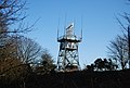 Radar Station - geograph.org.uk - 3834201.jpg 640 × 430; 79 KB
-
 Rectory Rd - geograph.org.uk - 3839738.jpg 640 × 430; 126 KB
-
 Rectory Rd - geograph.org.uk - 3839739.jpg 640 × 430; 120 KB
-
 Rectory Rd - geograph.org.uk - 3839742.jpg 640 × 430; 78 KB
-
 Road Junction (A140 and A149) at Manor Farm - geograph.org.uk - 4253684.jpg 4,000 × 3,000; 3.52 MB
-
 Road sign on Craft Lane - geograph.org.uk - 3839735.jpg 640 × 522; 164 KB
-
 Sand Lane - geograph.org.uk - 5964754.jpg 1,600 × 1,200; 625 KB
-
 Shrieking Pit - geograph.org.uk - 3834344.jpg 640 × 430; 124 KB
-
 Shrieking Pit - geograph.org.uk - 3839599.jpg 640 × 430; 124 KB
-
 Sign on NATS compound - geograph.org.uk - 6301096.jpg 1,024 × 768; 155 KB
-
 Solar farm near Crossdale Street - geograph.org.uk - 5964675.jpg 1,600 × 1,170; 329 KB
-
 Solar farm near Crossdale Street - geograph.org.uk - 5964694.jpg 1,600 × 1,166; 305 KB
-
 Southrepps in the distance - geograph.org.uk - 3844373.jpg 640 × 361; 51 KB
-

-
 Sugar beet as far as the eye can see - geograph.org.uk - 4602743.jpg 640 × 480; 179 KB
-
 Sugar Beet, Hungry Hill - geograph.org.uk - 3834317.jpg 640 × 430; 93 KB
-
 The entrance to North Norfolk Business Centre - geograph.org.uk - 5412651.jpg 1,992 × 1,458; 909 KB
-
 The Legend of The Shrieking Pit - geograph.org.uk - 3839602.jpg 430 × 640; 58 KB
-
 The Paston Way - geograph.org.uk - 3844336.jpg 640 × 430; 78 KB
-
 The Rectory - geograph.org.uk - 3839769.jpg 640 × 430; 61 KB
-
 The Shrieking Pit - geograph.org.uk - 3839604.jpg 640 × 430; 132 KB
-

-
 View towards Southrepps - geograph.org.uk - 3844368.jpg 640 × 356; 35 KB
-
 Watering the hedge - geograph.org.uk - 5127206.jpg 1,600 × 1,200; 930 KB
-
 Winter wheat, Hungry Hill - geograph.org.uk - 3839647.jpg 640 × 430; 74 KB
-
 Woodland by Paston Way - geograph.org.uk - 3839676.jpg 640 × 430; 109 KB
-
 Woodland in winter - geograph.org.uk - 3834197.jpg 640 × 430; 156 KB
-
 Woodland south of Overstrand - geograph.org.uk - 3834152.jpg 640 × 430; 99 KB


_at_Manor_Farm_-_geograph.org.uk_-_4253684.jpg)


