Category:Northern Sea Route
Appearance
shipping lane from the Kara Sea to the Pacific Ocean | |||||
| Upload media | |||||
| Instance of | |||||
|---|---|---|---|---|---|
| Part of |
| ||||
| Named after | |||||
| Located in or next to body of water | |||||
 | |||||
sometimes also called "Northeast Passage"
see also: Category:Northwest Passage
Subcategories
This category has only the following subcategory.
Media in category "Northern Sea Route"
The following 41 files are in this category, out of 41 total.
-
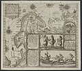
1598 map of the Polar Regions by Willem Barentsz.jpg 13,719 × 10,160; 30.66 MB
-
2000. Марка России 0557 hi.jpg 560 × 258; 40 KB
-
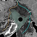
2007 Envisat mosaic of Arctic Ocean ESA210015.jpg 2,700 × 2,700; 1.69 MB
-
Arctic Routes (RUS).svg 1,010 × 1,267; 1.46 MB
-
Barents third voyage.jpg 2,000 × 1,511; 965 KB
-
Barentskartet, 1598 (12068020364).jpg 2,842 × 2,091; 3.85 MB
-
Barentsz Full Map.jpg 1,000 × 742; 258 KB
-
Flyet "Kristine" blir montert, mai 1923 (12114604474).jpg 4,600 × 3,571; 9.81 MB
-
Forminsket utgave av Barentskartet - no-nb krt 00487.jpg 4,418 × 3,449; 3.45 MB
-
Harald Ulrik Sverdrup måler solstrålenes intensitet, 1919 (12114497643).jpg 6,200 × 2,604; 11.47 MB
-
India Orientalis - no-nb digibok 2013101026001-314.jpg 4,662 × 2,949; 2.38 MB
-
Inuitene morer seg med såkalt skinndans, 1922-1923 (12114498483).jpg 5,000 × 3,271; 10.36 MB
-
Julaften feires i "Maud"s salong, 24. desember 1918 (12114496973).jpg 5,800 × 2,758; 8.32 MB
-
Karte Nordwestpassage und Nordostpassage.png 1,152 × 1,152; 469 KB
-
Linschoten Map of Scandinavia.jpg 1,536 × 1,316; 540 KB
-
Linschotens nordenkart, 1601 (12067624705) (2).jpg 4,400 × 3,609; 22.96 MB
-
Linschotens nordenkart, 1601 (12067624705).jpg 4,037 × 3,455; 22.29 MB
-
Nordenskiöld-Lettres-1880-carte du Passage Nord-Est.jpg 4,816 × 3,792; 6.64 MB
-
Nordlys over "Maud", 1918-1925 (12114500453).jpg 4,100 × 3,982; 6.08 MB
-
Nordostpassage NASA Worldwind-globe.png 900 × 900; 1.04 MB
-
Northern Sea Route vs Southern Sea Route.svg 550 × 550; 227 KB
-
Northernsearoute.PNG 534 × 364; 128 KB
-
Nuclearicebreakeryamal.jpg 1,280 × 960; 631 KB
-
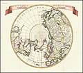
Nuova Carta Del Polo Artico secondo l'ultime osservazioni.jpg 8,640 × 7,533; 11.07 MB
-
Open Northern Sea Route.jpg 2,500 × 2,500; 3.68 MB
-
Pontanus 1611 Arctic Map.jpg 2,852 × 2,142; 802 KB
-
Sevmorput'.jpg 741 × 740; 195 KB
-
SG's Arctic Voyage.jpg 640 × 478; 211 KB
-
Shipping in the Russian Arctic Ocean.jpg 3,508 × 2,540; 2 MB
-
Tankers paths cross on Arctic Northern Sea Route without icebreaker escort in January.png 3,535 × 2,567; 27.67 MB
-
To uidentifiserte personer partererer en hvalross, 1918-1925 (12114861176).jpg 4,600 × 3,536; 10.74 MB
-
Панорама арктики.JPG 5,184 × 3,456; 5.85 MB
-
С вертолета-2.JPG 2,048 × 1,536; 276 KB


