Category:Northend, Buckinghamshire
Jump to navigation
Jump to search
village in Buckinghamshire/Oxfordshire, England, UK | |||||
| Upload media | |||||
| Instance of | |||||
|---|---|---|---|---|---|
| Location |
| ||||
 | |||||
English: Northend is a village that straddles the border of the two English counties of Buckinghamshire and Oxfordshire. The eastern half is in the civil parish of Turville in Buckinghamshire, while the western half is across the border into Oxfordshire, in the Watlington parish.
Media in category "Northend, Buckinghamshire"
The following 19 files are in this category, out of 19 total.
-
 Below Northend - geograph.org.uk - 114700.jpg 640 × 480; 83 KB
-
 Bridleway, Northend - geograph.org.uk - 686497.jpg 640 × 480; 170 KB
-
 Chiltern Way - geograph.org.uk - 1271368.jpg 640 × 480; 134 KB
-
 Entering Northend - geograph.org.uk - 1637695.jpg 640 × 480; 98 KB
-
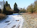
 Frozen pond, Northend - geograph.org.uk - 115053.jpg 640 × 480; 95 KB
-
 Holloway Lane, Northend - geograph.org.uk - 686500.jpg 640 × 480; 183 KB
-
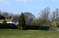
 Houses, Northend - geograph.org.uk - 686511.jpg 640 × 480; 189 KB
-
 In Hungryhill Woods - geograph.org.uk - 1435222.jpg 640 × 426; 204 KB
-
 Longhill Hanging Wood - geograph.org.uk - 797895.jpg 480 × 640; 209 KB
-
 No public access - geograph.org.uk - 1435218.jpg 640 × 426; 222 KB
-
 Northend Common - geograph.org.uk - 114689.jpg 640 × 480; 84 KB
-
 Northend Common, east end - geograph.org.uk - 667696.jpg 640 × 424; 79 KB
-
 Northend Village Hall - geograph.org.uk - 115078.jpg 640 × 480; 78 KB
-
 Pasture, Northend - geograph.org.uk - 641147.jpg 640 × 480; 149 KB
-
 Seedlings near Hollandridge Farm - geograph.org.uk - 819097.jpg 640 × 481; 237 KB
-
 South of Wormsley Park - geograph.org.uk - 1435214.jpg 640 × 426; 186 KB
-
 The valley below Northend - geograph.org.uk - 115055.jpg 640 × 480; 84 KB
-
 The White House, Northend - geograph.org.uk - 686505.jpg 640 × 480; 209 KB
-
 Woods and pasture, Northend - geograph.org.uk - 295254.jpg 640 × 480; 117 KB


