Category:North Shore Mountains
Jump to navigation
Jump to search
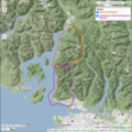
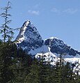
English: The North Shore Mountains — a mountain range overlooking Vancouver in British Columbia, Canada. They are part of the Pacific Ranges System, of the Pacific Coast Ranges and North American Cordillera.
mountain sub-range of the Coast Mountains of the Pacific Coast Ranges of North America | |||||
| Upload media | |||||
| Instance of | |||||
|---|---|---|---|---|---|
| Location |
| ||||
| Mountain range | |||||
| Area |
| ||||
| Elevation above sea level |
| ||||
 | |||||
Subcategories
This category has the following 9 subcategories, out of 9 total.
B
- Mount Burwell (3 F)
C
- Coliseum Mountain (2 F)
- Cypress Mountain Ski Area (26 F)
G
- Goat Mountain (44 F)
T
- The Lions (peaks) (36 F)
Media in category "North Shore Mountains"
The following 75 files are in this category, out of 75 total.
-
2015 Brunswick Mountain.jpg 8,230 × 3,225; 14.46 MB
-
A blue scene (3814358439).jpg 2,592 × 1,722; 516 KB
-
Aerial view of Vancouver and the Coast Mountains.JPG 5,184 × 3,456; 8.48 MB
-
Ben Lomond Mountain, British Columbia.jpg 2,447 × 2,521; 1.23 MB
-
Britannia Range Boundaries.png 879 × 878; 1.11 MB
-
Buntzen Lake Port Moody.jpg 5,579 × 3,719; 2.08 MB
-
Cleveland Dam mountain view (Unsplash).jpg 3,264 × 2,448; 4.48 MB
-
Coal Harbour, 1974 01.jpg 3,348 × 2,227; 1.49 MB
-
English Bay from Point Grey 01.jpg 4,608 × 3,072; 14.91 MB
-
English Bay from Point Grey 02.jpg 4,608 × 3,072; 14.84 MB
-
English Bay from Point Grey 03.jpg 4,608 × 3,072; 14.24 MB
-
English Bay from Point Grey 04.jpg 4,608 × 3,072; 13.77 MB
-
Fannin Range.png 878 × 879; 1.17 MB
-
Forest fire water supply tank near Whyte Lake.jpg 4,032 × 3,024; 3.57 MB
-
Grouse Mountain View.jpg 4,608 × 3,456; 6.49 MB
-
Hanover from Brunswick.jpg 2,914 × 1,763; 1.21 MB
-
Harbour Air seaplane over Horseshoe Bay.jpg 3,895 × 2,921; 3.18 MB
-
Hat Mountain BC.jpg 2,803 × 2,010; 1.9 MB
-
HFRS2.JPG 2,048 × 1,536; 359 KB
-
Hfrstechlanding.jpg 3,072 × 2,304; 3.34 MB
-
Horseshoe Bay, 23 mars 2009, 1.jpg 768 × 1,024; 372 KB
-
Horseshoe Bay, 23 mars 2009, 2.jpg 768 × 1,024; 366 KB
-
Lynn creek.jpg 700 × 525; 100 KB
-
Mount Habrich.jpg 1,506 × 1,573; 529 KB
-
Mount Sheer.jpg 2,759 × 1,921; 1.35 MB
-
Mountseymour.jpg 500 × 375; 137 KB
-
Mt Fromme from Sunrise Park.jpg 3,256 × 1,408; 612 KB
-
Mt Seymour 1.jpg 3,888 × 2,592; 3.46 MB
-
Mt Seymour 3.jpg 3,888 × 2,592; 4.23 MB
-
Mt Seymour 4.jpg 3,888 × 2,592; 3.14 MB
-
Mt Seymour 5.jpg 3,888 × 2,592; 3.17 MB
-
Mt Seymour 6.jpg 3,888 × 2,592; 3.29 MB
-
Mt Seymour 7.jpg 3,888 × 2,592; 3.08 MB
-
Mt Seymour.jpg 3,888 × 2,592; 3.36 MB
-
Mt Seymour2.jpg 3,888 × 2,592; 3.94 MB
-
Mt. Hanover and Brunswick Mountain.jpg 998 × 726; 251 KB
-
Mt. Hanover.jpg 2,854 × 1,979; 1.43 MB
-
Mt. Sheer.jpg 2,134 × 1,217; 648 KB
-
MysteryChair.png 1,741 × 1,160; 5.79 MB
-
North Shore Mountains 01.JPG 6,000 × 4,000; 19.27 MB
-
North Shore Mountains from Canadian Trail.jpg 6,000 × 4,000; 12.78 MB
-
North Shore Mountains from Howe Sound.jpg 2,592 × 1,944; 592 KB
-
North Shore Mountains from the Science World 1.jpg 5,712 × 3,880; 12.41 MB
-
North Shore Mountains from the Science World 2.jpg 4,000 × 6,000; 12.38 MB
-
North Shore over exposed Spanish Banks.JPG 3,008 × 2,000; 1.46 MB
-
North Vancouver from canada place.JPG 1,728 × 2,304; 1.58 MB
-
North-Shore-Mountains.jpg 5,848 × 3,796; 13.62 MB
-
Relief map of North Shore Mountains location.png 578 × 600; 643 KB
-
Runner Peak and Mount Elsay.jpg 6,000 × 4,000; 19.17 MB
-
Sky Pilot and Habrich.jpg 2,517 × 1,557; 1.2 MB
-
Snowy Westshore Mountains - panoramio.jpg 4,000 × 3,000; 4.89 MB
-
Spanish Banks Sports.jpg 3,116 × 1,700; 7.71 MB
-
Tandemarplanding.jpg 375 × 500; 74 KB
-
The Lions.jpg 3,766 × 2,160; 5.41 MB
-
Trolleybuses at Broadway & Commercial Drive (4215414982).jpg 2,592 × 1,944; 5.09 MB
-
Tugboat in front of North Vancouver.jpg 2,572 × 1,906; 3.61 MB
-
Vancouver from Eagle Bluffs.jpg 17,919 × 3,342; 9.48 MB
-
Vancouver in snow - panoramio - Colin W.jpg 2,560 × 1,712; 1.71 MB
-
Vancouver Northshore Mountains (53457560077).jpg 6,227 × 6,281; 34.43 MB
-
Vancouver Northshore Mountains (53458486871).jpg 9,504 × 5,878; 44.82 MB
-
Vancouver Northshore Mountains (53458611658).jpg 6,336 × 5,247; 22.43 MB
-
Vancouver Northshore Mountains (53458611863).jpg 6,336 × 8,394; 32.12 MB
-
Vancouver Northshore Mountains (53458611868).jpg 9,504 × 6,336; 37.34 MB
-
Vancouver Northshore Mountains (53458794719).jpg 8,665 × 3,925; 22.88 MB
-
Vancouver Northshore Mountains (53458896835).jpg 7,956 × 4,032; 26.01 MB
-
Vancouver Northshore Mountains (53458897305).jpg 9,321 × 5,001; 35.45 MB
-
Vancouver Skyline and Mountains.jpg 4,416 × 2,480; 2.12 MB
-
Vancouver west end.jpg 3,381 × 2,021; 4.72 MB
-
Vancouver, North Vancouver, North Shore Mountains.jpg 10,005 × 3,500; 15.22 MB
-
View from lower Eagle Bluffs.jpg 10,943 × 3,535; 15.1 MB
-
View from the Eye of the Wind.jpg 4,872 × 2,127; 2.64 MB
-
Winter Olympics in Vancouver.jpg 2,500 × 3,000; 1.99 MB
-
Wooded mountain near North Vancouver (Unsplash).jpg 3,630 × 2,907; 1.59 MB
-
Woodf1a.jpg 1,200 × 1,504; 501 KB
-
Yaletown across the False Creek.jpg 6,000 × 4,000; 11.85 MB


