Category:North Platte River in Wyoming
Jump to navigation
Jump to search
Subcategories
This category has the following 10 subcategories, out of 10 total.
Media in category "North Platte River in Wyoming"
The following 27 files are in this category, out of 27 total.
-
 Photograph of the Red Buttes - NARA - 516886.jpg 3,000 × 2,283; 1.44 MB
-

-
 Bluffs on the North Fork of the Platte. Wyoming - NARA - 516945.jpg 3,000 × 2,233; 1.3 MB
-

-
 I25 over North Platte River Douglas.jpg 3,264 × 2,448; 1.99 MB
-
 May 14, 2014 – Casper, WY (14364934287).jpg 2,469 × 1,829; 1.94 MB
-
 May 14, 2014 – Casper, WY (14547981571).jpg 1,426 × 960; 283 KB
-
 May 14, 2014 – Casper, WY (14550476702).jpg 2,532 × 1,918; 961 KB
-
 My Public Lands Roadtrip- North Platte River in Wyoming (19260604804).jpg 6,000 × 4,000; 2.66 MB
-
 My Public Lands Roadtrip- North Platte River in Wyoming (19260605974).jpg 6,000 × 4,000; 2.33 MB
-
 My Public Lands Roadtrip- North Platte River in Wyoming (19260607174).jpg 6,000 × 4,000; 2.43 MB
-
 My Public Lands Roadtrip- North Platte River in Wyoming (19695223438).jpg 6,000 × 4,000; 2.22 MB
-
 My Public Lands Roadtrip- North Platte River in Wyoming (19696606559).jpg 6,000 × 4,000; 2.25 MB
-
 My Public Lands Roadtrip- North Platte River in Wyoming (19888264941).jpg 6,000 × 4,000; 2.7 MB
-
 My Public Lands Roadtrip- Wyoming (19268032654).jpg 3,318 × 2,212; 4.24 MB
-
 North Platte River in Casper.jpg 2,063 × 1,377; 1.23 MB
-
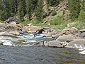 North Platte River Northgate Canyon Canoers.jpg 640 × 480; 83 KB
-
 North Platte River Register Cliff P7180361.jpg 3,072 × 2,304; 1.17 MB
-
 North Platte River, at Fort Steele. Carbon County, Wyoming - NARA - 516615.jpg 3,000 × 2,342; 1.01 MB
-
 NorthPlatteRiverMay2002.jpg 1,760 × 1,100; 215 KB
-
 NorthPlatteRiverNearSaratogaWY.jpg 1,024 × 680; 243 KB
-
 PSM V70 D376 Dam site in the pathfinder canyon on the north platte river.png 1,637 × 1,224; 519 KB
-
 PSM V70 D377 Interior of pathfinder diversion tunnel.png 1,623 × 1,239; 525 KB
-
 PSM V70 D378 Fifty foot cut on the interstate canal.png 1,641 × 1,215; 513 KB
-
 Trappers Route Special Recreation Management Area, North Platte River.jpg 3,000 × 2,000; 7.04 MB
-
 US GENERAL LAND OFFICE Geodetic control point Douglas WY.JPG 3,264 × 2,448; 1.97 MB
-


.jpg)
.jpg)
.jpg)
.jpg)
.jpg)
.jpg)
.jpg)
.jpg)
.jpg)
.jpg)


Categories:
- Rivers of Wyoming
- North Platte River
- Locations along Interstate 25 in Wyoming
- Locations along Interstate 80 in Wyoming
- Locations along U.S. Route 20 in Wyoming
- Locations along U.S. Route 26 in Wyoming
- Locations along U.S. Route 30 in Wyoming
- Locations along U.S. Route 85 in Wyoming
- Locations along U.S. Route 87 in Wyoming
- Locations along U.S. Route 287 in Wyoming
- Locations along U.S. Route 20 Business (Casper, Wyoming)
- Locations along Wyoming Highway 59
- Locations along Wyoming Highway 93
- Locations along Wyoming Highway 94
- Locations along Wyoming Highway 95
- Locations along Wyoming Highway 130
- Locations along Wyoming Highway 156
- Locations along Wyoming Highway 157
- Locations along Wyoming Highway 160
- Locations along Wyoming Highway 220
- Locations along Wyoming Highway 256
- Locations along Wyoming Highway 257
- Locations along Wyoming Highway 317
- Locations along Wyoming Highway 319