Category:North Lodge
Jump to navigation
Jump to search
civil parish in County Durham, England | |||||
| Upload media | |||||
| Instance of | |||||
|---|---|---|---|---|---|
| Location | County Durham, North East England, England | ||||
| Population |
| ||||
 | |||||
Subcategories
This category has only the following subcategory.
W
- The Wheatsheaf, North Lodge (3 F)
Media in category "North Lodge"
The following 41 files are in this category, out of 41 total.
-
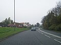
 A1(M) North of Chester-le-Street - geograph.org.uk - 6458421.jpg 800 × 533; 255 KB
-
 A1(M) northbound - geograph.org.uk - 6674706.jpg 640 × 439; 55 KB
-
 A1(M) northbound - geograph.org.uk - 6674709.jpg 640 × 417; 48 KB
-

-
 Ash Meadows, Picktree - geograph.org.uk - 2053858.jpg 640 × 480; 80 KB
-
 Blind Lane heading west - geograph.org.uk - 4742778.jpg 640 × 481; 50 KB
-

-
 Bridleway from Bonemill Lane adjacent to The General's Wood - geograph.org.uk - 6514682.jpg 3,024 × 4,032; 5.12 MB
-

-
 C2C at Birtley - geograph.org.uk - 129201.jpg 640 × 480; 106 KB
-

-

-
 Derelict land by Ouston junction - geograph.org.uk - 2424119.jpg 640 × 524; 50 KB
-
 Disused railway bridge over the A167 - geograph.org.uk - 3441013.jpg 640 × 480; 77 KB
-
 Durham Road, South Pelaw - geograph.org.uk - 3807540.jpg 640 × 480; 73 KB
-
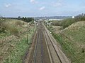 East Coast Main Line heading north - geograph.org.uk - 3441009.jpg 640 × 480; 85 KB
-
 Factory units on Drum Road Industrial Estate - geograph.org.uk - 5384210.jpg 1,500 × 1,125; 1.41 MB
-
 Former mineral railway - geograph.org.uk - 3780925.jpg 640 × 480; 352 KB
-
 Houses at Barley Mow - geograph.org.uk - 4922845.jpg 1,500 × 1,000; 1.82 MB
-
 Houses near Lambton Castle - geograph.org.uk - 4532320.jpg 640 × 480; 472 KB
-
 Houses on Lyndhurst Avenue - geograph.org.uk - 2879547.jpg 640 × 347; 44 KB
-
 Lane at Chartershaugh - geograph.org.uk - 4164815.jpg 4,608 × 3,456; 5.52 MB
-
 North Lodge , A1(M) - geograph.org.uk - 6640885.jpg 6,000 × 4,000; 7.79 MB
-
 North Lodge , A1(M) - geograph.org.uk - 6640886.jpg 5,711 × 3,807; 4.97 MB
-
 North Lodge , A1(M) - geograph.org.uk - 6640887.jpg 6,000 × 4,000; 7.33 MB
-

-
 Old mineral railway, Vigo - geograph.org.uk - 3780914.jpg 640 × 480; 303 KB
-
 Old railway bridge - geograph.org.uk - 3441008.jpg 640 × 480; 119 KB
-
 Ordnance Survey Flush Bracket 10924 - geograph.org.uk - 4588142.jpg 4,000 × 3,000; 3.61 MB
-
 Pelaw Grange Greyhound Stadium - geograph.org.uk - 2879544.jpg 640 × 480; 44 KB
-
 Pelaw Grange Greyhound Stadium - geograph.org.uk - 3568545.jpg 4,294 × 2,964; 1.92 MB
-
 Pond at Chartershaugh - geograph.org.uk - 4880604.jpg 4,608 × 3,456; 4.78 MB
-
 Pool at Chartershaugh in late summer - geograph.org.uk - 5877699.jpg 4,415 × 3,311; 2.48 MB
-
 Queensmere - geograph.org.uk - 4728324.jpg 640 × 480; 78 KB
-
 Small pond, Drum Industrial Estate - geograph.org.uk - 3441005.jpg 640 × 480; 97 KB
-

-
 The General's Wood - geograph.org.uk - 4532324.jpg 640 × 480; 362 KB
-
 The Lambton Worm - geograph.org.uk - 4728491.jpg 640 × 480; 95 KB
-
 The River Wear at Chartershaugh - geograph.org.uk - 3459430.jpg 4,608 × 3,456; 5.21 MB
-
 Unit on the Drum Industrial Estate - geograph.org.uk - 3441001.jpg 640 × 480; 53 KB
-
 View across the woods at Chartershaugh - geograph.org.uk - 4164787.jpg 4,608 × 3,456; 5.32 MB
_North_of_Chester-le-Street_-_geograph.org.uk_-_6458421.jpg)
_northbound_-_geograph.org.uk_-_6674706.jpg)
_northbound_-_geograph.org.uk_-_6674709.jpg)


_-_geograph.org.uk_-_6640885.jpg)
_-_geograph.org.uk_-_6640886.jpg)
_-_geograph.org.uk_-_6640887.jpg)
_towards_the_Vigo_Interchange_-_geograph.org.uk_-_6458429.jpg)


