Category:North Fambridge
Jump to navigation
Jump to search
English: North Fambridge is a village and civil parish on the Dengie peninsula in the English county of Essex.
village in the United Kingdom  | |||||
| Upload media | |||||
| Instance of | |||||
|---|---|---|---|---|---|
| Location | Maldon, Essex, East of England, England | ||||
 | |||||
Subcategories
This category has the following 5 subcategories, out of 5 total.
Media in category "North Fambridge"
The following 142 files are in this category, out of 142 total.
-
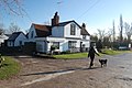
 'Beric' at North Fambridge - geograph.org.uk - 497865.jpg 427 × 640; 97 KB
-
-
 A little Calf.jpg 3,072 × 2,304; 2.01 MB
-
 Birds cross the winter sun - geograph.org.uk - 3310215.jpg 3,648 × 2,736; 2.19 MB
-
 Blue House Farm - geograph.org.uk - 5486239.jpg 640 × 428; 105 KB
-
 Blue House Farm Nature Reserve Information Board - geograph.org.uk - 2869689.jpg 3,648 × 2,736; 1.9 MB
-
 Bluehouse Farm Nature Reserve - geograph.org.uk - 5491414.jpg 640 × 480; 128 KB
-
 Boats on the Crouch - geograph.org.uk - 592224.jpg 640 × 436; 72 KB
-
 Boats on the Crouch near sundown, North Fambridge - geograph.org.uk - 5272465.jpg 2,909 × 1,798; 1.12 MB
-
 Borrow Dyke - geograph.org.uk - 2878232.jpg 3,648 × 2,255; 2.2 MB
-
 Borrow dyke, Blue House Farm Nature Reserve - geograph.org.uk - 3835516.jpg 3,648 × 2,736; 2 MB
-
 Busted Bus and United Free - geograph.org.uk - 157046.jpg 640 × 426; 108 KB
-
 Cattle, Bluehouse Farm - geograph.org.uk - 5491117.jpg 640 × 480; 126 KB
-
 Channel through the mud - geograph.org.uk - 2877970.jpg 3,648 × 2,255; 2.16 MB
-
 Channels in the marshes - geograph.org.uk - 2878245.jpg 3,648 × 2,736; 1.97 MB
-
 Children's playground - geograph.org.uk - 2869765.jpg 3,648 × 2,255; 2.43 MB
-
 Church Road, North Fambridge - geograph.org.uk - 2619021.jpg 4,000 × 3,000; 4.06 MB
-
 Cottages, Ferry Road - geograph.org.uk - 3978001.jpg 1,011 × 758; 177 KB
-
 Crashed car, Honeypot Lane - geograph.org.uk - 5486100.jpg 640 × 480; 170 KB
-
 Creek east of Brandy Hole Marshes - geograph.org.uk - 161897.jpg 640 × 480; 93 KB
-

-
 Crouch Mud - geograph.org.uk - 2877987.jpg 3,648 × 2,255; 2.15 MB
-
 Crouch Valley Line - geograph.org.uk - 130335.jpg 640 × 452; 94 KB
-
 Crouch Valley View - geograph.org.uk - 2869746.jpg 3,648 × 1,972; 1.48 MB
-
 Dike on Blue House Farm - geograph.org.uk - 3967583.jpg 640 × 424; 60 KB
-

-
 Essex, IBS Boatyard, North Fambridge - geograph.org.uk - 2333784.jpg 3,456 × 2,304; 4.98 MB
-
 Essex, Jeff's Cottages, North Fambridge - geograph.org.uk - 2333980.jpg 3,456 × 2,304; 4.37 MB
-
 Essex, North Fambridge Yacht Club - geograph.org.uk - 2333830.jpg 3,456 × 2,304; 4.86 MB
-
 Essex, Office, North Fambridge Yacht Station - geograph.org.uk - 2333841.jpg 3,456 × 2,304; 4.96 MB
-
 Essex, Sports car at North Fambridge - geograph.org.uk - 2333855.jpg 3,456 × 2,304; 5.59 MB
-
 Essex, The 'Ferry Boat Inn', North Fambridge - geograph.org.uk - 2333801.jpg 3,456 × 2,304; 5.08 MB
-
 Essex, The 'Ferry Prince' at North Fambridge - geograph.org.uk - 2333820.jpg 3,456 × 2,304; 4.97 MB
-
 Essex, Winch at North Fambridge - geograph.org.uk - 2333879.jpg 3,456 × 2,304; 1.33 MB
-
 Fambridge PTS 37 - geograph.org.uk - 129411.jpg 640 × 477; 94 KB
-
 Fambridge Pumping Station - geograph.org.uk - 129416.jpg 640 × 462; 67 KB
-
 Fambridge Station - geograph.org.uk - 6414337.jpg 1,024 × 1,024; 167 KB
-
 Fambridge Yacht Haven - geograph.org.uk - 827665.jpg 640 × 360; 68 KB
-
 Fambridge Yacht Haven yard - geograph.org.uk - 2878219.jpg 3,648 × 2,255; 2.17 MB
-
 Ferry Boat Inn, North Fambridge - geograph.org.uk - 3872460.jpg 640 × 428; 108 KB
-
 Ferry Road, North Fambridge - geograph.org.uk - 2619026.jpg 4,000 × 3,000; 3.95 MB
-
 Footpath and Field - geograph.org.uk - 160469.jpg 640 × 426; 132 KB
-
 Footpath to Blue House Farm - geograph.org.uk - 2878266.jpg 3,648 × 2,736; 2.64 MB
-
 Footpath to Norton Hall - geograph.org.uk - 128100.jpg 480 × 640; 66 KB
-

-
 Gates and fields by Fambridge Road - geograph.org.uk - 4143953.jpg 1,064 × 1,600; 470 KB
-
 Holy Trinity Churchyard - geograph.org.uk - 2878273.jpg 3,648 × 2,255; 3.6 MB
-
 Honeypot Lane - geograph.org.uk - 3216350.jpg 1,876 × 2,821; 1.66 MB
-

-
 Inn sign, Ferry Boat Inn - geograph.org.uk - 3872884.jpg 480 × 640; 110 KB
-
 January Ditch - geograph.org.uk - 3310204.jpg 3,648 × 2,736; 3.39 MB
-
 Junction of B1012 and Fambridge Road - geograph.org.uk - 3432389.jpg 1,024 × 768; 209 KB
-
 Junction of Ferry Road and Church Road - geograph.org.uk - 3250689.jpg 1,600 × 1,064; 490 KB
-
 Large gate on entrance to field on Honey Pot Lane - geograph.org.uk - 2701841.jpg 3,648 × 2,255; 2.45 MB
-
 Lone horse - geograph.org.uk - 2869752.jpg 3,648 × 2,255; 1.99 MB
-
 Looking across to South Fambridge - geograph.org.uk - 497868.jpg 640 × 427; 67 KB
-
 Looking north along Ferry Road - geograph.org.uk - 3978055.jpg 1,002 × 740; 179 KB
-
 Low Tide - geograph.org.uk - 2756871.jpg 2,804 × 1,864; 776 KB
-
 Lowland Sheep - geograph.org.uk - 2878270.jpg 3,396 × 2,099; 2.36 MB
-
 Luxe Motor at North Fambridge - geograph.org.uk - 876881.jpg 640 × 480; 72 KB
-
 Man made barrier - geograph.org.uk - 2878257.jpg 3,648 × 2,736; 3.45 MB
-
 Marina at North Fambridge - geograph.org.uk - 2120438.jpg 1,024 × 683; 146 KB
-
 Marsh near Stow Creek.jpg 2,592 × 1,944; 1.9 MB
-
 Marshes near Blue House Farm - geograph.org.uk - 3250708.jpg 1,600 × 1,064; 387 KB
-
 North Fambridge - geograph.org.uk - 497827.jpg 640 × 427; 79 KB
-

-
 North Fambridge Hall - geograph.org.uk - 2877979.jpg 3,521 × 2,176; 1.84 MB
-
 North Fambridge Quay Slipway - geograph.org.uk - 2878263.jpg 2,681 × 1,657; 1.17 MB
-
 North Fambridge Station - geograph.org.uk - 4407100.jpg 800 × 537; 58 KB
-
 North Fambridge station, 2015 - geograph.org.uk - 5612165.jpg 2,401 × 1,604; 2.98 MB
-
 North Fambridge Village Sign (Detail) - geograph.org.uk - 2869993.jpg 1,813 × 1,813; 1.09 MB
-
 North Fambridge Village Sign - geograph.org.uk - 2869990.jpg 2,201 × 2,201; 1.2 MB
-
 Old School House ^ Village Hall - geograph.org.uk - 2877974.jpg 3,648 × 2,255; 2.54 MB
-
 Owl Cam - geograph.org.uk - 3967580.jpg 640 × 424; 58 KB
-
 Part of Bluehouse Farm Nature Reserve - geograph.org.uk - 5491334.jpg 640 × 480; 130 KB
-
 Part of Bluehouse Farm Nature Reserve - geograph.org.uk - 5491419.jpg 640 × 480; 132 KB
-
 Pontoon on Crouch - geograph.org.uk - 2775019.jpg 1,600 × 1,200; 413 KB
-
 Pontoon on Crouch - geograph.org.uk - 2775022.jpg 1,600 × 1,078; 278 KB
-
 Port Moor Cottage - geograph.org.uk - 2765441.jpg 1,600 × 1,200; 435 KB
-
 Port Moor cottage - geograph.org.uk - 827667.jpg 640 × 360; 32 KB
-
 Port Moor cottage - geograph.org.uk - 827668.jpg 640 × 360; 59 KB
-
 Port Moor Cottage - geograph.org.uk - 827681.jpg 640 × 360; 18 KB
-
 Red glasswort fringing borrow dyke - geograph.org.uk - 5488642.jpg 640 × 480; 134 KB
-
 Refuelling the boat YE 140 - geograph.org.uk - 3977945.jpg 1,044 × 783; 183 KB
-

-

-
 River Crouch - geograph.org.uk - 2765437.jpg 1,600 × 1,200; 196 KB
-
 River Crouch - geograph.org.uk - 3253732.jpg 640 × 430; 55 KB
-
 River Crouch East of Fambridge - geograph.org.uk - 154498.jpg 640 × 426; 58 KB
-
 River View - geograph.org.uk - 2763000.jpg 1,600 × 1,200; 170 KB
-
 Roost on Blue House Farm - geograph.org.uk - 3967577.jpg 640 × 424; 66 KB
-
 Russell Road - geograph.org.uk - 2869537.jpg 3,648 × 2,736; 3.02 MB
-
 Salt Marsh ^ Mudflats - geograph.org.uk - 2878253.jpg 3,648 × 2,736; 3.49 MB
-

-

-
 Sheep, Bluehouse Farm Nature Reserve - geograph.org.uk - 5491425.jpg 640 × 480; 118 KB
-
 Shepherding on Blue House Farm - geograph.org.uk - 3967595.jpg 640 × 424; 36 KB
-
 Ship PZ 81 at North Fambridge Quay - geograph.org.uk - 2619028.jpg 4,000 × 3,000; 4.18 MB
-

-
 Smugglers Cottage - geograph.org.uk - 2869804.jpg 3,648 × 2,255; 2.05 MB
-
 Spring Lambs - geograph.org.uk - 2869641.jpg 3,648 × 2,255; 2.45 MB
-
 Stow Creek - geograph.org.uk - 2877972.jpg 3,648 × 2,255; 1.95 MB
-
 Stow Creek - geograph.org.uk - 4143955.jpg 1,600 × 1,064; 407 KB
-
 The entrance to Lords Acre Garden Centre - geograph.org.uk - 6340140.jpg 1,920 × 1,280; 1.11 MB
-
 The entrance to Lords Acre Garden Centre - geograph.org.uk - 6340141.jpg 1,906 × 1,260; 1.41 MB
-
 The Ferry Boat Inn, Ferry Road - geograph.org.uk - 3978036.jpg 1,011 × 758; 177 KB
-
 The Ferry Boat Inn, North Fambridge - geograph.org.uk - 3250695.jpg 1,600 × 1,064; 494 KB
-
 Thunder Clouds at Fambridge Yacht Haven.jpg 4,818 × 3,212; 5.35 MB
-
 Train on Southminster branch (geograph 5491386).jpg 640 × 480; 114 KB
-
 View across the River - geograph.org.uk - 2764252.jpg 1,600 × 1,200; 347 KB
-
 View from North Fambridge - geograph.org.uk - 47629.jpg 640 × 427; 60 KB
-
 View from the Wall - geograph.org.uk - 2775018.jpg 1,600 × 1,200; 698 KB
-
 View over Longpole Reach - geograph.org.uk - 4143967.jpg 1,600 × 1,064; 355 KB
-
 View Towards Fambridge - geograph.org.uk - 129402.jpg 640 × 480; 49 KB
-
 Waterfront at North Fambridge - geograph.org.uk - 3977928.jpg 946 × 709; 108 KB
-
 A view of Ferry Road - geograph.org.uk - 717219.jpg 640 × 424; 48 KB
-

-
 Beckney Farm - geograph.org.uk - 161761.jpg 640 × 480; 91 KB
-
 Beckney Farm Pumping Station - geograph.org.uk - 129430.jpg 640 × 480; 67 KB
-
 Busted Barns - geograph.org.uk - 128028.jpg 640 × 480; 84 KB
-
 Canada Goose - geograph.org.uk - 157090.jpg 640 × 485; 89 KB
-
 Clements Dam West - geograph.org.uk - 128009.jpg 640 × 480; 63 KB
-
 End of the path to South Fambridge - geograph.org.uk - 150365.jpg 640 × 480; 63 KB
-
 Footbridge north of Pudsey Hall - geograph.org.uk - 160351.jpg 640 × 480; 114 KB
-
 Green Pond - geograph.org.uk - 219838.jpg 640 × 454; 109 KB
-
 Guest bedrooms at the 'Ferry Boat Inn' - geograph.org.uk - 498070.jpg 640 × 427; 114 KB
-

-
-
 Horselands - geograph.org.uk - 128044.jpg 640 × 480; 94 KB
-

-
 Lovedowns Sluice - geograph.org.uk - 161764.jpg 640 × 480; 82 KB
-
 Low tide - Eastern Creek - geograph.org.uk - 166110.jpg 640 × 480; 93 KB
-
 Old Rectory Cottage - geograph.org.uk - 128062.jpg 640 × 480; 110 KB
-
 Reeds in the Borrowdyke - geograph.org.uk - 154524.jpg 640 × 426; 71 KB
-
 Sea Wall, Brandy Hole Reach - geograph.org.uk - 293010.jpg 640 × 418; 79 KB
-
 The End of the Centenary - geograph.org.uk - 592304.jpg 640 × 427; 59 KB
-

-

-
 Vanishing Footpath - geograph.org.uk - 160463.jpg 426 × 640; 195 KB
-
 Waymark at footpath junction - geograph.org.uk - 160358.jpg 640 × 480; 70 KB
-
 Wellington Rd - geograph.org.uk - 157052.jpg 640 × 426; 184 KB
-
 Wild Farm - geograph.org.uk - 130326.jpg 640 × 480; 80 KB


_-_geograph.org.uk_-_2869993.jpg)


.jpg)


