Category:North Duffield
Jump to navigation
Jump to search
village in United Kingdom  | |||||
| Upload media | |||||
| Instance of | |||||
|---|---|---|---|---|---|
| Location | Selby, North Yorkshire, Yorkshire and the Humber, England | ||||
| Population |
| ||||
 | |||||
Subcategories
This category has the following 3 subcategories, out of 3 total.
Media in category "North Duffield"
The following 200 files are in this category, out of 222 total.
(previous page) (next page)-
 A Field of Beans - geograph.org.uk - 196557.jpg 640 × 480; 104 KB
-
 A flooded Derwent Valley - geograph.org.uk - 5272335.jpg 1,024 × 768; 127 KB
-
 A glimpse of the River Derwent - geograph.org.uk - 5253989.jpg 1,024 × 768; 386 KB
-
 A163 towards Bubwith - geograph.org.uk - 2359165.jpg 1,600 × 1,200; 371 KB
-
 A163 towards Bubwith - geograph.org.uk - 2359188.jpg 1,600 × 1,200; 465 KB
-

-
 Across the Derwent - geograph.org.uk - 3566733.jpg 640 × 427; 90 KB
-
 Along Cornelius Causeway - geograph.org.uk - 5952990.jpg 1,024 × 683; 489 KB
-
 Approaching Derwent Bridge - geograph.org.uk - 2466655.jpg 800 × 600; 202 KB
-
 Ash Close, North Duffield - geograph.org.uk - 3227593.jpg 4,428 × 2,952; 2.79 MB
-
 Aysgarth House Farm - geograph.org.uk - 5491420.jpg 1,600 × 1,065; 500 KB
-
 Back Lane, North Duffield - geograph.org.uk - 5490220.jpg 1,600 × 1,065; 610 KB
-
 Blackwood Lane (track) - geograph.org.uk - 3902222.jpg 4,000 × 3,000; 4.04 MB
-
 Blackwood Lane - geograph.org.uk - 5254014.jpg 1,024 × 768; 307 KB
-
 Blackwood Lane - geograph.org.uk - 6252516.jpg 1,600 × 1,200; 645 KB
-
 Blackwood Lane - geograph.org.uk - 6252518.jpg 1,600 × 1,200; 493 KB
-
 Blackwood Lane near North Duffield - geograph.org.uk - 2466755.jpg 800 × 600; 306 KB
-
 Blackwood Lane towards North Duffield - geograph.org.uk - 5883772.jpg 1,600 × 1,065; 764 KB
-
 Boardwalk and hide - geograph.org.uk - 5274493.jpg 1,024 × 768; 318 KB
-
 Boat Moorings at The Breighton Ferry - geograph.org.uk - 201349.jpg 640 × 480; 104 KB
-
 Boats moored on the River Derwent - geograph.org.uk - 1580578.jpg 640 × 480; 58 KB
-
 Boats on the River Derwent near Breighton - geograph.org.uk - 5272240.jpg 1,024 × 768; 202 KB
-
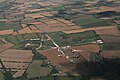 Breighton aerodrome, aerial 2016 - geograph.org.uk - 5092786.jpg 640 × 427; 59 KB
-
 Breighton aerodrome, aerial 2016 - geograph.org.uk - 5092791.jpg 440 × 640; 55 KB
-
 Brick Arches - geograph.org.uk - 6074111.jpg 4,608 × 3,456; 6.78 MB
-
 Bridleway to nowhere - geograph.org.uk - 3794227.jpg 1,024 × 768; 109 KB
-

-
 Built in 1793 the Derwent Bridge Bubwith - geograph.org.uk - 4593204.jpg 4,608 × 3,456; 5.12 MB
-
 Bungalow on York Road - geograph.org.uk - 5491418.jpg 1,600 × 1,065; 628 KB
-
 By the River Derwent - geograph.org.uk - 5272341.jpg 1,024 × 768; 273 KB
-
 Car park entrance at Skipwith Common - geograph.org.uk - 5491424.jpg 1,600 × 1,065; 848 KB
-
 Champions Gate, North Duffield - geograph.org.uk - 5490446.jpg 1,600 × 1,065; 454 KB
-
 Chapel Farm, North Duffield - geograph.org.uk - 5253170.jpg 1,024 × 768; 209 KB
-
 Common Drain - geograph.org.uk - 2561416.jpg 1,600 × 1,200; 580 KB
-
 Common Drain - geograph.org.uk - 5253142.jpg 1,024 × 768; 228 KB
-
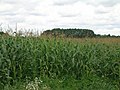
 Corn Field - geograph.org.uk - 482600.jpg 640 × 427; 163 KB
-
 Cornelius Causeway at Skipwith Common - geograph.org.uk - 2466779.jpg 800 × 600; 325 KB
-
 Cornelius Causeway towards the A163 - geograph.org.uk - 2359136.jpg 1,600 × 1,200; 339 KB
-
 Cottage, Menthorpe Gate - geograph.org.uk - 2359181.jpg 1,600 × 1,200; 608 KB
-
 Daffodils on North Duffield Village Green - geograph.org.uk - 370846.jpg 640 × 480; 106 KB
-
 Dead End Paths - geograph.org.uk - 750372.jpg 640 × 427; 88 KB
-
 Derwent Bridge - geograph.org.uk - 6071011.jpg 1,024 × 768; 247 KB
-
 Derwent Bridge near Bubwith - geograph.org.uk - 5490034.jpg 1,600 × 1,065; 478 KB
-
 Derwent Bridge near Bubwith - geograph.org.uk - 5490039.jpg 1,600 × 1,065; 610 KB
-
 Derwent Bridge, Bubwith - geograph.org.uk - 2748533.jpg 3,264 × 2,448; 1.21 MB
-
 Derwent Bridge, Bubwith - geograph.org.uk - 5272331.jpg 1,024 × 768; 155 KB
-

-
 Dismantled Railway and River Derwent - geograph.org.uk - 2638576.jpg 3,264 × 2,448; 1.56 MB
-
 Dismantled Railway now used as field access - geograph.org.uk - 3900339.jpg 4,000 × 3,000; 3.22 MB
-
 Downstream along the Derwent - geograph.org.uk - 2748541.jpg 3,208 × 2,372; 1.22 MB
-
 Drain south of Sandfield Bridge - geograph.org.uk - 6252521.jpg 1,600 × 1,200; 613 KB
-

-
 Entering North Duffield - geograph.org.uk - 2466665.jpg 800 × 600; 268 KB
-
 Entering North Duffield - geograph.org.uk - 2561412.jpg 1,600 × 1,200; 658 KB
-
 Entering North Duffield at Sandfield Bridge on A163 - geograph.org.uk - 5397343.jpg 1,839 × 1,319; 1.05 MB
-
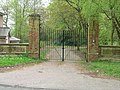 Entrance gates, Blackwood Hall - geograph.org.uk - 2359133.jpg 1,600 × 1,200; 693 KB
-
 Entrance sign for North Duffield - geograph.org.uk - 5490216.jpg 1,600 × 1,065; 837 KB
-
 Entrance to Longland Farm - geograph.org.uk - 3902175.jpg 4,000 × 3,000; 3.14 MB
-
 Farm buildings, Gothic Farm, North Duffield - geograph.org.uk - 5253167.jpg 1,024 × 768; 208 KB
-
 Farm buildings, Longland Farm - geograph.org.uk - 2359175.jpg 1,600 × 1,200; 408 KB
-
 Farm track near Menthorpe - geograph.org.uk - 5254408.jpg 1,024 × 768; 168 KB
-
 Farm track near North Duffield Lodge - geograph.org.uk - 2561425.jpg 1,600 × 1,200; 592 KB
-
 Farm track off Highfield North Lane - geograph.org.uk - 2561415.jpg 1,600 × 1,200; 443 KB
-
 Farm track off the A163 - geograph.org.uk - 2359159.jpg 1,600 × 1,200; 617 KB
-
 Farmland east of North Common Plantation - geograph.org.uk - 6062700.jpg 1,600 × 1,200; 630 KB
-
 Farmland near North Duffield Lodge - geograph.org.uk - 2561420.jpg 1,600 × 1,200; 556 KB
-
 Farmland off Highfield North Lane - geograph.org.uk - 2561414.jpg 1,600 × 1,200; 459 KB
-
 Farmland off Menthorpe Lane - geograph.org.uk - 2359172.jpg 1,600 × 1,200; 352 KB
-
 Farmland, North Duffield Common - geograph.org.uk - 2561410.jpg 1,600 × 1,200; 627 KB
-
 Farmland, North Duffield Lodge - geograph.org.uk - 2561422.jpg 1,600 × 1,200; 434 KB
-
 Fenced area on Sandy Lane (track) - geograph.org.uk - 5388390.jpg 2,302 × 1,726; 2.7 MB
-
 Field by the River Derwent - geograph.org.uk - 5253162.jpg 1,024 × 768; 277 KB
-
 Field near North Duffield Lodge - geograph.org.uk - 5253147.jpg 1,024 × 768; 187 KB
-
 Field to Menthorpe Gate from Dyon Lane - geograph.org.uk - 3900322.jpg 4,000 × 3,000; 3.1 MB
-
 Fields to Redmoor Farm - geograph.org.uk - 1214940.jpg 640 × 480; 51 KB
-
 Fields towards Blackwood House Farm - geograph.org.uk - 1551808.jpg 640 × 480; 53 KB
-
 Floods at Bubwith - geograph.org.uk - 5274519.jpg 1,024 × 768; 200 KB
-
 Floods at Derwent Bridge, Bubwith - geograph.org.uk - 5729023.jpg 1,024 × 768; 98 KB
-
 Footpath from the river - geograph.org.uk - 5253993.jpg 1,024 × 768; 385 KB
-
 Footpath off Blackwood Lane - geograph.org.uk - 5883774.jpg 1,600 × 1,065; 740 KB
-
 Former school, North Duffield - geograph.org.uk - 5253952.jpg 1,024 × 768; 192 KB
-
 Former telephone kiosk on Main Street, North Duffield - geograph.org.uk - 5490408.jpg 1,065 × 1,600; 476 KB
-
 Former Village School - geograph.org.uk - 5490270.jpg 1,600 × 1,065; 517 KB
-
 Grey Partridge Conservation Area - geograph.org.uk - 1214917.jpg 640 × 480; 94 KB
-
 Hugh Field Lane - geograph.org.uk - 5491417.jpg 1,600 × 1,065; 687 KB
-
 Ivy covered tree - geograph.org.uk - 5253971.jpg 1,024 × 768; 261 KB
-
-
 Kings Arms, North Duffield - geograph.org.uk - 5486061.jpg 1,600 × 1,065; 449 KB
-
 Kings Arms, North Duffield - geograph.org.uk - 5486062.jpg 1,600 × 1,065; 503 KB
-
 Kings Arms, North Duffield - geograph.org.uk - 5486065.jpg 1,561 × 1,600; 627 KB
-
 Kings Arms, North Duffield - geograph.org.uk - 6252529.jpg 1,600 × 1,200; 431 KB
-
 Ladypit Drain - geograph.org.uk - 2359186.jpg 1,600 × 1,200; 779 KB
-
 Ladypit Drain coming under Dyon Lane - geograph.org.uk - 3902193.jpg 4,000 × 3,000; 5.01 MB
-
 Ladypit Drain east of Dyon Lane - geograph.org.uk - 3902187.jpg 4,000 × 3,000; 4.35 MB
-
 Lawns House Farm - geograph.org.uk - 1214906.jpg 640 × 480; 48 KB
-
 Line of dismantled railway - geograph.org.uk - 3900351.jpg 4,000 × 3,000; 2.67 MB
-
 Long fence near Chapel Farm, North Duffield - geograph.org.uk - 5254422.jpg 1,024 × 768; 226 KB
-
 Longland Farm, North Duffield - geograph.org.uk - 5253172.jpg 1,024 × 768; 201 KB
-
 Longland Field - geograph.org.uk - 1347828.jpg 640 × 480; 44 KB
-
 Longland Field Pond in the trees - geograph.org.uk - 3900379.jpg 4,000 × 3,000; 2.38 MB
-
 Looking Downriver from the Derwent Bridge - geograph.org.uk - 197212.jpg 640 × 480; 110 KB
-
 Looking NW over River Derwent Near Gunby - geograph.org.uk - 248355.jpg 640 × 426; 402 KB
-

-
 Main Street, North Duffield - geograph.org.uk - 2277318.jpg 800 × 600; 214 KB
-
 Main Street, North Duffield - geograph.org.uk - 5490402.jpg 1,600 × 1,065; 536 KB
-
 Main Street, North Duffield - geograph.org.uk - 5490417.jpg 1,600 × 1,065; 475 KB
-
 Main Street, North Duffield - geograph.org.uk - 5490428.jpg 1,600 × 1,065; 521 KB
-
 Main Street, South Duffield - geograph.org.uk - 2359168.jpg 1,600 × 1,200; 376 KB
-
 Menthorpe Lane - geograph.org.uk - 2359173.jpg 1,600 × 1,200; 603 KB
-
 Menthorpe Lane - geograph.org.uk - 2359177.jpg 1,600 × 1,200; 404 KB
-
 Methodist Church - geograph.org.uk - 5490243.jpg 1,600 × 1,065; 473 KB
-
 Methodist Church and Wesleyan Chapel - geograph.org.uk - 3902209.jpg 4,000 × 3,000; 2.1 MB
-
 Methodist Church, North Duffield - geograph.org.uk - 2359167.jpg 1,600 × 1,200; 342 KB
-
 Miscanthus on both sides of the road - geograph.org.uk - 5253968.jpg 1,024 × 768; 126 KB
-
 Modern extension to an old bridge - geograph.org.uk - 4593217.jpg 4,608 × 3,456; 4.33 MB
-
 Nature Reserve Pond - geograph.org.uk - 1214968.jpg 640 × 480; 110 KB
-
 A Track to Two Isolated Cottages - geograph.org.uk - 197176.jpg 640 × 480; 78 KB
-
 North Duffield Bowling Club - geograph.org.uk - 5491406.jpg 1,600 × 1,065; 627 KB
-
 North Duffield Bowling Club - geograph.org.uk - 5491410.jpg 1,600 × 1,065; 514 KB
-
 North Duffield Carrs - geograph.org.uk - 1214960.jpg 640 × 480; 53 KB
-
 North Duffield Crossroads - geograph.org.uk - 1214952.jpg 640 × 480; 68 KB
-
 North Duffield Lodge - geograph.org.uk - 2561424.jpg 1,600 × 1,200; 426 KB
-
 North Duffield Lodge - geograph.org.uk - 5253998.jpg 1,024 × 768; 225 KB
-
 North Duffield Village Hall - geograph.org.uk - 196563.jpg 640 × 480; 110 KB
-
 North Duffield Village Pond - geograph.org.uk - 196545.jpg 640 × 480; 112 KB
-
 North Duffield War Memorial - geograph.org.uk - 5490231.jpg 1,600 × 1,417; 879 KB
-
 North to North Duffield - geograph.org.uk - 2277307.jpg 800 × 600; 254 KB
-
 Not such a Great Wood - geograph.org.uk - 5253982.jpg 1,024 × 768; 235 KB
-
 Not the most enticing of paths - geograph.org.uk - 5253958.jpg 1,024 × 768; 174 KB
-
 Oak in winter - geograph.org.uk - 3798237.jpg 1,024 × 768; 224 KB
-
 Ordnance Survey Flush Bracket S9380 - geograph.org.uk - 3299561.jpg 4,000 × 3,000; 3.84 MB
-
 Over fields to Menthorpe - geograph.org.uk - 3900311.jpg 4,000 × 3,000; 2.13 MB
-
 Parkland near Bowthorpe Hall - geograph.org.uk - 5254172.jpg 1,024 × 768; 318 KB
-
 Path north from North Duffield Lodge - geograph.org.uk - 5254007.jpg 1,024 × 768; 130 KB
-
 Path to the right, floodbank to the left - geograph.org.uk - 5253986.jpg 1,024 × 768; 265 KB
-
 Path to the River Derwent - geograph.org.uk - 5253155.jpg 1,024 × 768; 285 KB
-
 Pavilion at North Duffield playing field - geograph.org.uk - 5388323.jpg 1,975 × 1,475; 1.21 MB
-
 Pond in woodland off Sandy Lane (track) - geograph.org.uk - 5388381.jpg 2,302 × 1,724; 2.71 MB
-
 Pond on the village green North Duffield - geograph.org.uk - 5388308.jpg 2,304 × 1,728; 2.14 MB
-
 Remains of the railway bridge near Gunby - geograph.org.uk - 5272256.jpg 1,024 × 768; 173 KB
-
 Remains of the railway viaduct at Gunby - geograph.org.uk - 5274430.jpg 1,024 × 768; 224 KB
-
 River Derwent - geograph.org.uk - 432448.jpg 640 × 480; 76 KB
-
 River Derwent - geograph.org.uk - 6237373.jpg 1,024 × 768; 198 KB
-
 River Derwent - geograph.org.uk - 871274.jpg 640 × 480; 136 KB
-
 River Derwent - geograph.org.uk - 871294.jpg 480 × 640; 81 KB
-
 River Derwent in Flood - geograph.org.uk - 1205138.jpg 480 × 640; 76 KB
-
 River Derwent near Aughton Clough - geograph.org.uk - 1414405.jpg 640 × 480; 35 KB
-
 River Derwent near Breighton - geograph.org.uk - 1199508.jpg 640 × 480; 66 KB
-
 River Derwent near Breighton.jpg 640 × 480; 104 KB
-
 River Derwent near Gunby, East Yorks. - geograph.org.uk - 807974.jpg 640 × 362; 164 KB
-
 Road to Menthorpe - geograph.org.uk - 5253177.jpg 1,024 × 768; 154 KB
-
 Road towards North Duffield Lodge - geograph.org.uk - 2561418.jpg 1,600 × 1,200; 401 KB
-
 Roadway to Hall Farm, North Duffield - geograph.org.uk - 5254726.jpg 1,024 × 768; 214 KB
-
 Roadway to Redmoor Farm - geograph.org.uk - 3794222.jpg 1,024 × 768; 133 KB
-
 Sandfield Bridge on A163 - geograph.org.uk - 3902216.jpg 4,000 × 3,000; 2.69 MB
-
 Sandy Lane (track) - geograph.org.uk - 2561411.jpg 1,600 × 1,200; 620 KB
-
 Sandy Lane - geograph.org.uk - 254348.jpg 640 × 384; 72 KB
-
 Sandy Lane - geograph.org.uk - 6252532.jpg 1,600 × 1,200; 979 KB
-
 Sandy Lane towards Cornelius Causeway - geograph.org.uk - 5486068.jpg 1,600 × 1,065; 965 KB
-
 Sandy Lane towards Cornelius Causeway - geograph.org.uk - 5491422.jpg 1,600 × 1,065; 960 KB
-
 Sandy Lane towards Cornelius Causeway - geograph.org.uk - 5491423.jpg 1,600 × 1,065; 878 KB
-
 Selby Road at Green Lane, North Duffield - geograph.org.uk - 5883776.jpg 1,600 × 1,065; 371 KB
-
 Selby Road, North Duffield - geograph.org.uk - 5490226.jpg 1,600 × 1,065; 493 KB
-
 Sign at the car park entrance - geograph.org.uk - 5393939.jpg 2,288 × 1,708; 1.49 MB
-
 Signpost - geograph.org.uk - 197154.jpg 640 × 480; 61 KB
-
 Sports field, North Duffield - geograph.org.uk - 2561413.jpg 1,600 × 1,200; 375 KB
-
 Stone carving at Blackwood Hall - geograph.org.uk - 388502.jpg 480 × 640; 158 KB
-
 Surgery on Main Road, North Duffield - geograph.org.uk - 5490425.jpg 1,600 × 1,065; 581 KB
-
 The A163 to Selby - geograph.org.uk - 196559.jpg 640 × 480; 112 KB
-
 The A163 towards North Duffield - geograph.org.uk - 5490208.jpg 1,600 × 1,065; 460 KB
-
 The Derwent Flyer - geograph.org.uk - 2277343.jpg 800 × 600; 209 KB
-

-
 The edge of North Duffield (geograph 5253347).jpg 1,024 × 768; 150 KB
-
 The Junction - geograph.org.uk - 197157.jpg 640 × 480; 50 KB
-

-
 The King's Arms, North Duffield - geograph.org.uk - 196544.jpg 640 × 480; 100 KB
-
 The King's Arms, North Duffield - geograph.org.uk - 196547.jpg 640 × 480; 77 KB
-
 The Lake at Blackwood Hall - geograph.org.uk - 388508.jpg 640 × 480; 139 KB
-
 The Lonely Walker on the Country Road - geograph.org.uk - 197198.jpg 640 × 480; 93 KB
-
 The Lower Derwent Valley Nature Reserve, - geograph.org.uk - 2466721.jpg 800 × 600; 293 KB
-
 The Main Street of North Duffield.jpg 640 × 480; 83 KB
-
 The old railway line looking north east - geograph.org.uk - 420430.jpg 640 × 480; 143 KB
-
 The Private Road to Bowthorpe Hall - geograph.org.uk - 197153.jpg 640 × 480; 70 KB
-
 The Rear of Blackwood Hall - geograph.org.uk - 388497.jpg 640 × 480; 86 KB
-

-
 The River Derwent in flood - geograph.org.uk - 5274421.jpg 1,024 × 768; 129 KB
-
 The River Derwent in flood at Bubwith - geograph.org.uk - 5274524.jpg 1,024 × 768; 213 KB
-
 The River Derwent near Breighton - geograph.org.uk - 5274470.jpg 1,024 × 768; 221 KB
-
 The River Derwent south of Breighton - geograph.org.uk - 2277183.jpg 800 × 600; 383 KB
-

-
 The Road to Menthorpe - geograph.org.uk - 197046.jpg 640 × 480; 73 KB
-
 The Road to Menthorpe - geograph.org.uk - 197150.jpg 640 × 480; 61 KB
-
 The Road to Menthorpe - geograph.org.uk - 197177.jpg 640 × 480; 52 KB
-
 The Road to Menthorpe - geograph.org.uk - 197200.jpg 640 × 480; 70 KB
-
 The road to Menthorpe - geograph.org.uk - 2277286.jpg 800 × 600; 212 KB
-
 The Road to North Duffield - geograph.org.uk - 197195.jpg 640 × 480; 103 KB
-
 The road to Skipwith, from Sandy Lane - geograph.org.uk - 2277331.jpg 800 × 600; 233 KB
-
 The Road to Woodhall - geograph.org.uk - 197158.jpg 640 × 480; 67 KB
-
 The Road to Woodhall - geograph.org.uk - 197179.jpg 640 × 480; 66 KB
-
 The village pond at North Duffield - geograph.org.uk - 2277325.jpg 800 × 600; 286 KB


_-_geograph.org.uk_-_3902222.jpg)


_-_geograph.org.uk_-_5388390.jpg)


_-_geograph.org.uk_-_5388381.jpg)


_-_geograph.org.uk_-_2561411.jpg)


.jpg)


