Category:North Curry
Jump to navigation
Jump to search
English: North Curry is a village and civil parish in Somerset, England, situated east of Taunton in the Taunton Deane district. The village has a population of 1,625.
village in Somerset, England, UK  | |||||
| Upload media | |||||
| Instance of | |||||
|---|---|---|---|---|---|
| Location |
| ||||
| Population |
| ||||
 | |||||
Subcategories
This category has the following 4 subcategories, out of 4 total.
Media in category "North Curry"
The following 200 files are in this category, out of 316 total.
(previous page) (next page)-
 A little-used gate, Knapp - geograph.org.uk - 4782030.jpg 1,600 × 1,200; 408 KB
-
 A rather unkempt Rodwell Lane - geograph.org.uk - 4605141.jpg 1,024 × 768; 265 KB
-
 A withy bed, North Curry - geograph.org.uk - 1082890.jpg 640 × 480; 94 KB
-
 A378 approaches Stony Head - geograph.org.uk - 4008461.jpg 3,322 × 2,551; 1.31 MB
-
 A378 at Listock - geograph.org.uk - 5363488.jpg 1,600 × 799; 546 KB
-
 A378 in Lord's Wood - geograph.org.uk - 5363537.jpg 1,600 × 1,200; 797 KB
-
 A378 junction with West Sedgemore Road - geograph.org.uk - 4008767.jpg 3,648 × 2,736; 1.19 MB
-
 A378 passes Wrantage Feed Mills - geograph.org.uk - 4008671.jpg 3,400 × 2,581; 1.21 MB
-
 A378 west of Underhill Farm - geograph.org.uk - 4008696.jpg 3,348 × 2,552; 1.29 MB
-
 A378, Wrantage - geograph.org.uk - 3416979.jpg 640 × 475; 74 KB
-
 An unusual barn roof, Knappwoods Barn - geograph.org.uk - 4782042.jpg 1,600 × 1,200; 225 KB
-
 Barn by the road, Higher Lillesdon Farm - geograph.org.uk - 5370254.jpg 1,600 × 1,200; 645 KB
-
 Barns at Higher Lillesdon Farm - geograph.org.uk - 5370253.jpg 1,600 × 798; 492 KB
-
 Barton Way North Curry - geograph.org.uk - 1814669.jpg 640 × 480; 67 KB
-
 Bend in the River Tone - geograph.org.uk - 4572991.jpg 1,024 × 768; 262 KB
-
 Bend in the River Tone - geograph.org.uk - 4573662.jpg 1,024 × 768; 215 KB
-
 Bowldish Farm - geograph.org.uk - 4606578.jpg 1,024 × 768; 193 KB
-
 Bridge across ditch, Wrantage - geograph.org.uk - 3416950.jpg 640 × 480; 117 KB
-

-
 Bridge over Old Rhyne - geograph.org.uk - 4782597.jpg 1,600 × 800; 188 KB
-
 Bus shelter at Lillesdon Terrace - geograph.org.uk - 5370258.jpg 1,600 × 1,067; 738 KB
-
 Cattle on West Sedge Moor - geograph.org.uk - 3124639.jpg 640 × 480; 92 KB
-
 Centre of North Curry - geograph.org.uk - 1920184.jpg 640 × 480; 79 KB
-
 Centre Rhyne and Currymoor Drove - geograph.org.uk - 4782595.jpg 1,600 × 1,200; 219 KB
-
 Chard Canal Aqueduct Abutments - geograph.org.uk - 1806990.jpg 640 × 447; 66 KB
-
 Chard Canal aqueduct in Wrantage - geograph.org.uk - 3417076.jpg 640 × 477; 80 KB
-
 Chard Canal aqueduct in Wrantage - geograph.org.uk - 3417388.jpg 640 × 410; 67 KB
-
 Chard Canal tunnel - geograph.org.uk - 4117951.jpg 640 × 426; 103 KB
-
 Chestnut Farm - geograph.org.uk - 1814662.jpg 640 × 480; 89 KB
-
 Church Meads, North Curry - geograph.org.uk - 1920174.jpg 640 × 480; 96 KB
-

-
 Cobwebs cottage, Rock Hill - geograph.org.uk - 4572726.jpg 1,024 × 768; 173 KB
-
 Coffee shop in North Curry, Somerset.jpg 225 × 300; 30 KB
-
 Cogload Farm from Currymoor Drove - geograph.org.uk - 5030843.jpg 1,600 × 900; 297 KB
-
 Combe Lane, Knapp - geograph.org.uk - 3662210.jpg 1,024 × 768; 247 KB
-
 Combe Lane, Knapp - geograph.org.uk - 4782040.jpg 1,600 × 1,200; 301 KB
-
 Cottage at Poplar Farm - geograph.org.uk - 4606593.jpg 1,024 × 782; 190 KB
-
 Cottage at Wrantage - geograph.org.uk - 3416961.jpg 640 × 456; 89 KB
-
 Cottage near Huntham - geograph.org.uk - 2007947.jpg 640 × 480; 102 KB
-
 Cottages, Knapp - geograph.org.uk - 3662202.jpg 1,024 × 768; 251 KB
-
 Countryside near Knapp - geograph.org.uk - 1608964.jpg 640 × 480; 85 KB
-
 Course of Chard Canal, Wrantage, 1972 - geograph.org.uk - 5720137.jpg 640 × 427; 175 KB
-
 Cross roads on Rodwell Lane - geograph.org.uk - 3208911.jpg 3,888 × 2,592; 1.28 MB
-
 Crossroads at Borough Cross - geograph.org.uk - 5370250.jpg 1,600 × 1,145; 700 KB
-
 Crossroads, North Curry - geograph.org.uk - 3662255.jpg 1,024 × 763; 164 KB
-
 Curry Moor - geograph.org.uk - 2707999.jpg 3,888 × 2,592; 589 KB
-
 Development and construction on the edge of Wrantage - geograph.org.uk - 5363480.jpg 1,600 × 1,279; 687 KB
-
 Direction Sign - Signpost on Greenway, North Curry - geograph.org.uk - 6061106.jpg 1,806 × 1,164; 218 KB
-
 Direction Sign - Signpost on the A378 south of Listock - geograph.org.uk - 6083774.jpg 1,170 × 1,765; 159 KB
-
 Direction Sign – Signpost on the A378 Stonyhead Hill - geograph.org.uk - 6047997.jpg 1,182 × 1,717; 180 KB
-

-
 Does my roof look bigger than yours^ - geograph.org.uk - 5370240.jpg 1,600 × 1,064; 597 KB
-
 Downhill lane in the sun and shade - geograph.org.uk - 4031614.jpg 640 × 480; 207 KB
-
 Drain on West Sedge Moor - geograph.org.uk - 4939174.jpg 1,024 × 768; 239 KB
-

-
 Entering Knapp - geograph.org.uk - 1871040.jpg 640 × 480; 109 KB
-
 Entrance drive, Lillesdon Court - geograph.org.uk - 4604511.jpg 1,024 × 768; 180 KB
-
 Entrance drive, Lillesdon Farm - geograph.org.uk - 4603605.jpg 1,024 × 768; 209 KB
-
 Entrance to Four Oaks - geograph.org.uk - 1814652.jpg 640 × 480; 63 KB
-
 Evening sky over the River Tone, Curry Moor.jpg 5,152 × 3,864; 4.29 MB
-
 Farm building, Huntham - geograph.org.uk - 2007976.jpg 640 × 451; 74 KB
-
 Farm buildings, Huntham - geograph.org.uk - 2008023.jpg 640 × 446; 85 KB
-
 Farm road to New Barn - geograph.org.uk - 4604531.jpg 1,024 × 768; 186 KB
-
 Farmland east of Thorn Hill - geograph.org.uk - 5573289.jpg 2,048 × 1,536; 459 KB
-
 Field at Wrantage - geograph.org.uk - 3416937.jpg 640 × 466; 120 KB
-
 Field boundary, Solomon's Hollow - geograph.org.uk - 3368638.jpg 640 × 480; 122 KB
-
 Field entrance - geograph.org.uk - 4031613.jpg 640 × 480; 216 KB
-
 Field of Wheat, New Barn - geograph.org.uk - 4605089.jpg 1,024 × 768; 241 KB
-
 Field, near Listock - geograph.org.uk - 4606588.jpg 1,024 × 768; 203 KB
-
 Fields and a pair of swans on Hay Moor - geograph.org.uk - 5499307.jpg 640 × 480; 150 KB
-
 Fields below Knapp - geograph.org.uk - 2256153.jpg 640 × 480; 73 KB
-
 Fields on Curry Moor north-west of Currymoor Drove - geograph.org.uk - 4782596.jpg 1,600 × 1,200; 159 KB
-
 Fields on Hay Moor - geograph.org.uk - 4782587.jpg 1,600 × 1,200; 262 KB
-
 Flooded West Moor taken from Charlton bridge - geograph.org.uk - 4832689.jpg 1,600 × 1,065; 327 KB
-
 Floods at Curry Moor - geograph.org.uk - 2929118.jpg 3,888 × 2,592; 1.79 MB
-
 Floods at West Sedgemoor - geograph.org.uk - 2929620.jpg 3,888 × 2,592; 1.92 MB
-
 Fork for the link to Langlands Lane - geograph.org.uk - 5370266.jpg 1,600 × 1,280; 937 KB
-
 Former Methodist chapel, Wrantage - geograph.org.uk - 5363464.jpg 1,600 × 1,142; 759 KB
-
 Fosse Cottage.jpg 6,000 × 4,000; 12.59 MB
-
 Frog Lane Farm - geograph.org.uk - 2707954.jpg 3,888 × 2,592; 937 KB
-
 Frosty web on Aller Drove - geograph.org.uk - 1094656.jpg 480 × 640; 76 KB
-
 Fungi, near Moredon - geograph.org.uk - 1359481.jpg 640 × 480; 154 KB
-
 Gate on riverbank - geograph.org.uk - 4573660.jpg 1,024 × 768; 204 KB
-
 Gateway on Rodwell Lane - geograph.org.uk - 4605107.jpg 1,024 × 761; 293 KB
-
 Gateway to the fields - geograph.org.uk - 1804934.jpg 640 × 427; 97 KB
-
 Grazing sheep, Hammonds Farm - geograph.org.uk - 4603620.jpg 1,024 × 768; 164 KB
-
 Green trees on Stonyhead Hill - geograph.org.uk - 5363451.jpg 1,600 × 1,280; 840 KB
-
 Hammonds Farm - geograph.org.uk - 4604457.jpg 1,024 × 768; 165 KB
-
 Hay Moor - geograph.org.uk - 1941024.jpg 1,800 × 1,118; 450 KB
-
 Hay Moor - geograph.org.uk - 4572976.jpg 1,024 × 765; 258 KB
-
 Hay Moor - geograph.org.uk - 4573656.jpg 1,024 × 768; 213 KB
-
 Haymaking - geograph.org.uk - 3124510.jpg 640 × 481; 60 KB
-
 Haymoor Drove, ditch and track - geograph.org.uk - 4782584.jpg 1,600 × 1,200; 252 KB
-
 Hazels, Solomon's Hollow - geograph.org.uk - 3368645.jpg 640 × 480; 121 KB
-
 Helland Farm - geograph.org.uk - 4606533.jpg 1,024 × 759; 246 KB
-
 Helland House Farm - geograph.org.uk - 4606503.jpg 1,024 × 768; 169 KB
-
 Higher Huntham Farmhouse - geograph.org.uk - 2008034.jpg 640 × 543; 82 KB
-
 Higher Knapp Lane - geograph.org.uk - 4031616.jpg 640 × 480; 134 KB
-
 House at Helland - geograph.org.uk - 3124619.jpg 640 × 480; 76 KB
-
 House at Lillesdon - geograph.org.uk - 4604498.jpg 1,024 × 768; 155 KB
-
 House by the River Tone, at Newbridge - geograph.org.uk - 4573208.jpg 1,024 × 768; 231 KB
-
 House on the road towards North Curry - geograph.org.uk - 4618655.jpg 640 × 480; 145 KB
-
 House, Newport - geograph.org.uk - 4572750.jpg 1,024 × 768; 193 KB
-
 Houses and cars in North Curry - geograph.org.uk - 4031623.jpg 640 × 480; 118 KB
-
 Houses at Rock - geograph.org.uk - 1871045.jpg 640 × 480; 136 KB
-
 Houses in Knapp - geograph.org.uk - 3116367.jpg 640 × 480; 53 KB
-
 Huntham , West Sedgemoor - geograph.org.uk - 1814673.jpg 640 × 480; 54 KB
-
 Hunts End - geograph.org.uk - 4572758.jpg 1,024 × 768; 132 KB
-
 Independent Baptist Church, North Curry - geograph.org.uk - 5370247.jpg 1,600 × 1,143; 672 KB
-
 Isolated trees on West Sedge Moor - geograph.org.uk - 4939214.jpg 1,024 × 768; 233 KB
-
 Junction of A378 and Lillesdon Lane - geograph.org.uk - 5363456.jpg 1,600 × 1,200; 689 KB
-
 Knapp and surrounding fields - geograph.org.uk - 3753192.jpg 3,888 × 2,592; 1.63 MB
-
 Knapp bridge - geograph.org.uk - 2972796.jpg 800 × 487; 117 KB
-
 Knapp Bridge 01.jpg 5,152 × 3,864; 4.22 MB
-
 Knapp Bridge 02.jpg 5,152 × 3,864; 4.42 MB
-
 Knapp Bridge 03.jpg 5,152 × 3,864; 4.37 MB
-
 Knapp Lane - geograph.org.uk - 3662194.jpg 1,024 × 768; 244 KB
-
 Knapp Lane crossing Badlinch Hollow - geograph.org.uk - 4782573.jpg 1,600 × 1,200; 234 KB
-
 Knapp Lane, North Curry - geograph.org.uk - 3662285.jpg 1,024 × 787; 144 KB
-
 Lane junctions at Rock - geograph.org.uk - 1871043.jpg 640 × 480; 128 KB
-
 Large barn in Knapp - geograph.org.uk - 4782037.jpg 1,600 × 1,200; 403 KB
-
 Lillesdon Lane - geograph.org.uk - 5118099.jpg 3,648 × 2,432; 4.53 MB
-
 Line of former Chard Canal - geograph.org.uk - 4604465.jpg 1,024 × 768; 160 KB
-
 Line of the Chard Canal at Wrantage. - geograph.org.uk - 1807008.jpg 640 × 480; 91 KB
-
 Lodge House at the entrance to Moredon - geograph.org.uk - 3662334.jpg 1,024 × 768; 170 KB
-
 Lodwells Orchard, North Curry - geograph.org.uk - 4782577.jpg 1,600 × 1,200; 225 KB
-
 Long's House - geograph.org.uk - 3124577.jpg 640 × 480; 66 KB
-
 Lower Listock Farm - geograph.org.uk - 1807044.jpg 640 × 446; 83 KB
-
 Manor House - geograph.org.uk - 2707990.jpg 3,888 × 2,592; 988 KB
-
 Marsh grasses, West Sedge Moor - geograph.org.uk - 4939179.jpg 1,024 × 768; 267 KB
-
 Marsh Marigolds - geograph.org.uk - 4939193.jpg 1,024 × 768; 393 KB
-
 Meander in the River Tone - geograph.org.uk - 4573644.jpg 1,024 × 768; 210 KB
-
 Mistletoe, in old apple orchard, Huntham - geograph.org.uk - 3662494.jpg 1,024 × 768; 266 KB
-
 Moredon - geograph.org.uk - 6461647.jpg 1,200 × 800; 1.08 MB
-
 Mute Swan at Middle Drove - geograph.org.uk - 4939253.jpg 1,024 × 768; 248 KB
-
 Ncurrypark.jpg 749 × 561; 221 KB
-
 Near Moredon - geograph.org.uk - 6461638.jpg 1,200 × 800; 1.21 MB
-
 New Bridge Sluice - geograph.org.uk - 4572834.jpg 1,024 × 768; 169 KB
-
 New Bridge, Curry Moor 01.jpg 5,152 × 3,864; 4.26 MB
-
 New Bridge, Curry Moor 02.jpg 5,152 × 3,864; 4.37 MB
-
 New Bridge, Curry Moor 03.jpg 5,152 × 3,864; 4.37 MB
-
 New Bridge, Curry Moor 04.jpg 5,152 × 3,864; 8.55 MB
-
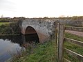
 New Bridge. North Curry - geograph.org.uk - 2707938.jpg 3,888 × 2,592; 4.65 MB
-
 Newbridge Sluice - geograph.org.uk - 4782588.jpg 1,600 × 1,200; 343 KB
-
 Newly ploughed field, edge of North Curry - geograph.org.uk - 5368351.jpg 1,600 × 1,279; 808 KB
-
 North Curry - 10 Queen Square (geograph 6795771).jpg 6,000 × 4,000; 6.1 MB
-
 North Curry - geograph.org.uk - 2707942.jpg 3,888 × 2,592; 1.14 MB
-
 North Curry - geograph.org.uk - 2707948.jpg 3,888 × 2,592; 4.3 MB
-
 North Curry - geograph.org.uk - 2707964.jpg 3,888 × 2,592; 3.81 MB
-
 North Curry - geograph.org.uk - 6461620.jpg 1,200 × 802; 1.26 MB
-
 North Curry church from Durston - geograph.org.uk - 3049965.jpg 3,888 × 2,592; 837 KB
-
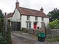
 North Curry post office - geograph.org.uk - 5368374.jpg 1,600 × 1,200; 691 KB
-
 North Curry Post Office and Stores, The Pavement - geograph.org.uk - 4951099.jpg 3,189 × 2,448; 1.96 MB
-
 North Curry Village Hall - geograph.org.uk - 4572762.jpg 1,024 × 768; 159 KB
-

-
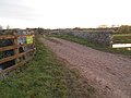
 North Drove - geograph.org.uk - 4606557.jpg 1,024 × 768; 221 KB
-

-
 Northeast from Thorn Hill - geograph.org.uk - 5573328.jpg 1,535 × 1,144; 145 KB
-
 Oakhill Farm riding school - geograph.org.uk - 5118103.jpg 3,648 × 2,432; 3.71 MB
-
 Oakhill Farm riding school - geograph.org.uk - 5118106.jpg 3,648 × 2,432; 3.47 MB
-
 Old canal bridge by The East Deane Way - geograph.org.uk - 3208862.jpg 2,592 × 3,888; 1.5 MB
-
 Old canal bridge on The East Deane Way - geograph.org.uk - 3208852.jpg 3,888 × 2,592; 1.56 MB
-
 Old Direction Sign - Signpost by Knapp Road, Lower Knapp - geograph.org.uk - 6048288.jpg 1,170 × 1,765; 333 KB
-
 Old Direction Sign - Signpost by Knapp Road, Lower Knapp - geograph.org.uk - 6083769.jpg 1,170 × 1,614; 237 KB
-

-

-
 Old Direction Sign - Signpost in North Curry - geograph.org.uk - 6095890.jpg 1,218 × 1,791; 207 KB
-
 Old Rhyne on Curry Moor - geograph.org.uk - 4782601.jpg 1,600 × 1,200; 278 KB
-
 Osiers near Listock - geograph.org.uk - 1807634.jpg 640 × 502; 82 KB
-
 Osiers near Listock - geograph.org.uk - 1807637.jpg 640 × 480; 90 KB
-
 Overgrown and neglected right of way, New Barn - geograph.org.uk - 4605129.jpg 1,024 × 768; 279 KB
-
 Overgrown canal bed, on former Chard Canal - geograph.org.uk - 4603609.jpg 813 × 1,024; 336 KB
-
 Oxen Lane - geograph.org.uk - 4572741.jpg 1,024 × 768; 168 KB
-
 Pasture at Priory Farm - geograph.org.uk - 1608948.jpg 640 × 438; 57 KB
-
 Pasture Field near Lord's Wood. - geograph.org.uk - 3124718.jpg 640 × 480; 100 KB
-
 Pillbox at Wrantage - geograph.org.uk - 1807024.jpg 640 × 480; 109 KB
-
 Pillbox beside Chard Canal - geograph.org.uk - 3416894.jpg 640 × 480; 79 KB
-
 Pillbox interior on the Chard Canal - geograph.org.uk - 3208859.jpg 3,888 × 2,592; 3.19 MB
-
 Pillbox on the Chard Canal - geograph.org.uk - 3208855.jpg 3,888 × 2,592; 1.31 MB
-
 Ploughed Field near Wrantage - geograph.org.uk - 1807030.jpg 640 × 480; 81 KB
-
 Pond in Solomon's Hollow - geograph.org.uk - 3368602.jpg 640 × 480; 131 KB
-
 Pond in Solomon's Hollow - geograph.org.uk - 3368612.jpg 480 × 640; 148 KB
-
 Pond in Solomon's Hollow - geograph.org.uk - 3368624.jpg 640 × 480; 142 KB
-
 Poplar Farm - geograph.org.uk - 3124694.jpg 640 × 480; 96 KB
-
 Post Office, North Curry - geograph.org.uk - 3662299.jpg 1,024 × 768; 141 KB
-
 Queen Square, North Curry and the war memorial - geograph.org.uk - 4782579.jpg 1,600 × 1,200; 405 KB
-
 Queen Victoria Diamond Jubilee memorial, North Curry, Somerset.jpg 340 × 579; 68 KB
-

-
 Rainbows near Thornfalcon - geograph.org.uk - 3208914.jpg 3,888 × 2,592; 578 KB
-
 Remains of Chard Canal, Wrantage - geograph.org.uk - 1621229.jpg 427 × 640; 100 KB
-
 Remains of old apple orchard, Huntham - geograph.org.uk - 3662487.jpg 1,024 × 768; 380 KB
-
 River Tone - geograph.org.uk - 381235.jpg 640 × 480; 59 KB
-
 River Tone - geograph.org.uk - 381252.jpg 640 × 480; 79 KB
-
 River Tone - geograph.org.uk - 4572958.jpg 1,024 × 768; 248 KB
-
 River Tone - geograph.org.uk - 4573650.jpg 1,024 × 768; 211 KB
-
 River Tone - geograph.org.uk - 6461657.jpg 1,200 × 800; 917 KB
-
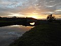
 River Tone and Curry Moor - geograph.org.uk - 377390.jpg 640 × 480; 94 KB
-
 River Tone west of Newbridge Sluice - geograph.org.uk - 4782590.jpg 1,600 × 1,200; 248 KB
-
 Riverbank path - geograph.org.uk - 4573001.jpg 1,024 × 768; 265 KB
-
 Road from North Curry meets the A378 - geograph.org.uk - 2256180.jpg 640 × 480; 73 KB


.jpg)


