Category:North Baddesley
Jump to navigation
Jump to search
village in United Kingdom  Eglwys Sant Ioan Fedyddiwr, North Baddesley | |||||
| Upload media | |||||
| Instance of | |||||
|---|---|---|---|---|---|
| Location | Test Valley, Hampshire, South East England, England | ||||
 | |||||
Subcategories
This category has the following 7 subcategories, out of 7 total.
Media in category "North Baddesley"
The following 156 files are in this category, out of 156 total.
-
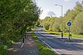
 A27 approaching Scrag Hill junction - geograph.org.uk - 3424572.jpg 640 × 428; 62 KB
-
-
 A27 enters North Baddesley - geograph.org.uk - 3648544.jpg 3,648 × 2,736; 1.42 MB
-
 A27 passes BP filling station - geograph.org.uk - 3648550.jpg 3,382 × 2,656; 1.28 MB
-
 Acleris hastiana1.jpg 768 × 576; 98 KB
-

-

-
 Ashfield View North Baddesley - geograph.org.uk - 1567510.jpg 640 × 480; 89 KB
-
 Aspilapteryx tringipennella.jpg 768 × 576; 217 KB
-
 Autumn leaves on Rownhams Lane, North Baddesley - geograph.org.uk - 5967692.jpg 683 × 1,024; 290 KB
-
 Baddesley Close - geograph.org.uk - 1945013.jpg 640 × 427; 218 KB
-
 Baddesley Close - geograph.org.uk - 1945018.jpg 640 × 427; 220 KB
-
 Baddesley Common - geograph.org.uk - 2398483.jpg 1,600 × 1,200; 294 KB
-

-
 Bend in Thomas Road - geograph.org.uk - 3424915.jpg 640 × 386; 58 KB
-
 Boggy clearing on Baddesley Common - geograph.org.uk - 1945061.jpg 640 × 427; 229 KB
-
 Borden Way, North Baddesley - geograph.org.uk - 789594.jpg 640 × 427; 111 KB
-
 Bungalows in Nutburn Road - geograph.org.uk - 6029145.jpg 1,024 × 576; 158 KB
-

-
 Chilcott Court on Borden Way - geograph.org.uk - 3424954.jpg 640 × 487; 70 KB
-
 Church Close, North Baddesley - geograph.org.uk - 1954205.jpg 640 × 480; 62 KB
-
 Clearing on Baddesley Common - geograph.org.uk - 1945053.jpg 640 × 427; 201 KB
-
-
 Crossroads on A27 at North Baddesley - geograph.org.uk - 789704.jpg 640 × 427; 102 KB
-
 Curious paling west of Emer Farm - geograph.org.uk - 1945100.jpg 640 × 427; 328 KB
-

-
 Electricity Substation at North Baddesley - geograph.org.uk - 786963.jpg 640 × 396; 121 KB
-
 Emer Bog boardwalk - geograph.org.uk - 1072892.jpg 400 × 600; 178 KB
-
 Emer Farm, Green Lane - geograph.org.uk - 1945116.jpg 640 × 427; 234 KB
-
 Entrance to Mountbatten Park - geograph.org.uk - 3866151.jpg 4,320 × 2,432; 3.59 MB
-
 Eupithecia succenturiata.jpg 768 × 576; 343 KB
-
 Farm at North Baddesley - geograph.org.uk - 2327718.jpg 640 × 427; 201 KB
-
 Farmland at North Baddesley - geograph.org.uk - 2327707.jpg 640 × 454; 228 KB
-
 Farmland at North Baddesley - geograph.org.uk - 2327711.jpg 497 × 640; 220 KB
-

-
 Field at North Baddesley - geograph.org.uk - 2738400.jpg 640 × 482; 49 KB
-
 Field off Green Lane - geograph.org.uk - 1950171.jpg 640 × 427; 202 KB
-

-

-
 Flexford Road - geograph.org.uk - 5786323.jpg 640 × 480; 122 KB
-
 Flexford Road at Castlehill Farm - geograph.org.uk - 3667909.jpg 640 × 465; 128 KB
-
 Flexford Road at Ryders Farm - geograph.org.uk - 3667907.jpg 640 × 503; 98 KB
-
 Flexford Road west of Manor House - geograph.org.uk - 3667778.jpg 640 × 463; 65 KB
-
 Flushing the water main - geograph.org.uk - 5276006.jpg 640 × 428; 106 KB
-
 Foot and cycle crossing on Botley Road - geograph.org.uk - 5804419.jpg 1,024 × 684; 268 KB
-
 Footpath across Baddesley Common - geograph.org.uk - 1945038.jpg 640 × 427; 206 KB
-
 Footpath across Baddesley Common - geograph.org.uk - 1945040.jpg 640 × 427; 191 KB
-

-
 Footpath exiting onto Nutburn Road - geograph.org.uk - 3866163.jpg 2,432 × 4,320; 2.61 MB
-
 Footpath from Bucket Corner - geograph.org.uk - 2327617.jpg 640 × 471; 207 KB
-
 Footpath on Baddesley Common - geograph.org.uk - 1945088.jpg 640 × 427; 310 KB
-
 Footpath on Baddesley Common - geograph.org.uk - 1945106.jpg 640 × 427; 222 KB
-
 Footpath past Emer Farm - geograph.org.uk - 1945112.jpg 640 × 427; 251 KB
-

-
 Footpath to North Baddesley - geograph.org.uk - 2327632.jpg 640 × 428; 213 KB
-
 Footpath To Valley Park through Great Covert - geograph.org.uk - 3866216.jpg 4,320 × 2,432; 3.11 MB
-
 Forestry operations in Hogtrough Wood - geograph.org.uk - 2777452.jpg 640 × 480; 117 KB
-
 Former feeding area - geograph.org.uk - 2327752.jpg 640 × 452; 228 KB
-
 Grassland, north of Baddesley Common - geograph.org.uk - 17802.jpg 640 × 480; 36 KB
-
 Green Acres - geograph.org.uk - 2327587.jpg 640 × 427; 214 KB
-
 Green Lane north of Emer Farm - geograph.org.uk - 3650838.jpg 3,202 × 2,599; 1.56 MB
-
 Green Lane passing Emer Farm - geograph.org.uk - 1948929.jpg 640 × 427; 249 KB
-
 Heatherbrae Gardens, North Baddesley - geograph.org.uk - 2335450.jpg 640 × 480; 52 KB
-

-

-
 Houses in Thomas Road - geograph.org.uk - 3424941.jpg 640 × 398; 82 KB
-
 Housing in Castle Lane - geograph.org.uk - 3669371.jpg 640 × 465; 69 KB
-
-

-

-

-
 Lavington Gardens, North Baddesley - geograph.org.uk - 2335439.jpg 640 × 480; 69 KB
-
-

-

-

-
 Manor House, Flexford Road, North Baddesley (NHLE Code 1157690) (May 2021).JPG 2,600 × 1,600; 1.96 MB
-
 Mesapamea sp. (2933435741).jpg 768 × 576; 276 KB
-
 Modern housing in Rownhams Road - geograph.org.uk - 6029144.jpg 1,024 × 576; 193 KB
-
 Monks Brook Source.jpg 640 × 426; 98 KB
-
 Newlands Copse - geograph.org.uk - 2327602.jpg 640 × 427; 218 KB
-
 North Baddesley Community Centre.jpg 640 × 427; 132 KB
-

-

-

-
 North Baddesley Recreation Ground - geograph.org.uk - 842055.jpg 640 × 480; 83 KB
-
 North Baddesley Sports Pavilion - geograph.org.uk - 1954197.jpg 640 × 480; 118 KB
-
 North Baddesley Sports Pavilion and car park - geograph.org.uk - 3866158.jpg 4,320 × 2,432; 2.16 MB
-
 North Baddesley Victory Gospel Church - geograph.org.uk - 2419544.jpg 1,600 × 1,005; 445 KB
-
 Nutburn Road - geograph.org.uk - 4733688.jpg 640 × 480; 61 KB
-
 Nutburn Road - geograph.org.uk - 5276001.jpg 640 × 480; 100 KB
-

-
 Nutburn Road junction with Pound Lane - geograph.org.uk - 3648554.jpg 3,304 × 2,381; 1.2 MB
-
 Nutburn Road, North Baddesley - geograph.org.uk - 1780279.jpg 640 × 480; 52 KB
-
-

-
 Path on Baddesley Common - geograph.org.uk - 3267174.jpg 640 × 427; 71 KB
-

-
 Pine Close, North Baddesley - geograph.org.uk - 2335458.jpg 640 × 480; 79 KB
-
 Playing Fields, Nutburn - geograph.org.uk - 1567500.jpg 640 × 480; 67 KB
-
 Post box by junction - geograph.org.uk - 3424970.jpg 640 × 425; 101 KB
-
 Pound Lane - geograph.org.uk - 5275991.jpg 640 × 480; 103 KB
-
 Pound Lane approaching Bucket Corner - geograph.org.uk - 3424973.jpg 640 × 487; 65 KB
-
 Pound Lane bridge under the railway - geograph.org.uk - 3648694.jpg 3,432 × 2,433; 1.82 MB
-
 Pound Lane railway bridge - geograph.org.uk - 3424974.jpg 640 × 472; 141 KB
-
 Railway bridge at North Baddesley - geograph.org.uk - 2327578.jpg 640 × 427; 187 KB
-
 Railway bridge in Pound Lane - geograph.org.uk - 3220602.jpg 640 × 482; 123 KB
-
 Railway bridge on Green Lane - geograph.org.uk - 3424558.jpg 640 × 520; 138 KB
-
 Railway Bridge over Green Lane - geograph.org.uk - 1950181.jpg 640 × 427; 172 KB
-
 Railway bridge over Pound Lane - geograph.org.uk - 5275986.jpg 640 × 428; 202 KB
-

-

-
 Recreation Ground, North Baddesley - geograph.org.uk - 789632.jpg 640 × 427; 118 KB
-
 Recreation Ground, North Baddesley - geograph.org.uk - 789639.jpg 640 × 427; 129 KB
-

-

-
 Rownhams Lane - geograph.org.uk - 4730289.jpg 640 × 480; 101 KB
-
 Rownhams Lane by The Bedes Lea - geograph.org.uk - 3424581.jpg 640 × 459; 88 KB
-
 Rownhams lane North baddesley - geograph.org.uk - 1567525.jpg 640 × 480; 111 KB
-
 Rownhams Lane, North Baddesley - geograph.org.uk - 789886.jpg 515 × 640; 169 KB
-
 Rownhams Lane, North Baddesley - geograph.org.uk - 789894.jpg 640 × 427; 187 KB
-
 Rownhams Road - geograph.org.uk - 4733751.jpg 640 × 453; 60 KB
-
 Rownhams Road at Borden Way junction - geograph.org.uk - 3424945.jpg 640 × 377; 62 KB
-
 Rownhams Road, North Baddesley - geograph.org.uk - 1954207.jpg 640 × 480; 65 KB
-
 Rownhams Road, North Baddesley - geograph.org.uk - 789905.jpg 427 × 640; 97 KB
-
 Sandy Lane junction by Gospel Church - geograph.org.uk - 3424963.jpg 640 × 387; 66 KB
-
 Sandy Lane, North Baddesley - geograph.org.uk - 1954192.jpg 640 × 480; 127 KB
-
 Screening conifers at The Shetland Field - geograph.org.uk - 1948922.jpg 640 × 427; 155 KB
-
-
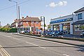
 Shops in Rownhams Road, North Baddesley - geograph.org.uk - 789336.jpg 640 × 427; 112 KB
-
 Shops on Fleming Avenue, North Baddesley - geograph.org.uk - 785885.jpg 640 × 427; 120 KB
-
 Sign for the Knights Cross - geograph.org.uk - 869038.jpg 480 × 640; 59 KB
-
 Silver Birches on Baddesley Common - geograph.org.uk - 1945046.jpg 640 × 427; 278 KB
-

-

-

-
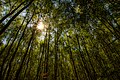 Sun through the treetops.jpg 4,760 × 3,173; 15.75 MB
-
 Sylvan Drive - geograph.org.uk - 4730286.jpg 640 × 480; 87 KB
-
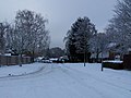 Sylvan Drive in the snow - geograph.org.uk - 2206210.jpg 640 × 480; 73 KB
-
 Sylvan Drive, North Baddersley - geograph.org.uk - 2335445.jpg 640 × 480; 82 KB
-
 Tadburn Lake near Emer Farm - geograph.org.uk - 1948936.jpg 450 × 640; 240 KB
-

-
 The Birches Close, North Baddesley - geograph.org.uk - 2335461.jpg 640 × 480; 74 KB
-

-

-
 Towards Tredgould's Copse - geograph.org.uk - 2327726.jpg 640 × 425; 179 KB
-
 Tree lined Rownhams Lane - geograph.org.uk - 3424579.jpg 640 × 493; 138 KB
-

-
 View across field near Green Acres - geograph.org.uk - 3220598.jpg 640 × 482; 153 KB
-

-
 Wheelers SL17 WTL - 36918011145.jpg 1,365 × 910; 751 KB
-

-
 Works entrance on A27, North Baddesley - geograph.org.uk - 789873.jpg 640 × 427; 161 KB
-
 Worm's eye view in a silver birch forest.jpg 3,230 × 4,845; 5.13 MB
-
 Worm's view of birch trees.jpg 4,829 × 3,219; 23.53 MB
-


_(May_2021).JPG)
.jpg)


_-_geograph.org.uk_-_2508777.jpg)


