Category:Norland Moor
Jump to navigation
Jump to search
Media in category "Norland Moor"
The following 40 files are in this category, out of 40 total.
-
 Cairn on Norland Moor - geograph.org.uk - 949449.jpg 640 × 480; 113 KB
-

-
 Calderdale Way crossing Norland Moor - geograph.org.uk - 3246955.jpg 2,048 × 1,536; 586 KB
-
 Calderdale Way Norland Moor Geograph-3119541-by-Humphrey-Bolton.jpg 2,000 × 1,500; 1.14 MB
-
 Car park on the edge of Norland Moor - geograph.org.uk - 3119615.jpg 2,000 × 1,482; 921 KB
-
 Chamber on possible reservoir, Norland Moor - geograph.org.uk - 2239603.jpg 2,000 × 1,500; 905 KB
-
 Disused quarry on Norland Moor - geograph.org.uk - 4624794.jpg 1,024 × 768; 195 KB
-
 Disused quarry, Norland Moor, Norland - geograph.org.uk - 963069.jpg 640 × 480; 118 KB
-

-

-
 Footpath near Norland Moor, Greetland - geograph.org.uk - 963027.jpg 640 × 480; 86 KB
-
 Footpath onto Norland Moor - geograph.org.uk - 4887202.jpg 2,048 × 1,536; 1,022 KB
-
 Footpath onto Norland Moor - geograph.org.uk - 4887214.jpg 2,048 × 1,536; 1.2 MB
-

-
 Lad Stone Rock - geograph.org.uk - 1621478.jpg 640 × 513; 70 KB
-
 Mysterious slab, Norland Moor, Norland - geograph.org.uk - 963182.jpg 480 × 640; 115 KB
-
 Narrow stile on the edge of Norland Moor - geograph.org.uk - 4624785.jpg 1,024 × 768; 253 KB
-
 Norland Moor - 53160137265.jpg 4,032 × 2,688; 8.48 MB
-
 Norland Moor.jpg 4,032 × 2,688; 9.13 MB
-
 Path along the edge of Norland Moor - geograph.org.uk - 3119553.jpg 2,000 × 1,500; 1.22 MB
-
 Path alongside an old boundary wall - geograph.org.uk - 3119600.jpg 2,000 × 1,500; 1.21 MB
-
 Path on Norland Moor - geograph.org.uk - 3119550.jpg 2,000 × 1,500; 1.04 MB
-
 Path to the triangulation pillar - geograph.org.uk - 3119572.jpg 2,000 × 1,500; 1.25 MB
-
 Pond on Norland Moor - geograph.org.uk - 3412902.jpg 2,000 × 1,460; 831 KB
-
 Remains of old boundary wall, Norland Moor - geograph.org.uk - 3119605.jpg 2,000 × 1,490; 1.11 MB
-
 Short, fat pylon, Norland Moor - geograph.org.uk - 2239615.jpg 2,000 × 1,500; 611 KB
-
 Solitary birch tree on Norland Moor - geograph.org.uk - 4624788.jpg 1,024 × 768; 130 KB
-
 Solitary oak tree on Norland moor - geograph.org.uk - 4624803.jpg 1,024 × 768; 241 KB
-
 Sowerby Bridge FP89 on Norland Moor - geograph.org.uk - 3119610.jpg 2,000 × 1,484; 1.11 MB
-
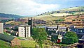 Sowerby Bridge geograph-3392758-by-Ben-Brooksbank.jpg 2,394 × 1,379; 3.15 MB
-
 Spoil heaps on Norland Moor - geograph.org.uk - 2239574.jpg 2,000 × 1,500; 833 KB
-
 Stile at the western end of Elland Bridleway 117 - geograph.org.uk - 3119564.jpg 2,000 × 1,483; 979 KB
-
 Stile on Elland FP45 - geograph.org.uk - 3119585.jpg 2,000 × 1,500; 927 KB
-
 The edge of Norland Moor - geograph.org.uk - 341728.jpg 640 × 480; 86 KB
-
 Triangulation pillar, Norland Moor - geograph.org.uk - 2239563.jpg 2,000 × 1,500; 556 KB
-
-
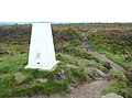
 Trig point on Norland Moor - geograph.org.uk - 3246935.jpg 2,048 × 1,536; 575 KB
-
 Trig point on Norland Moor above Sowerby Bridge - geograph.org.uk - 6325818.jpg 1,920 × 1,080; 597 KB
-
 Trig point, Norland Moor - geograph.org.uk - 36722.jpg 640 × 427; 67 KB
-
 Turgate Delph - geograph.org.uk - 949435.jpg 640 × 480; 145 KB


,_Norland_Moor,_Norland_-_geograph.org.uk_-_963194.jpg)


