Category:Norikura Echoline
Jump to navigation
Jump to search
English: Category for Norikura Echoline (part of the Nagano Prefectural Road Route 84)
日本語: 乗鞍エコーライン(長野県道84号乗鞍岳線の一部)に関するカテゴリ
Subcategories
This category has the following 2 subcategories, out of 2 total.
K
- Kuraigahara sanso (6 F)
T
- Tatamidaira Bus Terminal (7 F)
Media in category "Norikura Echoline"
The following 23 files are in this category, out of 23 total.
-
 Cycling in Norikura Echoline.jpg 3,840 × 2,560; 2.8 MB
-
 Hida Mountains and Norikura Echoline from Mount Fujimi.JPG 5,184 × 3,456; 7.23 MB
-
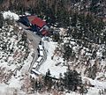
 Kuraigahara sanso and Autumn leaf color.JPG 5,184 × 3,456; 10.2 MB
-
 Kuraigahara sanso.JPG 3,200 × 2,880; 5.05 MB
-
 Mount Daikoku of Mount Norikura from Mount Fujimi.jpg 3,840 × 2,560; 2.67 MB
-
 Mount Hachimori from Mount Norikura.jpg 3,840 × 2,560; 1.56 MB
-
 Mount Onyu and Yotsu of Mount Norikura from Mount Fujimi.jpg 3,840 × 2,560; 2.42 MB
-
 Nagano Prefectural Road Route 84 and Sanbon Falls Rest House.jpg 6,000 × 4,000; 10.56 MB
-
 Norikura Echoline from Katanokoya.jpg 3,840 × 2,243; 2.52 MB
-
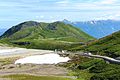
 Norikura Echoline under snow removal.jpg 3,840 × 2,560; 2.41 MB
-
 Norikura Echoline.jpg 1,280 × 877; 339 KB
-
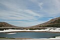 Norikura tsurugaike4.jpg 2,500 × 1,667; 1.94 MB
-
 Norikura-dake.JPG 640 × 480; 79 KB
-
 Norikuraecho.jpg 1,280 × 960; 463 KB
-
 NorikuraEchoLine.jpg 1,024 × 768; 272 KB
-
 Norikuramountaincycling.jpg 1,600 × 1,200; 631 KB
-
 North Alps from Norikuradake 1998-05-16.jpg 1,024 × 673; 116 KB
-
 Snow wall Norikura Echoline.jpg 1,920 × 1,280; 490 KB
-
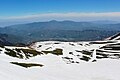
 South Alps from Norikuradake 1998-05-16.jpg 1,280 × 855; 281 KB
-
 Summer ski in Mount Norikura.jpg 3,840 × 1,988; 2.31 MB
-
 Views from Mount Norikura (2014-09-27).JPG 5,184 × 3,200; 7.18 MB
-
 乗鞍エコーライン - panoramio.jpg 3,648 × 2,048; 1.53 MB
-
 秋の乗鞍エコーライン.jpg 2,475 × 1,856; 661 KB


.JPG)

