Category:Nordenham range front
Jump to navigation
Jump to search
| Object location | | View all coordinates using: OpenStreetMap |
|---|
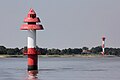
lighthouse in Germany  | |||||
| Upload media | |||||
| Instance of | |||||
|---|---|---|---|---|---|
| Part of | |||||
| Made from material | |||||
| Location | Nordenham, Wesermarsch, Lower Saxony, Germany | ||||
| Located in or next to body of water | |||||
| Has use |
| ||||
| Inception |
| ||||
| Height |
| ||||
 | |||||
Media in category "Nordenham range front"
The following 3 files are in this category, out of 3 total.
-
 Nordenham range front 0411 01.jpg 4,219 × 2,813; 2.43 MB
-
 Nordenham range front 0411 02.jpg 4,146 × 2,764; 2.54 MB
-
 Nordenham Uf Of 20120801b.jpg 1,920 × 1,279; 730 KB

